Stone Cabin Ranch Topo Map Nevada
To zoom in, hover over the map of Stone Cabin Ranch
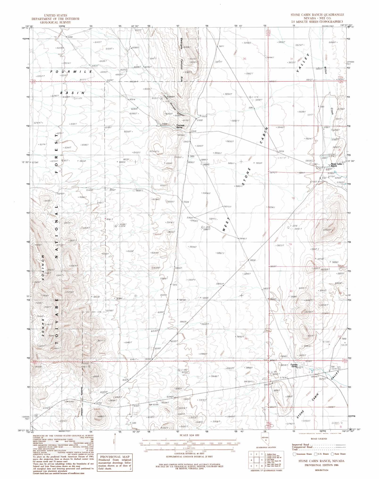
USGS Topo Quad 38116b6 - 1:24,000 scale
| Topo Map Name: | Stone Cabin Ranch |
| USGS Topo Quad ID: | 38116b6 |
| Print Size: | ca. 21 1/4" wide x 27" high |
| Southeast Coordinates: | 38.125° N latitude / 116.625° W longitude |
| Map Center Coordinates: | 38.1875° N latitude / 116.6875° W longitude |
| U.S. State: | NV |
| Filename: | o38116b6.jpg |
| Download Map JPG Image: | Stone Cabin Ranch topo map 1:24,000 scale |
| Map Type: | Topographic |
| Topo Series: | 7.5´ |
| Map Scale: | 1:24,000 |
| Source of Map Images: | United States Geological Survey (USGS) |
| Alternate Map Versions: |
Stone Cabin Ranch NV 1986, updated 1986 Download PDF Buy paper map Stone Cabin Ranch NV 2012 Download PDF Buy paper map Stone Cabin Ranch NV 2014 Download PDF Buy paper map |
| FStopo: | US Forest Service topo Stone Cabin Ranch is available: Download FStopo PDF Download FStopo TIF |
1:24,000 Topo Quads surrounding Stone Cabin Ranch
Big Ten Peak West |
Big Ten Peak East |
Mccann Canyon |
Mcintyre Summit |
Flagstaff Mountain |
Antelope Spring |
Saulsbury Basin |
Georges Canyon Rim |
Georges Canyon Rim Se |
Tybo |
Hannapah |
Mud Spring |
Stone Cabin Ranch |
Stone Cabin Ranch Ne |
Warm Springs Summit |
Mckinney Tanks |
Yellow Cone |
Stone Cabin Ranch Sw |
Stone Cabin Ranch Se |
Bellehelen |
Monitor Peak |
Reeds Ranch |
Stinking Spring Nw |
Stinking Spring |
Kawich Peak |
> Back to 38116a1 at 1:100,000 scale
> Back to 38116a1 at 1:250,000 scale
> Back to U.S. Topo Maps home
Stone Cabin Ranch topo map: Gazetteer
Stone Cabin Ranch: Basins
Fourmile Basin elevation 1866m 6122′Stone Cabin Ranch: Gaps
Saulsbury Summit elevation 1992m 6535′Stone Cabin Ranch: Springs
Fivemile Spring elevation 1745m 5725′Fourmile Spring elevation 1824m 5984′
Stone Cabin Ranch: Streams
Willow Creek elevation 1765m 5790′Stone Cabin Ranch: Valleys
Little Georges Canyon elevation 1811m 5941′Stone Cabin Ranch digital topo map on disk
Buy this Stone Cabin Ranch topo map showing relief, roads, GPS coordinates and other geographical features, as a high-resolution digital map file on DVD: