Tybo Well Topo Map Nevada
To zoom in, hover over the map of Tybo Well
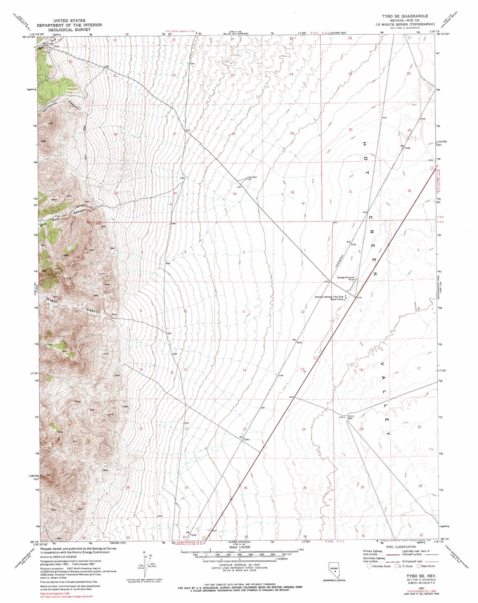
USGS Topo Quad 38116c3 - 1:24,000 scale
| Topo Map Name: | Tybo Well |
| USGS Topo Quad ID: | 38116c3 |
| Print Size: | ca. 21 1/4" wide x 27" high |
| Southeast Coordinates: | 38.25° N latitude / 116.25° W longitude |
| Map Center Coordinates: | 38.3125° N latitude / 116.3125° W longitude |
| U.S. State: | NV |
| Filename: | o38116c3.jpg |
| Download Map JPG Image: | Tybo Well topo map 1:24,000 scale |
| Map Type: | Topographic |
| Topo Series: | 7.5´ |
| Map Scale: | 1:24,000 |
| Source of Map Images: | United States Geological Survey (USGS) |
| Alternate Map Versions: |
Tybo SE NV 1967, updated 1973 Download PDF Buy paper map Tybo SE NV 1967, updated 1990 Download PDF Buy paper map Tybo Well NV 2012 Download PDF Buy paper map Tybo Well NV 2014 Download PDF Buy paper map |
1:24,000 Topo Quads surrounding Tybo Well
Eagle Pass |
Little Fish Lake |
Hobble Canyon |
Moores Station Sw |
Moores Station Se |
Mcintyre Summit |
Flagstaff Mountain |
Blue Jay Spring |
Palisade Mesa |
Lunar Crater |
Georges Canyon Rim Se |
Tybo |
Tybo Well |
Buckwheat Rim |
Chuck Wagon Flat |
Stone Cabin Ranch Ne |
Warm Springs Summit |
Warm Springs |
Twin Springs Slough |
Echo Canyon |
Stone Cabin Ranch Se |
Bellehelen |
Warm Springs Se |
Reveille |
Reveille Se |
> Back to 38116a1 at 1:100,000 scale
> Back to 38116a1 at 1:250,000 scale
> Back to U.S. Topo Maps home
Tybo Well topo map: Gazetteer
Tybo Well: Valleys
Fairbanks Canyon elevation 1844m 6049′Music Canyon elevation 1757m 5764′
Red Rock Canyon elevation 1804m 5918′
Tybo Well: Wells
Fallini Well elevation 1582m 5190′Pedro Well elevation 1879m 6164′
Tybo Well elevation 1624m 5328′
Tybo Well digital topo map on disk
Buy this Tybo Well topo map showing relief, roads, GPS coordinates and other geographical features, as a high-resolution digital map file on DVD: