Chaos Creek Topo Map Nevada
To zoom in, hover over the map of Chaos Creek
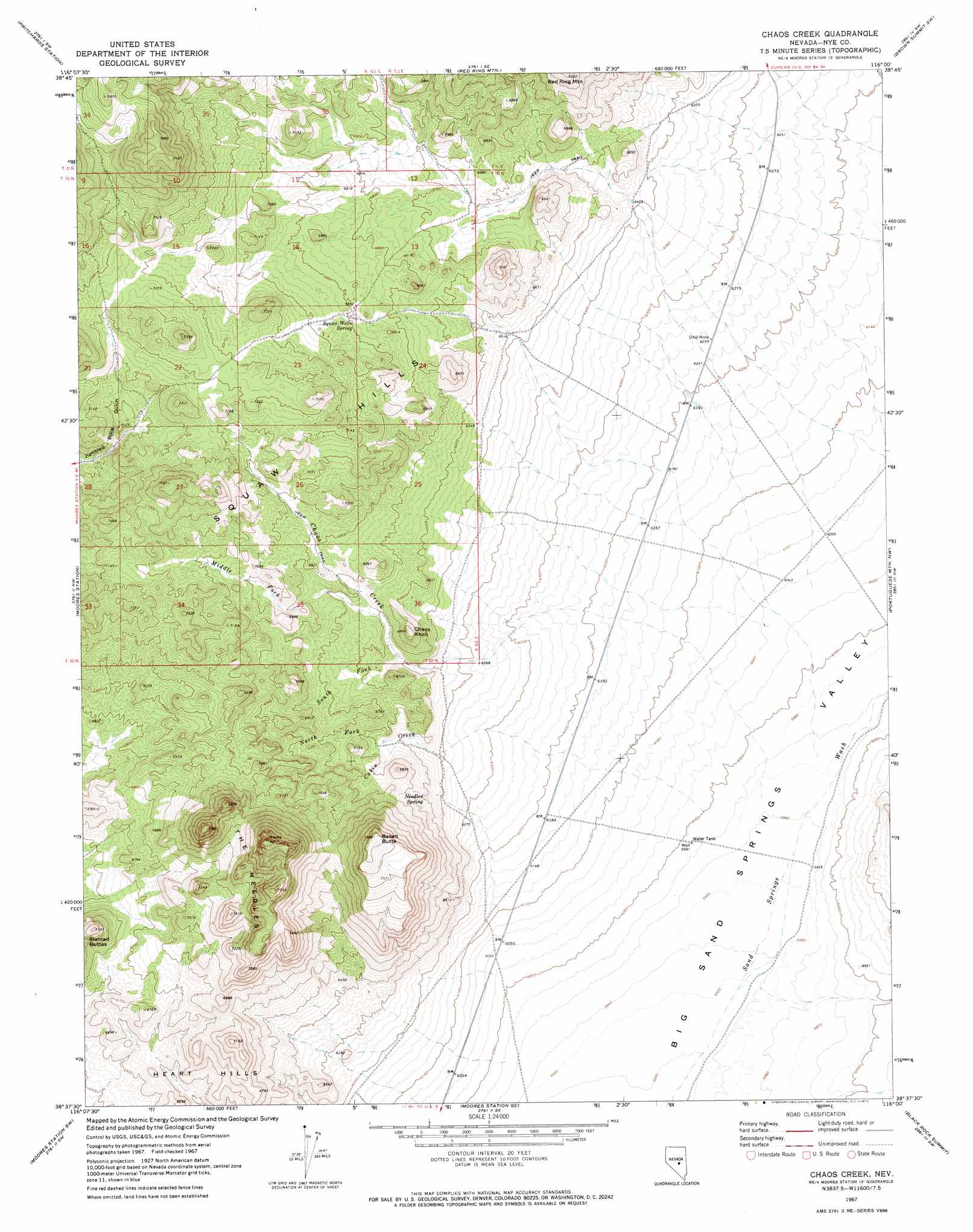
USGS Topo Quad 38116f1 - 1:24,000 scale
| Topo Map Name: | Chaos Creek |
| USGS Topo Quad ID: | 38116f1 |
| Print Size: | ca. 21 1/4" wide x 27" high |
| Southeast Coordinates: | 38.625° N latitude / 116° W longitude |
| Map Center Coordinates: | 38.6875° N latitude / 116.0625° W longitude |
| U.S. State: | NV |
| Filename: | o38116f1.jpg |
| Download Map JPG Image: | Chaos Creek topo map 1:24,000 scale |
| Map Type: | Topographic |
| Topo Series: | 7.5´ |
| Map Scale: | 1:24,000 |
| Source of Map Images: | United States Geological Survey (USGS) |
| Alternate Map Versions: |
Chaos Creek NV 1967, updated 1973 Download PDF Buy paper map Chaos Creek NV 2012 Download PDF Buy paper map Chaos Creek NV 2014 Download PDF Buy paper map |
1:24,000 Topo Quads surrounding Chaos Creek
Fish Springs Ne |
Park Mountain |
Summit Station |
Brown Summit Nw |
Brown Summit |
Fish Springs Se |
Pritchards Station |
Red Ring Mountain |
Brown Summit Sw |
Sand Spring |
Morey Peak |
Moores Station |
Chaos Creek |
Portuguese Mountain Nw |
Portuguese Mountain |
Hobble Canyon |
Moores Station Sw |
Moores Station Se |
Black Rock Summit |
Lockes |
Blue Jay Spring |
Palisade Mesa |
Lunar Crater |
The Wall |
The Wall Ne |
> Back to 38116e1 at 1:100,000 scale
> Back to 38116a1 at 1:250,000 scale
> Back to U.S. Topo Maps home
Chaos Creek topo map: Gazetteer
Chaos Creek: Ranges
Needle Range elevation 2417m 7929′Chaos Creek: Springs
Needles Spring elevation 1976m 6482′Squaw Wells Spring elevation 2103m 6899′
Chaos Creek: Streams
Cabin Creek elevation 1829m 6000′Chaos Creek elevation 1820m 5971′
Middle Fork Chaos Creek elevation 2011m 6597′
North Fork Cabin Creek elevation 1986m 6515′
South Fork Chaos Creek elevation 1980m 6496′
Chaos Creek: Summits
Basalt Butte elevation 2305m 7562′Chaos Knob elevation 2098m 6883′
Squaw Hills elevation 2314m 7591′
The Needles elevation 2271m 7450′
Chaos Creek: Wells
Sand Springs Well elevation 1827m 5994′Chaos Creek digital topo map on disk
Buy this Chaos Creek topo map showing relief, roads, GPS coordinates and other geographical features, as a high-resolution digital map file on DVD: