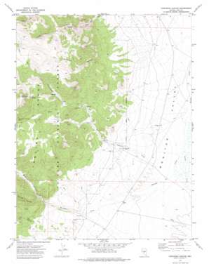
Corcoran Canyon Topo Map Nevada
To zoom in, hover over the map of Corcoran Canyon
USGS Topo Quad 38116f7 - 1:24,000 scale
| Topo Map Name: | Corcoran Canyon |
| USGS Topo Quad ID: | 38116f7 |
| Print Size: | ca. 21 1/4" wide x 27" high |
| Southeast Coordinates: | 38.625° N latitude / 116.75° W longitude |
| Map Center Coordinates: | 38.6875° N latitude / 116.8125° W longitude |
| U.S. State: | NV |
| Filename: | o38116f7.jpg |
| Download Map JPG Image: | Corcoran Canyon topo map 1:24,000 scale |
| Map Type: | Topographic |
| Topo Series: | 7.5´ |
| Map Scale: | 1:24,000 |
| Source of Map Images: | United States Geological Survey (USGS) |
| Alternate Map Versions: |
Corcoran Canyon NV 1971, updated 1974 Download PDF Buy paper map Corcoran Canyon NV 2012 Download PDF Buy paper map Corcoran Canyon NV 2014 Download PDF Buy paper map |
| FStopo: | US Forest Service topo Corcoran Canyon is available: Download FStopo PDF Download FStopo TIF |
1:24,000 Topo Quads surrounding Corcoran Canyon
> Back to 38116e1 at 1:100,000 scale
> Back to 38116a1 at 1:250,000 scale
> Back to U.S. Topo Maps home
Corcoran Canyon topo map: Gazetteer
Corcoran Canyon: Benches
Meadow Creek Bench elevation 2206m 7237′Corcoran Canyon: Populated Places
Stone House (historical) elevation 2177m 7142′Corcoran Canyon: Springs
Corcoran Divide Spring elevation 2641m 8664′Little Table Mountain Spring elevation 2591m 8500′
Corcoran Canyon: Streams
Barley Creek elevation 2117m 6945′Corcoran Creek elevation 2122m 6961′
Widow Smiths Creek elevation 2106m 6909′
Corcoran Canyon: Summits
Little Table Mountain elevation 2970m 9744′Tooth Rock elevation 2716m 8910′
Corcoran Canyon: Trails
Ellsworth Ophir Barley Creek Freight Route elevation 2179m 7148′Corcoran Canyon: Valleys
Corcoran Canyon elevation 2178m 7145′Meadow Canyon elevation 2172m 7125′
Ryecroft Canyon elevation 2266m 7434′
Toll Canyon elevation 2245m 7365′
Trail Canyon elevation 2247m 7372′
Waterfall Canyon elevation 2186m 7171′
Corcoran Canyon digital topo map on disk
Buy this Corcoran Canyon topo map showing relief, roads, GPS coordinates and other geographical features, as a high-resolution digital map file on DVD:


