Crescent Dunes Topo Map Nevada
To zoom in, hover over the map of Crescent Dunes
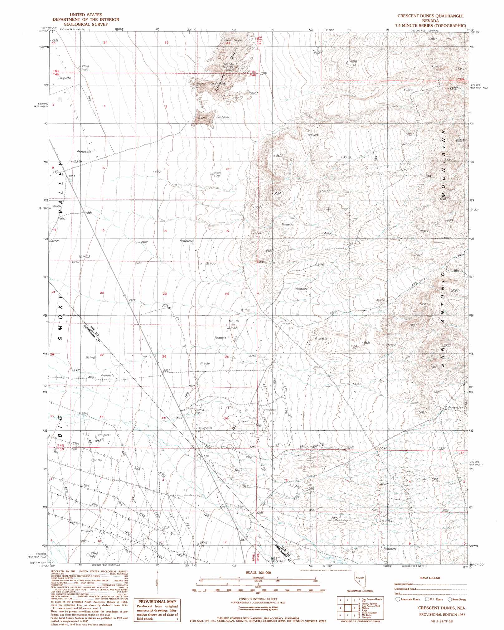
USGS Topo Quad 38117b3 - 1:24,000 scale
| Topo Map Name: | Crescent Dunes |
| USGS Topo Quad ID: | 38117b3 |
| Print Size: | ca. 21 1/4" wide x 27" high |
| Southeast Coordinates: | 38.125° N latitude / 117.25° W longitude |
| Map Center Coordinates: | 38.1875° N latitude / 117.3125° W longitude |
| U.S. State: | NV |
| Filename: | o38117b3.jpg |
| Download Map JPG Image: | Crescent Dunes topo map 1:24,000 scale |
| Map Type: | Topographic |
| Topo Series: | 7.5´ |
| Map Scale: | 1:24,000 |
| Source of Map Images: | United States Geological Survey (USGS) |
| Alternate Map Versions: |
Crescent Dunes NV 1987, updated 1987 Download PDF Buy paper map Crescent Dunes NV 2012 Download PDF Buy paper map Crescent Dunes NV 2014 Download PDF Buy paper map |
1:24,000 Topo Quads surrounding Crescent Dunes
Outlaw Springs Ne |
Rainier Mountain |
San Antonio Ranch |
Baxter Spring Nw |
Baxter Spring |
Outlaw Springs Se |
San Antonio Ranch Sw |
Liberty Springs |
San Antonio Well |
Henrys Well |
Crow Springs |
Millers |
Crescent Dunes |
Rays |
Thumder Mountain |
Gilbert Se |
Lone Mountain |
Mount Butte |
Tonopah |
East Of Tonopah |
Weepah |
Paymaster Canyon |
Klondike |
Mud Lake Nw |
Mud Lake North |
> Back to 38117a1 at 1:100,000 scale
> Back to 38116a1 at 1:250,000 scale
> Back to U.S. Topo Maps home
Crescent Dunes digital topo map on disk
Buy this Crescent Dunes topo map showing relief, roads, GPS coordinates and other geographical features, as a high-resolution digital map file on DVD: