Outlaw Springs Topo Map Nevada
To zoom in, hover over the map of Outlaw Springs
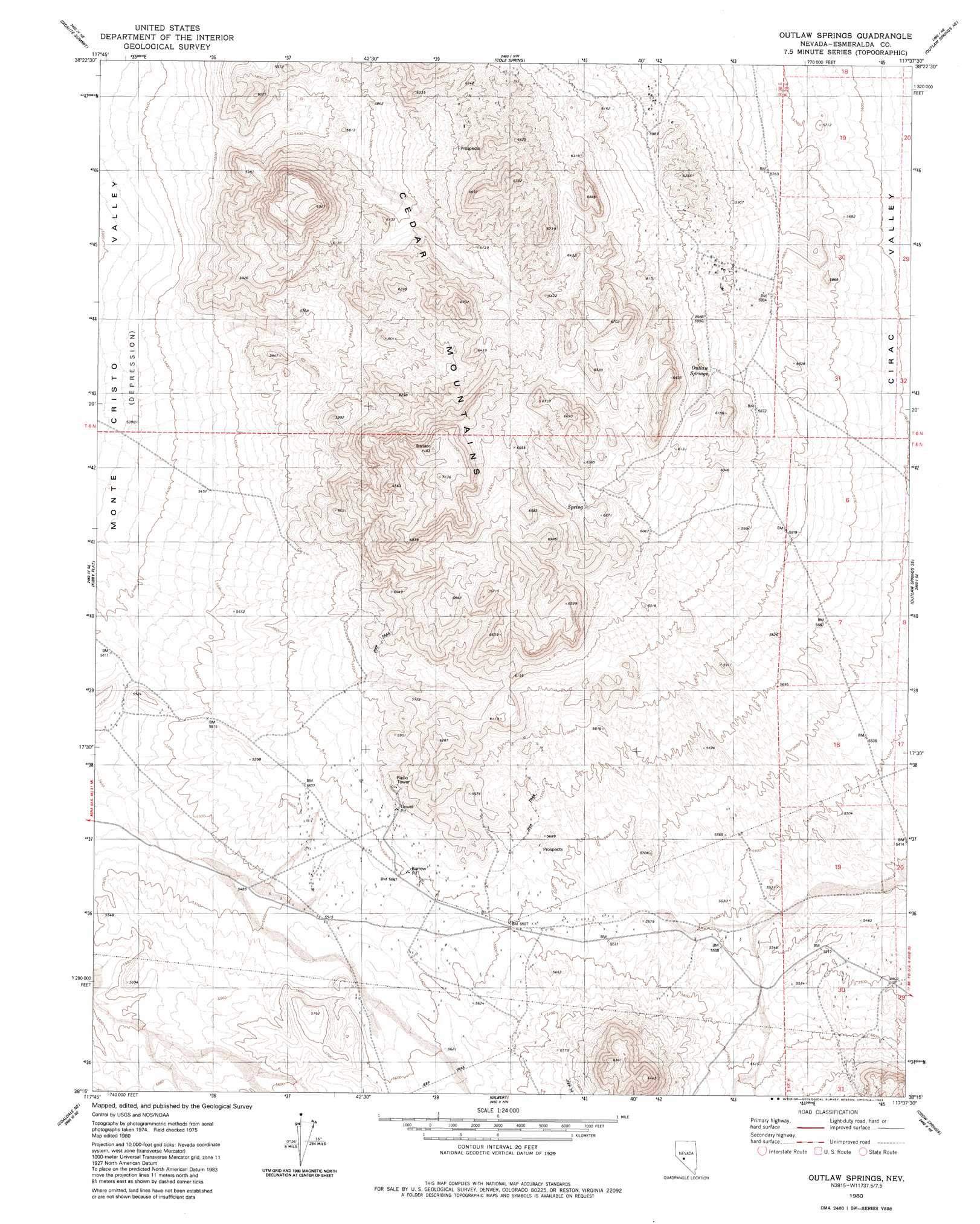
USGS Topo Quad 38117c6 - 1:24,000 scale
| Topo Map Name: | Outlaw Springs |
| USGS Topo Quad ID: | 38117c6 |
| Print Size: | ca. 21 1/4" wide x 27" high |
| Southeast Coordinates: | 38.25° N latitude / 117.625° W longitude |
| Map Center Coordinates: | 38.3125° N latitude / 117.6875° W longitude |
| U.S. State: | NV |
| Filename: | o38117c6.jpg |
| Download Map JPG Image: | Outlaw Springs topo map 1:24,000 scale |
| Map Type: | Topographic |
| Topo Series: | 7.5´ |
| Map Scale: | 1:24,000 |
| Source of Map Images: | United States Geological Survey (USGS) |
| Alternate Map Versions: |
Outlaw Springs NV 1980, updated 1980 Download PDF Buy paper map Outlaw Springs NV 1980, updated 1983 Download PDF Buy paper map Outlaw Springs NV 2012 Download PDF Buy paper map Outlaw Springs NV 2014 Download PDF Buy paper map |
1:24,000 Topo Quads surrounding Outlaw Springs
Stewart Spring |
Simon |
Black Spring |
Cloverdale Ranch |
Secret Basin |
Bettles Well |
Dicalite Summit |
Cole Spring |
Outlaw Springs Ne |
Rainier Mountain |
Eddyville |
Kirby Flat |
Outlaw Springs |
Outlaw Springs Se |
San Antonio Ranch Sw |
Rock Hill |
Coaldale Ne |
Gilbert |
Crow Springs |
Millers |
Coaldale |
Blair Junction |
Devils Gate |
Gilbert Se |
Lone Mountain |
> Back to 38117a1 at 1:100,000 scale
> Back to 38116a1 at 1:250,000 scale
> Back to U.S. Topo Maps home
Outlaw Springs digital topo map on disk
Buy this Outlaw Springs topo map showing relief, roads, GPS coordinates and other geographical features, as a high-resolution digital map file on DVD: