Stewart Spring Topo Map Nevada
To zoom in, hover over the map of Stewart Spring
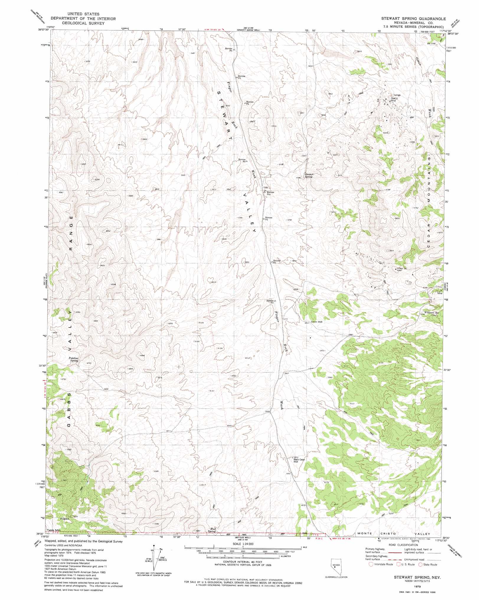
USGS Topo Quad 38117e8 - 1:24,000 scale
| Topo Map Name: | Stewart Spring |
| USGS Topo Quad ID: | 38117e8 |
| Print Size: | ca. 21 1/4" wide x 27" high |
| Southeast Coordinates: | 38.5° N latitude / 117.875° W longitude |
| Map Center Coordinates: | 38.5625° N latitude / 117.9375° W longitude |
| U.S. State: | NV |
| Filename: | o38117e8.jpg |
| Download Map JPG Image: | Stewart Spring topo map 1:24,000 scale |
| Map Type: | Topographic |
| Topo Series: | 7.5´ |
| Map Scale: | 1:24,000 |
| Source of Map Images: | United States Geological Survey (USGS) |
| Alternate Map Versions: |
Stewart Spring NV 1979, updated 1980 Download PDF Buy paper map Stewart Spring NV 2012 Download PDF Buy paper map Stewart Spring NV 2014 Download PDF Buy paper map |
1:24,000 Topo Quads surrounding Stewart Spring
Ramsey Spring |
Mount Annie Se |
Gabbs |
Paradise Peak |
Ione Sw |
Mount Ferguson |
Gabbs Mountain |
Granny Goose Well |
Goldyke |
Black Spring Nw |
Luning |
Sunrise Flat |
Stewart Spring |
Simon |
Black Spring |
Black Dyke Mountain |
Mina |
Bettles Well |
Dicalite Summit |
Cole Spring |
Camp Douglas |
Sodaville |
Eddyville |
Kirby Flat |
Outlaw Springs |
> Back to 38117e1 at 1:100,000 scale
> Back to 38116a1 at 1:250,000 scale
> Back to U.S. Topo Maps home
Stewart Spring topo map: Gazetteer
Stewart Spring: Mines
Harvey Taylor Mine elevation 1879m 6164′Mina Gold Mines Companys Mine elevation 1863m 6112′
OMCO Mine elevation 1818m 5964′
Stewart Spring: Populated Places
Omco elevation 1818m 5964′Stewart Spring: Post Offices
Omco Post Office (historical) elevation 1818m 5964′Stewart Spring: Springs
Mud Spring elevation 1961m 6433′Poleline Spring elevation 2000m 6561′
Stewart Spring elevation 1769m 5803′
Wildrose Spring elevation 1964m 6443′
Stewart Spring: Wells
Black Cabin Well elevation 1818m 5964′Simon Well elevation 1783m 5849′
Stewart Spring digital topo map on disk
Buy this Stewart Spring topo map showing relief, roads, GPS coordinates and other geographical features, as a high-resolution digital map file on DVD: