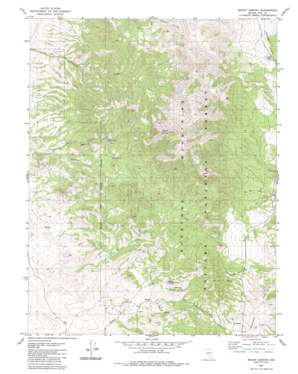
Mount Ardivey Topo Map Nevada
To zoom in, hover over the map of Mount Ardivey
USGS Topo Quad 38117f5 - 1:24,000 scale
| Topo Map Name: | Mount Ardivey |
| USGS Topo Quad ID: | 38117f5 |
| Print Size: | ca. 21 1/4" wide x 27" high |
| Southeast Coordinates: | 38.625° N latitude / 117.5° W longitude |
| Map Center Coordinates: | 38.6875° N latitude / 117.5625° W longitude |
| U.S. State: | NV |
| Filename: | o38117f5.jpg |
| Download Map JPG Image: | Mount Ardivey topo map 1:24,000 scale |
| Map Type: | Topographic |
| Topo Series: | 7.5´ |
| Map Scale: | 1:24,000 |
| Source of Map Images: | United States Geological Survey (USGS) |
| Alternate Map Versions: |
Mount Ardivey NV 1980, updated 1980 Download PDF Buy paper map Mount Ardivey NV 2011 Download PDF Buy paper map Mount Ardivey NV 2014 Download PDF Buy paper map |
| FStopo: | US Forest Service topo Mount Ardivey is available: Download FStopo PDF Download FStopo TIF |
1:24,000 Topo Quads surrounding Mount Ardivey
> Back to 38117e1 at 1:100,000 scale
> Back to 38116a1 at 1:250,000 scale
> Back to U.S. Topo Maps home
Mount Ardivey topo map: Gazetteer
Mount Ardivey: Gaps
Golden Summit elevation 2163m 7096′Mount Ardivey: Mines
East Golden Mine elevation 2181m 7155′Golden King Mine elevation 2166m 7106′
Republic Mines elevation 2201m 7221′
Mount Ardivey: Populated Places
Golden (historical) elevation 2122m 6961′Mount Ardivey: Post Offices
Golden Post Office (historical) elevation 2122m 6961′Mount Ardivey: Springs
Cripple Spring elevation 2319m 7608′Golden Spring elevation 2098m 6883′
Mount Ardivey: Summits
Mount Ardivey elevation 2869m 9412′Mount Ardivey: Valleys
Farrington Canyon elevation 2116m 6942′Merritt Canyon elevation 2073m 6801′
Mount Ardivey digital topo map on disk
Buy this Mount Ardivey topo map showing relief, roads, GPS coordinates and other geographical features, as a high-resolution digital map file on DVD:


