Carvers Ne Topo Map Nevada
To zoom in, hover over the map of Carvers Ne
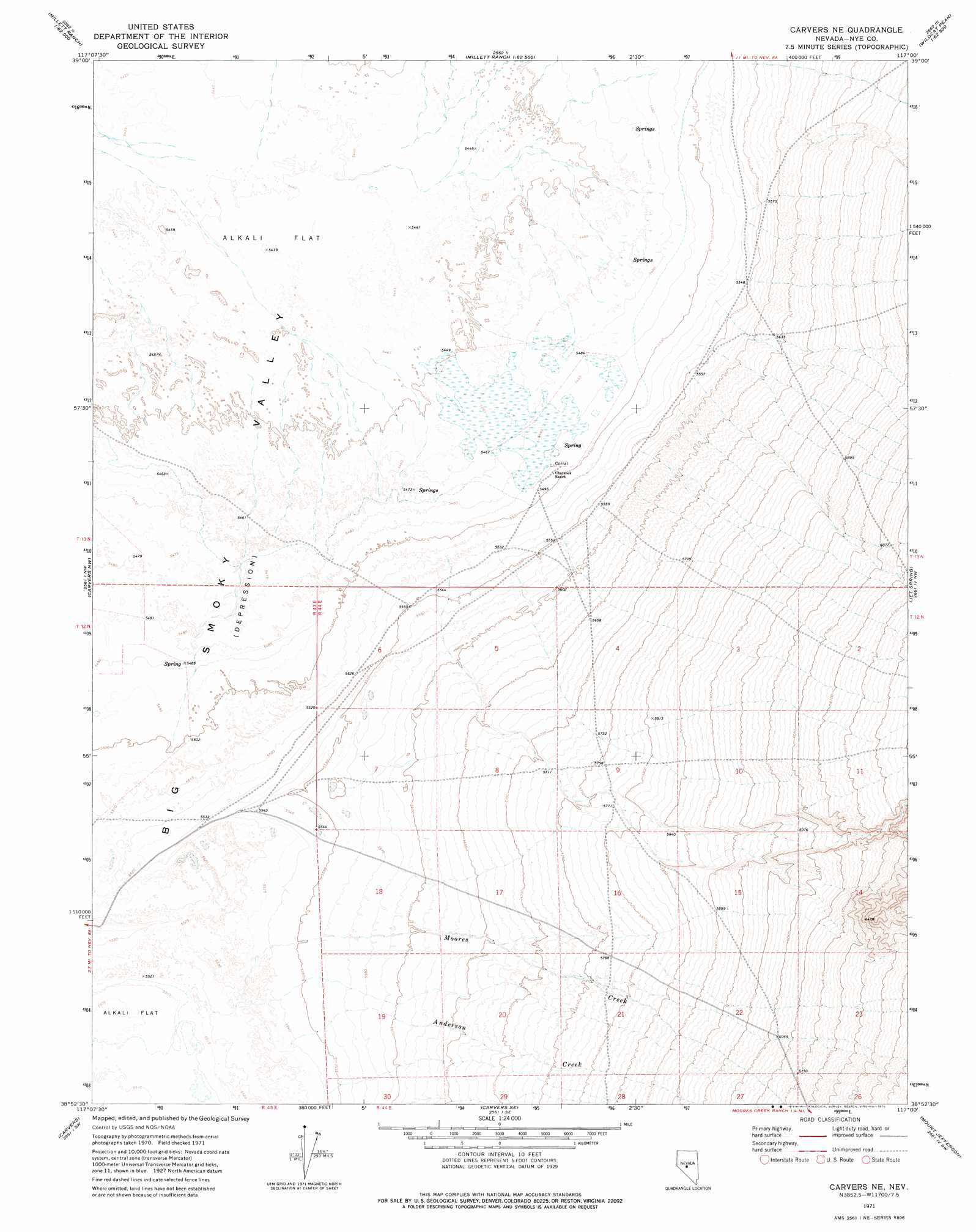
USGS Topo Quad 38117h1 - 1:24,000 scale
| Topo Map Name: | Carvers Ne |
| USGS Topo Quad ID: | 38117h1 |
| Print Size: | ca. 21 1/4" wide x 27" high |
| Southeast Coordinates: | 38.875° N latitude / 117° W longitude |
| Map Center Coordinates: | 38.9375° N latitude / 117.0625° W longitude |
| U.S. State: | NV |
| Filename: | o38117h1.jpg |
| Download Map JPG Image: | Carvers Ne topo map 1:24,000 scale |
| Map Type: | Topographic |
| Topo Series: | 7.5´ |
| Map Scale: | 1:24,000 |
| Source of Map Images: | United States Geological Survey (USGS) |
| Alternate Map Versions: |
Carvers NE NV 1971, updated 1975 Download PDF Buy paper map Carvers NE NV 2012 Download PDF Buy paper map Carvers NE NV 2014 Download PDF Buy paper map |
| FStopo: | US Forest Service topo Carvers NE is available: Download FStopo PDF Download FStopo TIF |
1:24,000 Topo Quads surrounding Carvers Ne
Reese River Butte |
Brewer Canyon |
Kingston |
Wildcat Peak Nw |
Petes Summit |
Tierney Creek |
Millett Ranch |
East Of Millett Ranch |
Wildcat Canyon |
Wildcat Peak |
South Toiyabe Peak |
Carvers Nw |
Carvers Ne |
Jet Spring |
Northumberland Pass |
Arc Dome |
Carvers |
Carvers Se |
Mount Jefferson |
Pine Creek Ranch |
Toms Canyon |
Pablo Canyon Ranch |
Round Mountain |
Jefferson |
Corcoran Canyon |
> Back to 38117e1 at 1:100,000 scale
> Back to 38116a1 at 1:250,000 scale
> Back to U.S. Topo Maps home
Carvers Ne topo map: Gazetteer
Carvers Ne: Springs
Big Blue Spring elevation 1673m 5488′Charnock Springs elevation 1669m 5475′
Carvers Ne: Streams
Anderson Creek elevation 1687m 5534′Moores Creek elevation 1682m 5518′
Carvers Ne digital topo map on disk
Buy this Carvers Ne topo map showing relief, roads, GPS coordinates and other geographical features, as a high-resolution digital map file on DVD: