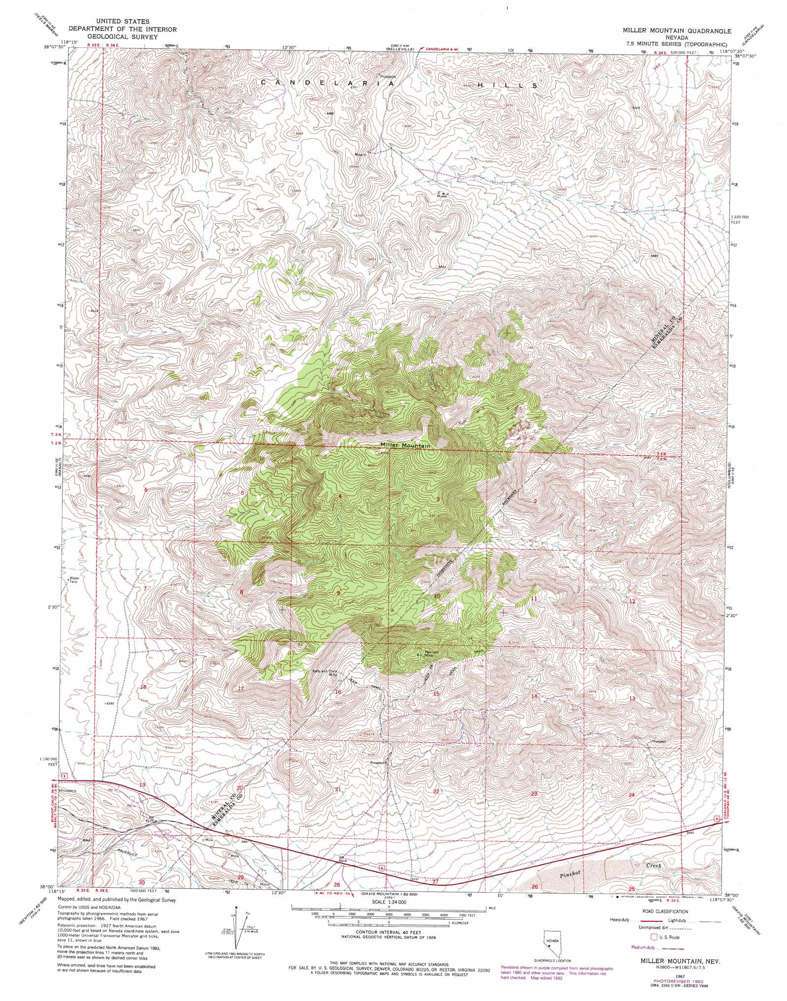
Miller Mountain Topo Map Nevada
To zoom in, hover over the map of Miller Mountain
USGS Topo Quad 38118a2 - 1:24,000 scale
| Topo Map Name: | Miller Mountain |
| USGS Topo Quad ID: | 38118a2 |
| Print Size: | ca. 21 1/4" wide x 27" high |
| Southeast Coordinates: | 38° N latitude / 118.125° W longitude |
| Map Center Coordinates: | 38.0625° N latitude / 118.1875° W longitude |
| U.S. State: | NV |
| Filename: | o38118a2.jpg |
| Download Map JPG Image: | Miller Mountain topo map 1:24,000 scale |
| Map Type: | Topographic |
| Topo Series: | 7.5´ |
| Map Scale: | 1:24,000 |
| Source of Map Images: | United States Geological Survey (USGS) |
| Alternate Map Versions: |
Miller Mountain NV 1967, updated 1969 Download PDF Buy paper map Miller Mountain NV 1967, updated 1982 Download PDF Buy paper map Miller Mountain NV 2011 Download PDF Buy paper map Miller Mountain NV 2014 Download PDF Buy paper map |
1:24,000 Topo Quads surrounding Miller Mountain
Rattlesnake Flat |
Moho Mountain |
Camp Douglas |
Sodaville |
Eddyville |
Little Huntoon Valley |
Teels Marsh |
Belleville |
Candelaria |
Rock Hill |
Jacks Spring |
Basalt |
Miller Mountain |
Columbus |
Coaldale |
Truman Meadows |
Mount Montgomery |
Volcanic Hills West |
Volcanic Hills East |
Rhyolite Ridge Nw |
Benton |
Boundary Peak |
Davis Mountain |
East Of Davis Mountain |
Rhyolite Ridge Sw |
> Back to 38118a1 at 1:100,000 scale
> Back to 38118a1 at 1:250,000 scale
> Back to U.S. Topo Maps home
Miller Mountain topo map: Gazetteer
Miller Mountain: Mines
Black Horse Mine elevation 1760m 5774′Dicalite Mine elevation 1820m 5971′
Kelly and Clark Mine elevation 2143m 7030′
Maxfield Mine elevation 2225m 7299′
Sorenson Construction Mine elevation 1816m 5958′
Miller Mountain: Summits
Miller Mountain elevation 2653m 8704′Miller Mountain digital topo map on disk
Buy this Miller Mountain topo map showing relief, roads, GPS coordinates and other geographical features, as a high-resolution digital map file on DVD: