Kirkwood Spring Topo Map California
To zoom in, hover over the map of Kirkwood Spring
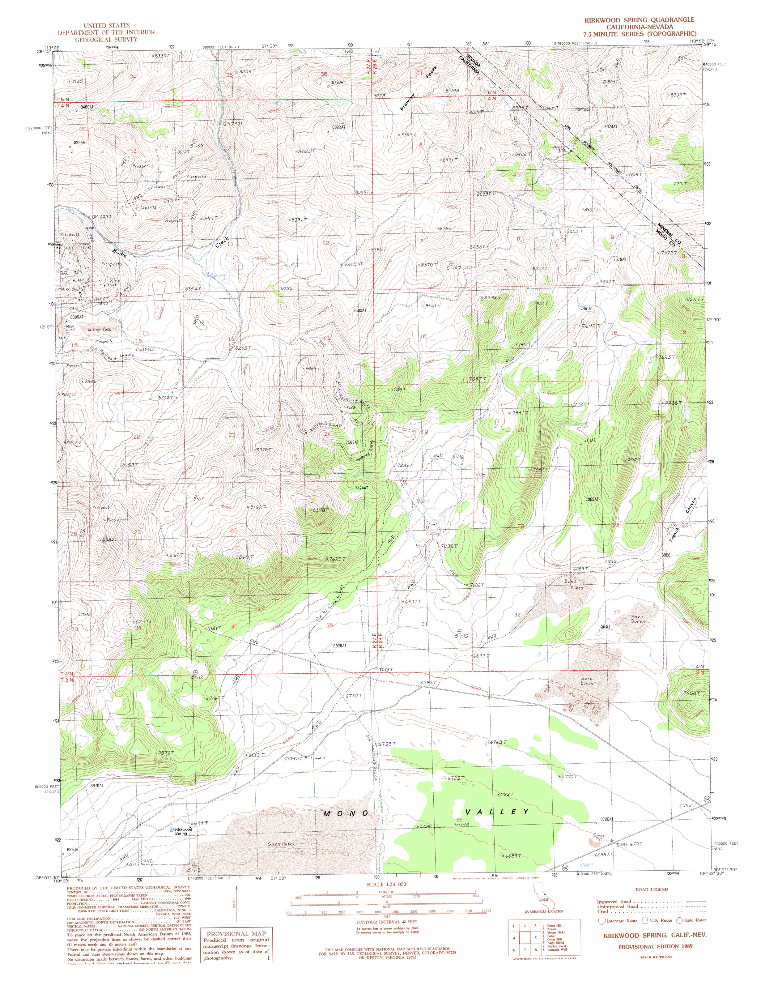
USGS Topo Quad 38118b8 - 1:24,000 scale
| Topo Map Name: | Kirkwood Spring |
| USGS Topo Quad ID: | 38118b8 |
| Print Size: | ca. 21 1/4" wide x 27" high |
| Southeast Coordinates: | 38.125° N latitude / 118.875° W longitude |
| Map Center Coordinates: | 38.1875° N latitude / 118.9375° W longitude |
| U.S. States: | CA, NV |
| Filename: | o38118b8.jpg |
| Download Map JPG Image: | Kirkwood Spring topo map 1:24,000 scale |
| Map Type: | Topographic |
| Topo Series: | 7.5´ |
| Map Scale: | 1:24,000 |
| Source of Map Images: | United States Geological Survey (USGS) |
| Alternate Map Versions: |
Kirkwood Spring CA 1989, updated 1989 Download PDF Buy paper map Kirkwood Spring CA 2012 Download PDF Buy paper map Kirkwood Spring CA 2015 Download PDF Buy paper map |
| FStopo: | US Forest Service topo Kirkwood Spring is available: Download FStopo PDF Download FStopo TIF |
1:24,000 Topo Quads surrounding Kirkwood Spring
Sweetwater Creek |
The Elbow |
Ninemile Ranch |
Corey Peak |
Lucky Boy |
Bridgeport |
Dome Hill |
Aurora |
Mount Hicks |
Powell Mountain |
Big Alkali |
Bodie |
Kirkwood Spring |
Cedar Hill |
Anchorite Hills |
Lundy |
Negit Island |
Sulphur Pond |
Alameda Well |
West Of Huntoon Spring |
Mount Dana |
Lee Vining |
Mono Mills |
Cowtrack Mountain |
Indian Meadows |
> Back to 38118a1 at 1:100,000 scale
> Back to 38118a1 at 1:250,000 scale
> Back to U.S. Topo Maps home
Kirkwood Spring topo map: Gazetteer
Kirkwood Spring: Ranges
Brawley Peaks elevation 2832m 9291′Kirkwood Spring: Springs
Kirkwood Spring elevation 2045m 6709′Kirkwood Spring: Summits
Brawley Peaks elevation 2806m 9206′Kirkwood Spring digital topo map on disk
Buy this Kirkwood Spring topo map showing relief, roads, GPS coordinates and other geographical features, as a high-resolution digital map file on DVD: