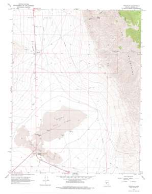
Sodaville Topo Map Nevada
To zoom in, hover over the map of Sodaville
USGS Topo Quad 38118c1 - 1:24,000 scale
| Topo Map Name: | Sodaville |
| USGS Topo Quad ID: | 38118c1 |
| Print Size: | ca. 21 1/4" wide x 27" high |
| Southeast Coordinates: | 38.25° N latitude / 118° W longitude |
| Map Center Coordinates: | 38.3125° N latitude / 118.0625° W longitude |
| U.S. State: | NV |
| Filename: | o38118c1.jpg |
| Download Map JPG Image: | Sodaville topo map 1:24,000 scale |
| Map Type: | Topographic |
| Topo Series: | 7.5´ |
| Map Scale: | 1:24,000 |
| Source of Map Images: | United States Geological Survey (USGS) |
| Alternate Map Versions: |
Sodaville NV 1967, updated 1970 Download PDF Buy paper map Sodaville NV 1967, updated 1978 Download PDF Buy paper map Sodaville NV 2011 Download PDF Buy paper map Sodaville NV 2014 Download PDF Buy paper map |
1:24,000 Topo Quads surrounding Sodaville
> Back to 38118a1 at 1:100,000 scale
> Back to 38118a1 at 1:250,000 scale
> Back to U.S. Topo Maps home
Sodaville topo map: Gazetteer
Sodaville: Flats
Rhodes Salt Marsh elevation 1321m 4333′Sodaville: Mines
American Mining Corporation elevation 1417m 4648′Arthur Salt and Borax Placer Mine elevation 1322m 4337′
Black Jack Mine elevation 1450m 4757′
Garfield Salt and Borax Placer Mine elevation 1325m 4347′
Sodaville: Populated Places
Rhodes (historical) elevation 1328m 4356′Sodaville elevation 1418m 4652′
Tonopah Junction elevation 1342m 4402′
Sodaville: Post Offices
Dea Post Office (historical) elevation 1328m 4356′Sodaville Post Office (historical) elevation 1418m 4652′
Sodaville: Springs
Martin Spring elevation 1839m 6033′Soda Springs elevation 1424m 4671′
Sulphur Spring elevation 1598m 5242′
Sodaville: Valleys
Long Canyon elevation 1476m 4842′Telephone Canyon elevation 1648m 5406′
Water Canyon elevation 1928m 6325′
Sodaville digital topo map on disk
Buy this Sodaville topo map showing relief, roads, GPS coordinates and other geographical features, as a high-resolution digital map file on DVD:


