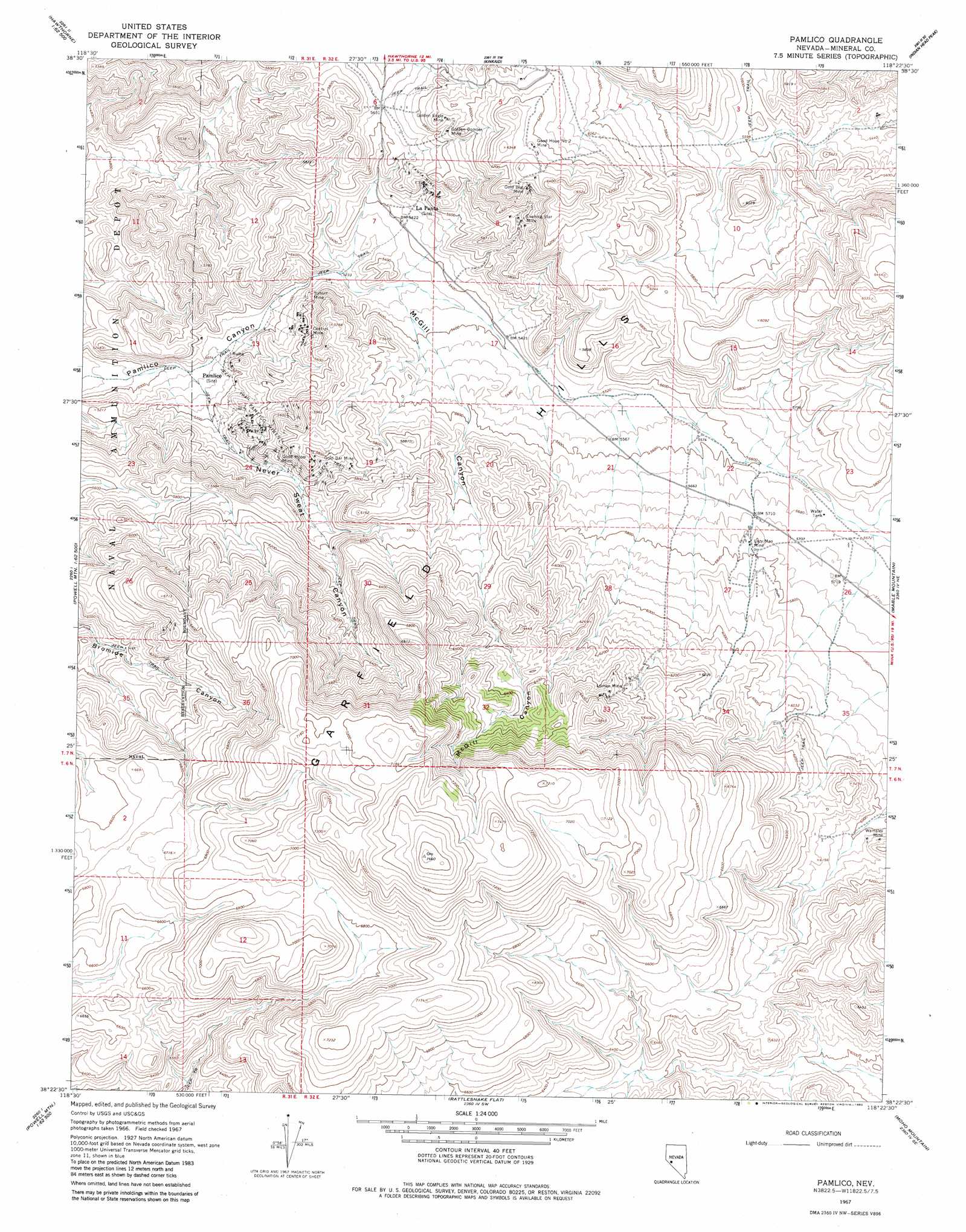
Pamlico Topo Map Nevada
To zoom in, hover over the map of Pamlico
USGS Topo Quad 38118d4 - 1:24,000 scale
| Topo Map Name: | Pamlico |
| USGS Topo Quad ID: | 38118d4 |
| Print Size: | ca. 21 1/4" wide x 27" high |
| Southeast Coordinates: | 38.375° N latitude / 118.375° W longitude |
| Map Center Coordinates: | 38.4375° N latitude / 118.4375° W longitude |
| U.S. State: | NV |
| Filename: | o38118d4.jpg |
| Download Map JPG Image: | Pamlico topo map 1:24,000 scale |
| Map Type: | Topographic |
| Topo Series: | 7.5´ |
| Map Scale: | 1:24,000 |
| Source of Map Images: | United States Geological Survey (USGS) |
| Alternate Map Versions: |
Pamlico NV 1967, updated 1969 Download PDF Buy paper map Pamlico NV 1967, updated 1982 Download PDF Buy paper map Pamlico NV 2011 Download PDF Buy paper map Pamlico NV 2014 Download PDF Buy paper map |
1:24,000 Topo Quads surrounding Pamlico
Walker Lake |
Ryan Canyon |
Kinkaid Nw |
Win Wan Flat |
Mount Ferguson |
Hawthorne West |
Hawthorne East |
Kinkaid |
Indian Head Peak |
Luning |
Lucky Boy |
Powell Mountain Ne |
Pamlico |
Mable Mountain |
Black Dyke Mountain |
Powell Mountain |
Whisky Flat |
Rattlesnake Flat |
Moho Mountain |
Camp Douglas |
Anchorite Hills |
Huntoon Valley |
Little Huntoon Valley |
Teels Marsh |
Belleville |
> Back to 38118a1 at 1:100,000 scale
> Back to 38118a1 at 1:250,000 scale
> Back to U.S. Topo Maps home
Pamlico topo map: Gazetteer
Pamlico: Mines
Ashby Gold Mines Incorporated elevation 1761m 5777′Big Deal Mine elevation 1844m 6049′
Central Mine elevation 1650m 5413′
Evening Star Mine elevation 1785m 5856′
Gold Bar Mine elevation 1766m 5793′
Gold Bug Mine elevation 1900m 6233′
Golden Bomber Mine elevation 1781m 5843′
Golden Eagle Mine elevation 1809m 5935′
Good Hope Mine elevation 1714m 5623′
Good Hope Number 2 Mine elevation 1905m 6250′
La Panta Mine elevation 1736m 5695′
Lazy Man Mine elevation 1761m 5777′
Loman Mine elevation 2001m 6564′
Pamlico Mines elevation 1662m 5452′
Sunset Mine elevation 1609m 5278′
Wamsley Mine elevation 1870m 6135′
Pamlico: Springs
Sagundai Spring elevation 1970m 6463′Pamlico: Valleys
McGill Canyon elevation 1620m 5314′Never Sweat Canyon elevation 1552m 5091′
Rhodes Cañon elevation 1594m 5229′
Pamlico digital topo map on disk
Buy this Pamlico topo map showing relief, roads, GPS coordinates and other geographical features, as a high-resolution digital map file on DVD: