Luning Topo Map Nevada
To zoom in, hover over the map of Luning
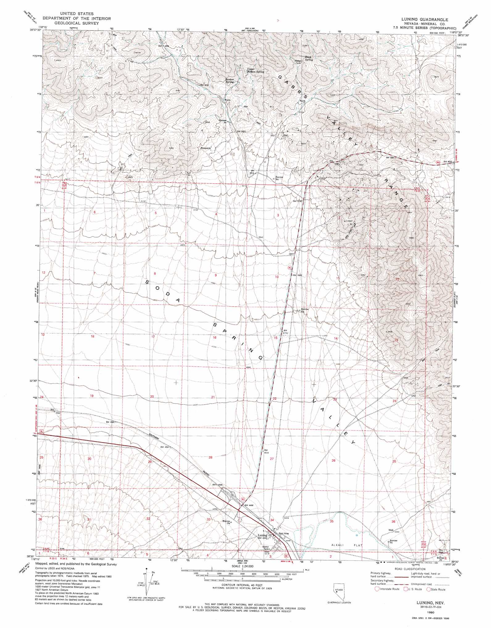
USGS Topo Quad 38118e2 - 1:24,000 scale
| Topo Map Name: | Luning |
| USGS Topo Quad ID: | 38118e2 |
| Print Size: | ca. 21 1/4" wide x 27" high |
| Southeast Coordinates: | 38.5° N latitude / 118.125° W longitude |
| Map Center Coordinates: | 38.5625° N latitude / 118.1875° W longitude |
| U.S. State: | NV |
| Filename: | o38118e2.jpg |
| Download Map JPG Image: | Luning topo map 1:24,000 scale |
| Map Type: | Topographic |
| Topo Series: | 7.5´ |
| Map Scale: | 1:24,000 |
| Source of Map Images: | United States Geological Survey (USGS) |
| Alternate Map Versions: |
Luning NV 1980, updated 1980 Download PDF Buy paper map Luning NV 1980, updated 1986 Download PDF Buy paper map Luning NV 2011 Download PDF Buy paper map Luning NV 2014 Download PDF Buy paper map |
1:24,000 Topo Quads surrounding Luning
Copper Mountain |
Poinsettia Spring |
Ramsey Spring |
Mount Annie Se |
Gabbs |
Kinkaid Nw |
Win Wan Flat |
Mount Ferguson |
Gabbs Mountain |
Granny Goose Well |
Kinkaid |
Indian Head Peak |
Luning |
Sunrise Flat |
Stewart Spring |
Pamlico |
Mable Mountain |
Black Dyke Mountain |
Mina |
Bettles Well |
Rattlesnake Flat |
Moho Mountain |
Camp Douglas |
Sodaville |
Eddyville |
> Back to 38118e1 at 1:100,000 scale
> Back to 38118a1 at 1:250,000 scale
> Back to U.S. Topo Maps home
Luning topo map: Gazetteer
Luning: Basins
Soda Spring Valley elevation 1382m 4534′Luning: Mines
Santa Fe Mine elevation 1644m 5393′Todd Mine elevation 1670m 5479′
Luning: Populated Places
Luning elevation 1370m 4494′Luning: Post Offices
Luning Post Office elevation 1370m 4494′Luning: Springs
Bank Spring elevation 1924m 6312′Benton Spring elevation 1783m 5849′
Upper Benton Spring elevation 1837m 6026′
Luning: Wells
Luning Well elevation 1363m 4471′Luning digital topo map on disk
Buy this Luning topo map showing relief, roads, GPS coordinates and other geographical features, as a high-resolution digital map file on DVD: