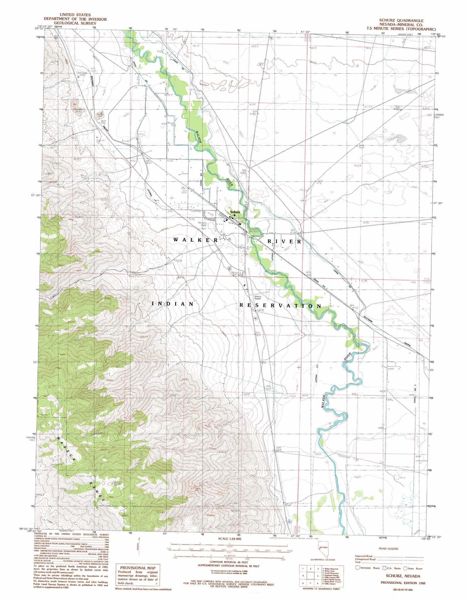
Schurz Topo Map Nevada
To zoom in, hover over the map of Schurz
USGS Topo Quad 38118h7 - 1:24,000 scale
| Topo Map Name: | Schurz |
| USGS Topo Quad ID: | 38118h7 |
| Print Size: | ca. 21 1/4" wide x 27" high |
| Southeast Coordinates: | 38.875° N latitude / 118.75° W longitude |
| Map Center Coordinates: | 38.9375° N latitude / 118.8125° W longitude |
| U.S. State: | NV |
| Filename: | o38118h7.jpg |
| Download Map JPG Image: | Schurz topo map 1:24,000 scale |
| Map Type: | Topographic |
| Topo Series: | 7.5´ |
| Map Scale: | 1:24,000 |
| Source of Map Images: | United States Geological Survey (USGS) |
| Alternate Map Versions: |
Schurz NV 1988, updated 1988 Download PDF Buy paper map Schurz NV 2011 Download PDF Buy paper map Schurz NV 2015 Download PDF Buy paper map |
1:24,000 Topo Quads surrounding Schurz
Parker Butte |
Wild Horse Basin |
Russell Spit |
Allen Springs |
Diamond Field Jack Wash |
Hinkson Slough |
Weber Reservoir |
Weber Dam |
Terrill Mountains |
Red Ridge |
Yerington Ne |
Hussman Spring |
Schurz |
Gillis Canyon Nw |
Hu-Pwi Wash |
Yerington Se |
Buck Brush Spring |
Reese River Canyon |
Gillis Canyon |
Ghost Dance Ridge |
Pine Grove Spring |
Butler Mountain |
Copper Canyon |
Walker Lake |
Ryan Canyon |
> Back to 38118e1 at 1:100,000 scale
> Back to 38118a1 at 1:250,000 scale
> Back to U.S. Topo Maps home
Schurz topo map: Gazetteer
Schurz: Airports
Schurz Airport elevation 1274m 4179′Schurz: Canals
Canal Number One elevation 1262m 4140′Canal Number Two elevation 1262m 4140′
Drain Number One elevation 1254m 4114′
Lateral One-A elevation 1262m 4140′
Lateral Two-A elevation 1248m 4094′
Lateral Two-B elevation 1260m 4133′
Lateral Two-D elevation 1251m 4104′
Lateral Two-E elevation 1249m 4097′
Schurz: Mines
Blue Ridge Tungsten Mine elevation 1662m 5452′Schurz: Populated Places
Schurz elevation 1258m 4127′Schurz: Post Offices
Schurz Post Office elevation 1258m 4127′Schurz digital topo map on disk
Buy this Schurz topo map showing relief, roads, GPS coordinates and other geographical features, as a high-resolution digital map file on DVD: