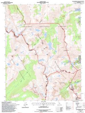
Dunderberg Peak Topo Map California
To zoom in, hover over the map of Dunderberg Peak
USGS Topo Quad 38119a3 - 1:24,000 scale
| Topo Map Name: | Dunderberg Peak |
| USGS Topo Quad ID: | 38119a3 |
| Print Size: | ca. 21 1/4" wide x 27" high |
| Southeast Coordinates: | 38° N latitude / 119.25° W longitude |
| Map Center Coordinates: | 38.0625° N latitude / 119.3125° W longitude |
| U.S. State: | CA |
| Filename: | o38119a3.jpg |
| Download Map JPG Image: | Dunderberg Peak topo map 1:24,000 scale |
| Map Type: | Topographic |
| Topo Series: | 7.5´ |
| Map Scale: | 1:24,000 |
| Source of Map Images: | United States Geological Survey (USGS) |
| Alternate Map Versions: |
Dunderberg Peak CA 1990, updated 1990 Download PDF Buy paper map Dunderberg Peak CA 1994, updated 1997 Download PDF Buy paper map Dunderberg Peak CA 2012 Download PDF Buy paper map Dunderberg Peak CA 2015 Download PDF Buy paper map |
| FStopo: | US Forest Service topo Dunderberg Peak is available: Download FStopo PDF Download FStopo TIF |
1:24,000 Topo Quads surrounding Dunderberg Peak
> Back to 38119a1 at 1:100,000 scale
> Back to 38118a1 at 1:250,000 scale
> Back to U.S. Topo Maps home
Dunderberg Peak topo map: Gazetteer
Dunderberg Peak: Gaps
Virginia Pass elevation 3210m 10531′Dunderberg Peak: Lakes
Bergona Lake elevation 3154m 10347′Big Valley Lake elevation 2993m 9819′
Blue Lake elevation 3015m 9891′
Burro Lake elevation 3214m 10544′
Cooney Lake elevation 3128m 10262′
East Lake elevation 2884m 9461′
Frog Lakes elevation 3165m 10383′
Gilman Lake elevation 2896m 9501′
Glenberry Lake elevation 3056m 10026′
Green Lake elevation 2726m 8943′
Hoover Lakes elevation 2994m 9822′
Hunewill Lake elevation 3079m 10101′
Lake Frances elevation 3179m 10429′
Lake Helen elevation 3079m 10101′
Little Valley elevation 2970m 9744′
Moat Lake elevation 3226m 10583′
Nutter Lake elevation 2924m 9593′
Onion Lake elevation 3179m 10429′
Par Value Lakes elevation 3142m 10308′
Red Lake elevation 3008m 9868′
Return Lake elevation 3118m 10229′
Shepherd Lake elevation 3140m 10301′
Soldier Lake elevation 3238m 10623′
Spiller Lake elevation 3250m 10662′
Summit Lake elevation 3104m 10183′
Trumbull Lake elevation 2957m 9701′
Turquoise Lake elevation 3191m 10469′
Virginia Lakes elevation 2993m 9819′
West Lake elevation 3006m 9862′
Dunderberg Peak: Mines
May Lundy Mine elevation 3271m 10731′Dunderberg Peak: Populated Places
Dunderberg Mill elevation 2624m 8608′Dunderberg Peak: Ridges
Kavanaugh Ridge elevation 3341m 10961′Monument Ridge elevation 3333m 10935′
Dunderberg Peak: Streams
East Fork Green Creek elevation 2540m 8333′West Fork Green Creek elevation 2538m 8326′
Dunderberg Peak: Summits
Black Mountain elevation 3584m 11758′Camiaca Peak elevation 3574m 11725′
Crater Crest elevation 3478m 11410′
Dunderberg Peak elevation 3774m 12381′
Epidote Peak elevation 3338m 10951′
Excelsior Mountain elevation 3791m 12437′
Gabbro Peak elevation 3340m 10958′
Grey Butte elevation 3452m 11325′
Mount Scowden elevation 3385m 11105′
Page Peaks elevation 3316m 10879′
Shepherd Crest elevation 3576m 11732′
Stanton Peak elevation 3552m 11653′
Twin Peaks elevation 3718m 12198′
Virginia Peak elevation 3646m 11961′
Dunderberg Peak: Valleys
Glines Canyon elevation 2726m 8943′Dunderberg Peak digital topo map on disk
Buy this Dunderberg Peak topo map showing relief, roads, GPS coordinates and other geographical features, as a high-resolution digital map file on DVD:


