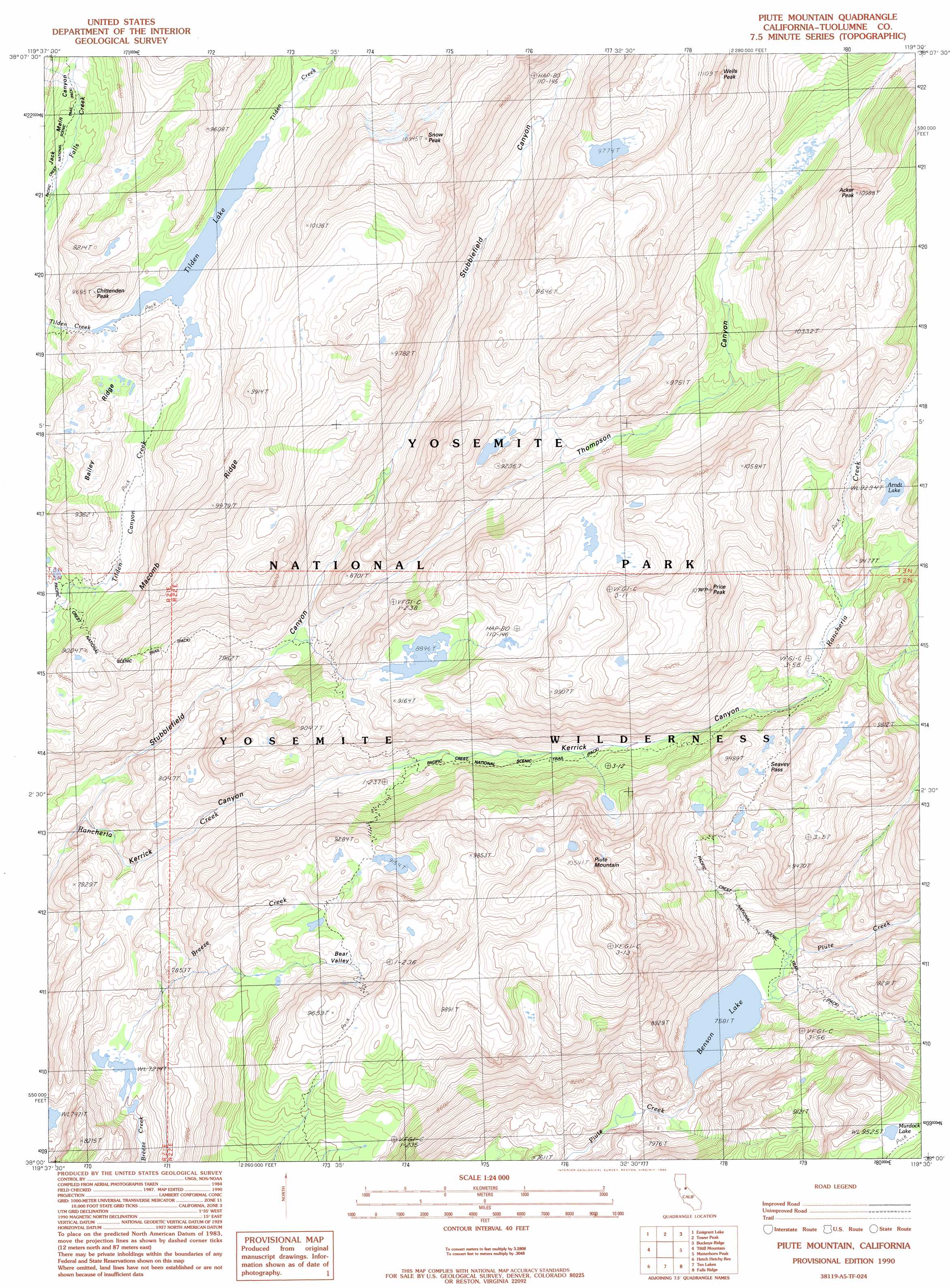
Piute Mountain Topo Map California
To zoom in, hover over the map of Piute Mountain
USGS Topo Quad 38119a5 - 1:24,000 scale
| Topo Map Name: | Piute Mountain |
| USGS Topo Quad ID: | 38119a5 |
| Print Size: | ca. 21 1/4" wide x 27" high |
| Southeast Coordinates: | 38° N latitude / 119.5° W longitude |
| Map Center Coordinates: | 38.0625° N latitude / 119.5625° W longitude |
| U.S. State: | CA |
| Filename: | o38119a5.jpg |
| Download Map JPG Image: | Piute Mountain topo map 1:24,000 scale |
| Map Type: | Topographic |
| Topo Series: | 7.5´ |
| Map Scale: | 1:24,000 |
| Source of Map Images: | United States Geological Survey (USGS) |
| Alternate Map Versions: |
Piute Mountain CA 1990, updated 1990 Download PDF Buy paper map Piute Mountain CA 2012 Download PDF Buy paper map Piute Mountain CA 2015 Download PDF Buy paper map |
1:24,000 Topo Quads surrounding Piute Mountain
Dardanelle |
Sonora Pass |
Pickel Meadow |
Fales Hot Springs |
Mount Jackson |
Cooper Peak |
Emigrant Lake |
Tower Peak |
Buckeye Ridge |
Twin Lakes |
Kibbie Lake |
Tiltill Mountain |
Piute Mountain |
Matterhorn Peak |
Dunderberg Peak |
Lake Eleanor |
Hetch Hetchy Reservoir |
Ten Lakes |
Falls Ridge |
Tioga Pass |
Ackerson Mountain |
Tamarack Flat |
Yosemite Falls |
Tenaya Lake |
Vogelsang Peak |
> Back to 38119a1 at 1:100,000 scale
> Back to 38118a1 at 1:250,000 scale
> Back to U.S. Topo Maps home
Piute Mountain topo map: Gazetteer
Piute Mountain: Basins
Bear Valley elevation 2693m 8835′Piute Mountain: Gaps
Seavey Pass elevation 2761m 9058′Piute Mountain: Lakes
Arndt Lake elevation 2812m 9225′Benson Lake elevation 2311m 7582′
Murdock Lake elevation 2908m 9540′
Tilden Lake elevation 2711m 8894′
Piute Mountain: Ridges
Bailey Ridge elevation 2855m 9366′Macomb Ridge elevation 3005m 9858′
Piute Mountain: Summits
Acker Peak elevation 3310m 10859′Chittenden Peak elevation 2920m 9580′
Piute Mountain elevation 3180m 10433′
Price Peak elevation 3251m 10666′
Snow Peak elevation 3324m 10905′
Wells Peak elevation 3366m 11043′
Piute Mountain: Valleys
Kerrick Canyon elevation 2192m 7191′Stubblefield Canyon elevation 2189m 7181′
Thompson Canyon elevation 2399m 7870′
Piute Mountain digital topo map on disk
Buy this Piute Mountain topo map showing relief, roads, GPS coordinates and other geographical features, as a high-resolution digital map file on DVD: