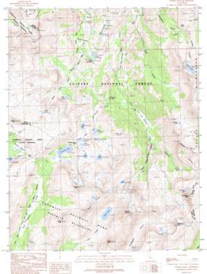
Tower Peak Topo Map California
To zoom in, hover over the map of Tower Peak
USGS Topo Quad 38119b5 - 1:24,000 scale
| Topo Map Name: | Tower Peak |
| USGS Topo Quad ID: | 38119b5 |
| Print Size: | ca. 21 1/4" wide x 27" high |
| Southeast Coordinates: | 38.125° N latitude / 119.5° W longitude |
| Map Center Coordinates: | 38.1875° N latitude / 119.5625° W longitude |
| U.S. State: | CA |
| Filename: | o38119b5.jpg |
| Download Map JPG Image: | Tower Peak topo map 1:24,000 scale |
| Map Type: | Topographic |
| Topo Series: | 7.5´ |
| Map Scale: | 1:24,000 |
| Source of Map Images: | United States Geological Survey (USGS) |
| Alternate Map Versions: |
Tower Peak CA 1990, updated 1990 Download PDF Buy paper map Tower Peak CA 2001, updated 2004 Download PDF Buy paper map Tower Peak CA 2001, updated 2004 Download PDF Buy paper map Tower Peak CA 2012 Download PDF Buy paper map Tower Peak CA 2015 Download PDF Buy paper map |
| FStopo: | US Forest Service topo Tower Peak is available: Download FStopo PDF Download FStopo TIF |
1:24,000 Topo Quads surrounding Tower Peak
> Back to 38119a1 at 1:100,000 scale
> Back to 38118a1 at 1:250,000 scale
> Back to U.S. Topo Maps home
Tower Peak topo map: Gazetteer
Tower Peak: Falls
Cascade Falls elevation 2542m 8339′Tower Peak: Flats
Grace Meadow elevation 2644m 8674′Lower Piute Meadows elevation 2459m 8067′
Summit Meadow elevation 2865m 9399′
Upper Piute Meadows elevation 2520m 8267′
Walker Meadows elevation 2616m 8582′
Tower Peak: Gaps
Bond Pass elevation 2961m 9714′Dorothy Lake Pass elevation 2927m 9603′
Piute Pass elevation 3053m 10016′
Tower Peak: Lakes
Anna Lake elevation 3226m 10583′Beartrap Lake elevation 3008m 9868′
Bonnie Lake elevation 2863m 9393′
Chain of Lakes elevation 2609m 8559′
Cinko Lake elevation 2800m 9186′
Cora Lake elevation 2855m 9366′
Dorothy Lake elevation 2865m 9399′
Grizzly Lake elevation 3000m 9842′
Kirkwood Lake elevation 3119m 10232′
Lake Harriet elevation 2814m 9232′
Lake Helen elevation 2950m 9678′
Lake Ruth elevation 2946m 9665′
Lower Long Lake elevation 2621m 8599′
Mary Lake elevation 2933m 9622′
Stella Lake elevation 2898m 9507′
Tower Lake elevation 2910m 9547′
Upper Long Lake elevation 2622m 8602′
Tower Peak: Ridges
Saurian Crest elevation 3357m 11013′Tower Peak: Streams
Cascade Creek elevation 2477m 8126′Kirkwood Creek elevation 2527m 8290′
Tower Peak: Summits
Craig Peak elevation 3362m 11030′Ehrnbeck Peak elevation 3428m 11246′
Forsyth Peak elevation 3299m 10823′
Grizzly Peak elevation 3114m 10216′
Hawksbeak Peak elevation 3385m 11105′
Keyes Peak elevation 3231m 10600′
Tower Peak elevation 3571m 11715′
Tower Peak: Valleys
Kennedy Canyon elevation 2613m 8572′Long Canyon elevation 2427m 7962′
Tower Canyon elevation 2526m 8287′
Tower Peak digital topo map on disk
Buy this Tower Peak topo map showing relief, roads, GPS coordinates and other geographical features, as a high-resolution digital map file on DVD:


