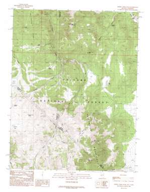
Desert Creek Peak Topo Map Nevada
To zoom in, hover over the map of Desert Creek Peak
USGS Topo Quad 38119e3 - 1:24,000 scale
| Topo Map Name: | Desert Creek Peak |
| USGS Topo Quad ID: | 38119e3 |
| Print Size: | ca. 21 1/4" wide x 27" high |
| Southeast Coordinates: | 38.5° N latitude / 119.25° W longitude |
| Map Center Coordinates: | 38.5625° N latitude / 119.3125° W longitude |
| U.S. States: | NV, CA |
| Filename: | o38119e3.jpg |
| Download Map JPG Image: | Desert Creek Peak topo map 1:24,000 scale |
| Map Type: | Topographic |
| Topo Series: | 7.5´ |
| Map Scale: | 1:24,000 |
| Source of Map Images: | United States Geological Survey (USGS) |
| Alternate Map Versions: |
Desert Creek Peak NV 1988, updated 1989 Download PDF Buy paper map Desert Creek Peak NV 2012 Download PDF Buy paper map Desert Creek Peak NV 2014 Download PDF Buy paper map |
| FStopo: | US Forest Service topo Desert Creek Peak is available: Download FStopo PDF Download FStopo TIF |
1:24,000 Topo Quads surrounding Desert Creek Peak
> Back to 38119e1 at 1:100,000 scale
> Back to 38118a1 at 1:250,000 scale
> Back to U.S. Topo Maps home
Desert Creek Peak topo map: Gazetteer
Desert Creek Peak: Basins
Taylor Valley elevation 2283m 7490′Desert Creek Peak: Flats
Jackass Flat elevation 2529m 8297′Desert Creek Peak: Lakes
Dry Lake elevation 2163m 7096′Desert Creek Peak: Mines
Rickey Mine elevation 2294m 7526′Desert Creek Peak: Populated Places
Sulfur elevation 1788m 5866′Desert Creek Peak: Ranges
Desert Creek Mountains elevation 2010m 6594′Wellington Hills elevation 2368m 7769′
Desert Creek Peak: Springs
Fourth of July Spring elevation 2426m 7959′Jackass Spring elevation 2445m 8021′
O'Banion Spring elevation 1922m 6305′
Trail Spring elevation 2119m 6952′
Willow Spring elevation 2182m 7158′
Desert Creek Peak: Streams
Coyote Creek elevation 2382m 7814′Jackass Creek elevation 2105m 6906′
Jackass Creek elevation 2080m 6824′
Sage Hen Creek elevation 2362m 7749′
Sage Hen Creek elevation 2359m 7739′
Desert Creek Peak: Summits
Black Mountain elevation 2479m 8133′Desert Creek Peak elevation 2717m 8914′
East Sister elevation 3144m 10314′
Middle Sister elevation 3306m 10846′
Middle Sister elevation 3287m 10784′
Desert Creek Peak: Valleys
Little Smith Valley elevation 2430m 7972′Desert Creek Peak digital topo map on disk
Buy this Desert Creek Peak topo map showing relief, roads, GPS coordinates and other geographical features, as a high-resolution digital map file on DVD:


