Mount Siegel Topo Map Nevada
To zoom in, hover over the map of Mount Siegel
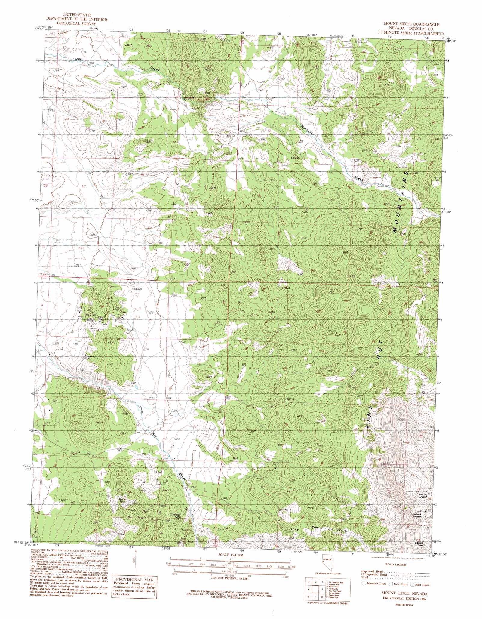
USGS Topo Quad 38119h5 - 1:24,000 scale
| Topo Map Name: | Mount Siegel |
| USGS Topo Quad ID: | 38119h5 |
| Print Size: | ca. 21 1/4" wide x 27" high |
| Southeast Coordinates: | 38.875° N latitude / 119.5° W longitude |
| Map Center Coordinates: | 38.9375° N latitude / 119.5625° W longitude |
| U.S. State: | NV |
| Filename: | o38119h5.jpg |
| Download Map JPG Image: | Mount Siegel topo map 1:24,000 scale |
| Map Type: | Topographic |
| Topo Series: | 7.5´ |
| Map Scale: | 1:24,000 |
| Source of Map Images: | United States Geological Survey (USGS) |
| Alternate Map Versions: |
Mount Siegel NV 1986, updated 1987 Download PDF Buy paper map Mount Siegel NV 2012 Download PDF Buy paper map Mount Siegel NV 2014 Download PDF Buy paper map |
| FStopo: | US Forest Service topo Mount Siegel is available: Download FStopo PDF Download FStopo TIF |
1:24,000 Topo Quads surrounding Mount Siegel
Carson City |
New Empire |
Dayton |
Como |
Churchill Canyon Well |
Genoa |
Mctarnahan Hill |
Mineral Peak |
Mount Como |
Lincoln Flat |
Minden |
Gardnerville |
Mount Siegel |
Pine Nut Valley |
Artesia Lake |
Woodfords |
Carters Station |
Double Spring |
Oreana Peak |
Smith |
Markleeville |
Heenan Lake |
Topaz Lake |
Long Dry Canyon |
Desert Creek Ranch |
> Back to 38119e1 at 1:100,000 scale
> Back to 38118a1 at 1:250,000 scale
> Back to U.S. Topo Maps home
Mount Siegel topo map: Gazetteer
Mount Siegel: Gaps
Galena Saddle elevation 2803m 9196′Mount Siegel: Mines
Cherokee Mine elevation 1847m 6059′Divide Mine elevation 1941m 6368′
Last Laugh Mine elevation 1908m 6259′
Monarch Mine elevation 1723m 5652′
Tungsten Hills Mine elevation 1841m 6040′
Mount Siegel: Summits
Galena Peak elevation 2866m 9402′Mount Siegel elevation 2869m 9412′
Mount Siegel: Valleys
Dutch Canyon elevation 1868m 6128′Lone Pine Canyon elevation 1775m 5823′
Mount Siegel: Wells
Uhaldi Well elevation 1643m 5390′Mount Siegel digital topo map on disk
Buy this Mount Siegel topo map showing relief, roads, GPS coordinates and other geographical features, as a high-resolution digital map file on DVD: