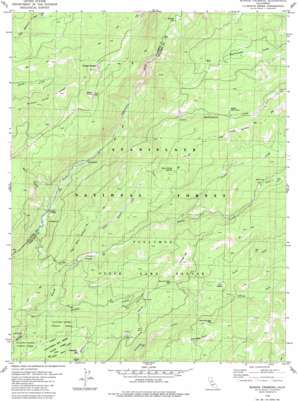
Boards Crossing Topo Map California
To zoom in, hover over the map of Boards Crossing
USGS Topo Quad 38120c2 - 1:24,000 scale
| Topo Map Name: | Boards Crossing |
| USGS Topo Quad ID: | 38120c2 |
| Print Size: | ca. 21 1/4" wide x 27" high |
| Southeast Coordinates: | 38.25° N latitude / 120.125° W longitude |
| Map Center Coordinates: | 38.3125° N latitude / 120.1875° W longitude |
| U.S. State: | CA |
| Filename: | o38120c2.jpg |
| Download Map JPG Image: | Boards Crossing topo map 1:24,000 scale |
| Map Type: | Topographic |
| Topo Series: | 7.5´ |
| Map Scale: | 1:24,000 |
| Source of Map Images: | United States Geological Survey (USGS) |
| Alternate Map Versions: |
Boards Crossing CA 1979, updated 1979 Download PDF Buy paper map Boards Crossing CA 1979, updated 1979 Download PDF Buy paper map Boards Crossing CA 2001, updated 2004 Download PDF Buy paper map Boards Crossing CA 2012 Download PDF Buy paper map Boards Crossing CA 2015 Download PDF Buy paper map |
| FStopo: | US Forest Service topo Boards Crossing is available: Download FStopo PDF Download FStopo TIF |
1:24,000 Topo Quads surrounding Boards Crossing
> Back to 38120a1 at 1:100,000 scale
> Back to 38120a1 at 1:250,000 scale
> Back to U.S. Topo Maps home
Boards Crossing topo map: Gazetteer
Boards Crossing: Flats
Cedar Flat elevation 1655m 5429′Grizzly Meadow elevation 1606m 5269′
Boards Crossing: Forests
Calaveras Bigtree National Forest elevation 1492m 4895′Boards Crossing: Populated Places
Boards Crossing elevation 1174m 3851′Cottage Springs elevation 1775m 5823′
Boards Crossing: Springs
Burnt Corral Spring elevation 1830m 6003′Cottage Spring elevation 1716m 5629′
Boards Crossing: Streams
Big Rattlesnake Creek elevation 1414m 4639′Crane Creek elevation 1547m 5075′
Grizzly Creek elevation 1398m 4586′
Little Beaver Creek elevation 1460m 4790′
Little Rattlesnake Creek elevation 1245m 4084′
Mill Creek elevation 1177m 3861′
North Fork Griswold Creek elevation 1561m 5121′
South Fork Griswold Creek elevation 1561m 5121′
Boards Crossing: Summits
Repeater Hill elevation 1672m 5485′Shumake Knoll elevation 1799m 5902′
Thunder Hill elevation 1824m 5984′
Boards Crossing digital topo map on disk
Buy this Boards Crossing topo map showing relief, roads, GPS coordinates and other geographical features, as a high-resolution digital map file on DVD:


