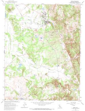
Ione Topo Map California
To zoom in, hover over the map of Ione
USGS Topo Quad 38120c8 - 1:24,000 scale
| Topo Map Name: | Ione |
| USGS Topo Quad ID: | 38120c8 |
| Print Size: | ca. 21 1/4" wide x 27" high |
| Southeast Coordinates: | 38.25° N latitude / 120.875° W longitude |
| Map Center Coordinates: | 38.3125° N latitude / 120.9375° W longitude |
| U.S. State: | CA |
| Filename: | o38120c8.jpg |
| Download Map JPG Image: | Ione topo map 1:24,000 scale |
| Map Type: | Topographic |
| Topo Series: | 7.5´ |
| Map Scale: | 1:24,000 |
| Source of Map Images: | United States Geological Survey (USGS) |
| Alternate Map Versions: |
Ione CA 1962, updated 1963 Download PDF Buy paper map Ione CA 1962, updated 1973 Download PDF Buy paper map Ione CA 2012 Download PDF Buy paper map Ione CA 2015 Download PDF Buy paper map |
1:24,000 Topo Quads surrounding Ione
> Back to 38120a1 at 1:100,000 scale
> Back to 38120a1 at 1:250,000 scale
> Back to U.S. Topo Maps home
Ione topo map: Gazetteer
Ione: Airports
Camanche Skypark elevation 156m 511′Howard Airport elevation 141m 462′
Ranch Airstrip elevation 89m 291′
Ione: Canals
Isaacs Ditch elevation 155m 508′Kreth Ditch elevation 158m 518′
Ione: Dams
Arroyo Seco 471 Dam elevation 81m 265′Henderson Forebay 1-011 Dam elevation 170m 557′
Jackson Creek 1035 Dam elevation 100m 328′
John Orr 483 Dam elevation 69m 226′
Preston 1-022 Dam elevation 109m 357′
Sand Plant 485 Dam elevation 98m 321′
Ione: Mines
Newton Mine elevation 187m 613′Ione: Parks
Charles Howard Park elevation 98m 321′Pioneer Park elevation 95m 311′
Ione: Pillars
The Chemisal elevation 238m 780′Ione: Populated Places
Buena Vista elevation 90m 295′Camanche Village elevation 84m 275′
Chinatown (historical) elevation 105m 344′
Clarsona elevation 83m 272′
Dagon elevation 80m 262′
Firebrick elevation 115m 377′
Ione elevation 91m 298′
Sunnybrook elevation 240m 787′
Ione: Post Offices
Ione Post Office elevation 90m 295′Ione: Reservoirs
Lake Amador elevation 100m 328′Lake Flint elevation 114m 374′
Loch Lane Lake elevation 81m 265′
Preston Reservoir elevation 109m 357′
Ione: Streams
Carson Creek elevation 97m 318′Copper Creek elevation 107m 351′
Mountain Spring Creek elevation 98m 321′
Mule Creek elevation 73m 239′
Sutter Creek elevation 71m 232′
Ione: Summits
Buena Vista Peaks elevation 251m 823′Church Bell Hill elevation 240m 787′
Dutschke Hill elevation 197m 646′
Newman Hill elevation 137m 449′
Ione: Valleys
Grapevine Gulch elevation 78m 255′Hicks Gulch elevation 115m 377′
Ione Valley elevation 69m 226′
Jackson Valley elevation 59m 193′
Ione digital topo map on disk
Buy this Ione topo map showing relief, roads, GPS coordinates and other geographical features, as a high-resolution digital map file on DVD:


