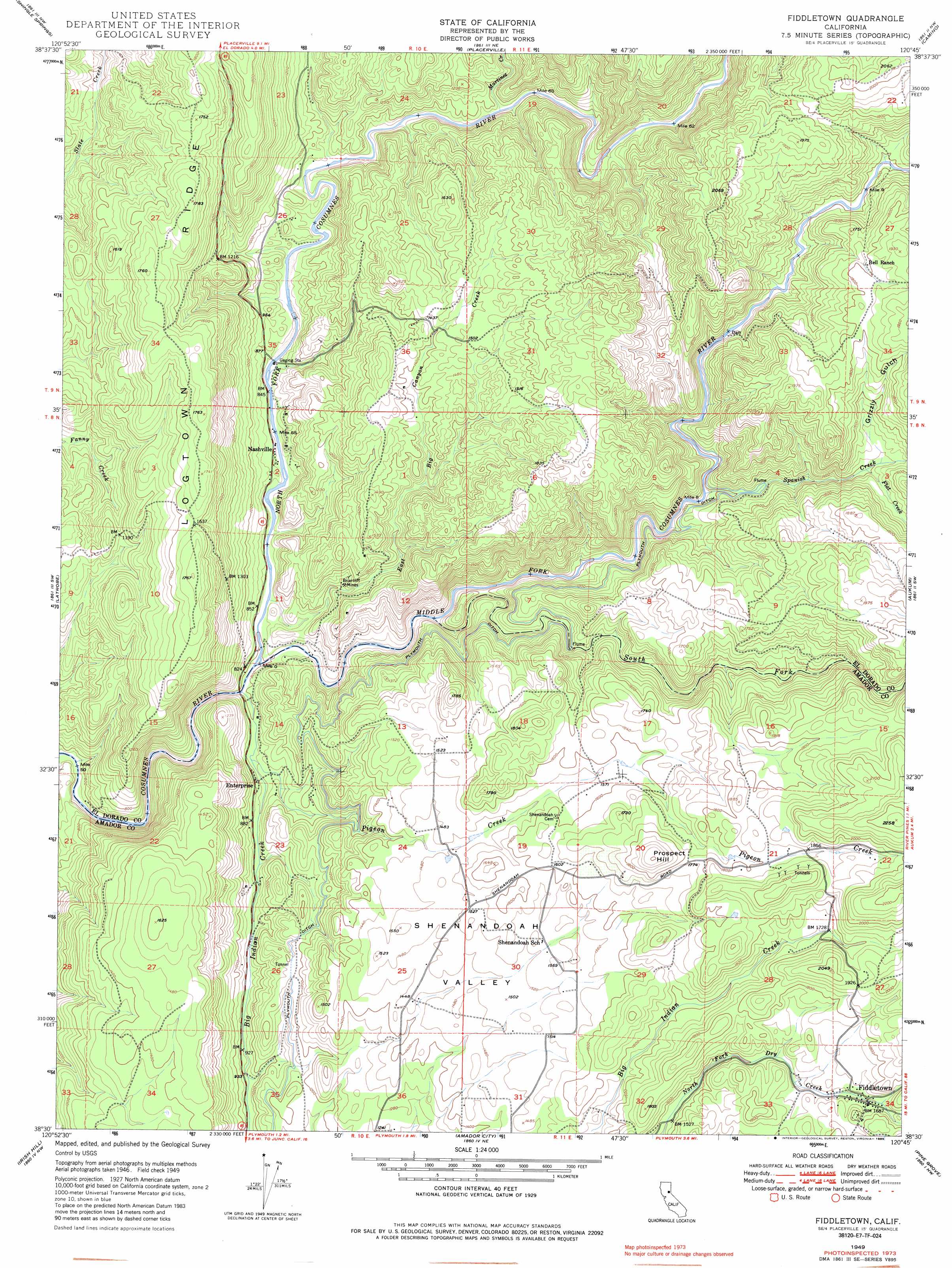
Fiddletown Topo Map California
To zoom in, hover over the map of Fiddletown
USGS Topo Quad 38120e7 - 1:24,000 scale
| Topo Map Name: | Fiddletown |
| USGS Topo Quad ID: | 38120e7 |
| Print Size: | ca. 21 1/4" wide x 27" high |
| Southeast Coordinates: | 38.5° N latitude / 120.75° W longitude |
| Map Center Coordinates: | 38.5625° N latitude / 120.8125° W longitude |
| U.S. State: | CA |
| Filename: | o38120e7.jpg |
| Download Map JPG Image: | Fiddletown topo map 1:24,000 scale |
| Map Type: | Topographic |
| Topo Series: | 7.5´ |
| Map Scale: | 1:24,000 |
| Source of Map Images: | United States Geological Survey (USGS) |
| Alternate Map Versions: |
Fiddletown CA 1949, updated 1985 Download PDF Buy paper map Fiddletown CA 1949, updated 1986 Download PDF Buy paper map Fiddletown CA 1950, updated 1950 Download PDF Buy paper map Fiddletown CA 2012 Download PDF Buy paper map Fiddletown CA 2015 Download PDF Buy paper map |
1:24,000 Topo Quads surrounding Fiddletown
Pilot Hill |
Coloma |
Garden Valley |
Slate Mountain |
Pollock Pines |
Clarksville |
Shingle Springs |
Placerville |
Camino |
Sly Park |
Folsom Se |
Latrobe |
Fiddletown |
Aukum |
Omo Ranch |
Carbondale |
Irish Hill |
Amador City |
Pine Grove |
West Point |
Goose Creek |
Ione |
Jackson |
Mokelumne Hill |
Rail Road Flat |
> Back to 38120e1 at 1:100,000 scale
> Back to 38120a1 at 1:250,000 scale
> Back to U.S. Topo Maps home
Fiddletown topo map: Gazetteer
Fiddletown: Canals
Plymouth Ditch elevation 354m 1161′Fiddletown: Dams
Jameson 481 Dam elevation 474m 1555′Shenandoah Lake 486 Dam elevation 464m 1522′
Fiddletown: Flats
Shenandoah Valley elevation 452m 1482′Fiddletown: Mines
Briarcliff Mines elevation 320m 1049′Fiddletown: Populated Places
Enterprise elevation 267m 875′Fiddletown elevation 513m 1683′
Nashville elevation 263m 862′
Fiddletown: Ridges
Logtown Ridge elevation 529m 1735′Fiddletown: Streams
Big Indian Creek elevation 236m 774′East Big Canyon Creek elevation 247m 810′
Flat Creek elevation 425m 1394′
Martinez Creek elevation 298m 977′
Middle Fork Cosumnes River elevation 240m 787′
North Fork Cosumnes River elevation 240m 787′
Pigeon Creek elevation 257m 843′
South Fork Cosumnes River elevation 280m 918′
Spanish Creek elevation 350m 1148′
Fiddletown: Summits
Prospect Hill elevation 609m 1998′Fiddletown: Valleys
Grizzly Gulch elevation 433m 1420′Fiddletown digital topo map on disk
Buy this Fiddletown topo map showing relief, roads, GPS coordinates and other geographical features, as a high-resolution digital map file on DVD: