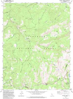
Tragedy Spring Topo Map California
To zoom in, hover over the map of Tragedy Spring
USGS Topo Quad 38120f2 - 1:24,000 scale
| Topo Map Name: | Tragedy Spring |
| USGS Topo Quad ID: | 38120f2 |
| Print Size: | ca. 21 1/4" wide x 27" high |
| Southeast Coordinates: | 38.625° N latitude / 120.125° W longitude |
| Map Center Coordinates: | 38.6875° N latitude / 120.1875° W longitude |
| U.S. State: | CA |
| Filename: | o38120f2.jpg |
| Download Map JPG Image: | Tragedy Spring topo map 1:24,000 scale |
| Map Type: | Topographic |
| Topo Series: | 7.5´ |
| Map Scale: | 1:24,000 |
| Source of Map Images: | United States Geological Survey (USGS) |
| Alternate Map Versions: |
Tragedy Spring CA 1979, updated 1980 Download PDF Buy paper map Tragedy Spring CA 1979, updated 1983 Download PDF Buy paper map Tragedy Spring CA 1992, updated 1994 Download PDF Buy paper map Tragedy Spring CA 1992, updated 1994 Download PDF Buy paper map Tragedy Spring CA 2012 Download PDF Buy paper map Tragedy Spring CA 2015 Download PDF Buy paper map |
| FStopo: | US Forest Service topo Tragedy Spring is available: Download FStopo PDF Download FStopo TIF |
1:24,000 Topo Quads surrounding Tragedy Spring
> Back to 38120e1 at 1:100,000 scale
> Back to 38120a1 at 1:250,000 scale
> Back to U.S. Topo Maps home
Tragedy Spring topo map: Gazetteer
Tragedy Spring: Basins
Hells Delight Valley elevation 1779m 5836′Tragedy Spring: Bridges
Fitch Rantz Bridge elevation 1695m 5561′Tragedy Spring: Flats
Cody Meadow elevation 2312m 7585′Convict Meadow elevation 1982m 6502′
Forgotten Flat elevation 1903m 6243′
Government Meadow elevation 1924m 6312′
Hay Flat elevation 2335m 7660′
Jake Schneider Meadow elevation 1843m 6046′
Negro Flat elevation 2116m 6942′
Shaw Flat elevation 2043m 6702′
Silver Fork Meadow elevation 2004m 6574′
Spicer Meadow elevation 2099m 6886′
Willow Flat elevation 1970m 6463′
Tragedy Spring: Lakes
Shealor Lakes elevation 2193m 7194′Tragedy Spring: Populated Places
Plasse elevation 2221m 7286′Tragedy Spring (historical) elevation 2410m 7906′
Tragedy Spring: Springs
Jim Quinn Spring elevation 2096m 6876′Singleton Springs elevation 2252m 7388′
Tragedy Spring elevation 2420m 7939′
Tragedy Spring: Streams
Caples Creek elevation 1784m 5853′Girard Creek elevation 1518m 4980′
Hells Delight Creek elevation 1583m 5193′
Martin Creek elevation 1621m 5318′
North Tragedy Creek elevation 1695m 5561′
Willow Flat Creek elevation 1865m 6118′
Tragedy Spring: Summits
Alder Hill elevation 2359m 7739′Tragedy Spring: Valleys
Bark Sharrly Canyon elevation 1602m 5255′Negro Canyon elevation 1964m 6443′
Sherman Canyon elevation 1726m 5662′
Spicer Canyon elevation 2024m 6640′
Tragedy Spring: Woods
Bankers Tree elevation 1656m 5433′Tragedy Spring digital topo map on disk
Buy this Tragedy Spring topo map showing relief, roads, GPS coordinates and other geographical features, as a high-resolution digital map file on DVD:


