Leek Spring Hill Topo Map California
To zoom in, hover over the map of Leek Spring Hill
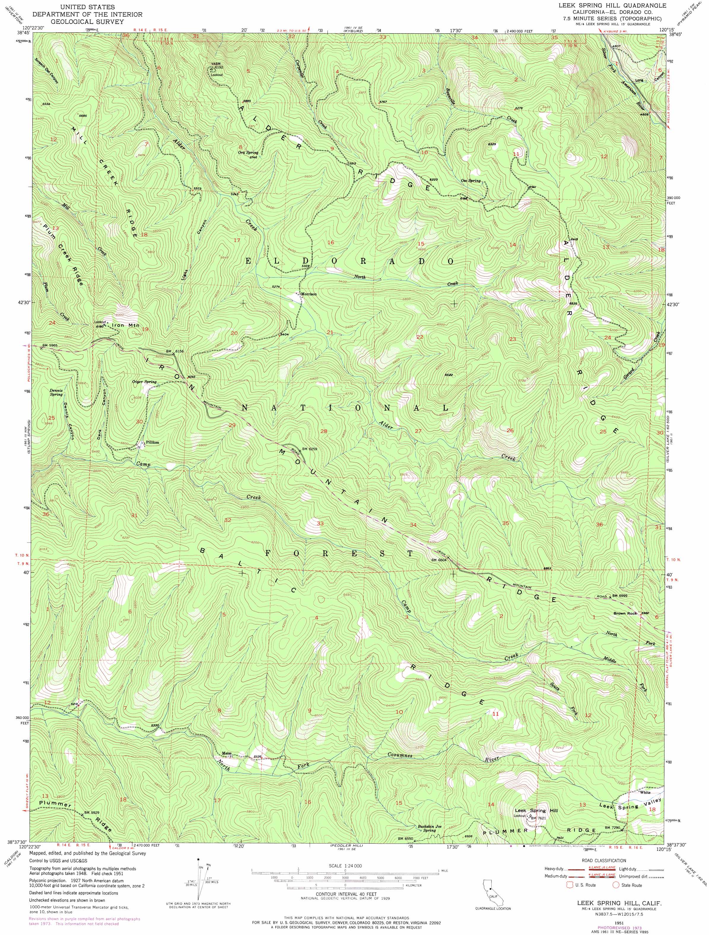
USGS Topo Quad 38120f3 - 1:24,000 scale
| Topo Map Name: | Leek Spring Hill |
| USGS Topo Quad ID: | 38120f3 |
| Print Size: | ca. 21 1/4" wide x 27" high |
| Southeast Coordinates: | 38.625° N latitude / 120.25° W longitude |
| Map Center Coordinates: | 38.6875° N latitude / 120.3125° W longitude |
| U.S. State: | CA |
| Filename: | o38120f3.jpg |
| Download Map JPG Image: | Leek Spring Hill topo map 1:24,000 scale |
| Map Type: | Topographic |
| Topo Series: | 7.5´ |
| Map Scale: | 1:24,000 |
| Source of Map Images: | United States Geological Survey (USGS) |
| Alternate Map Versions: |
Leek Spring Hill CA 1951, updated 1956 Download PDF Buy paper map Leek Spring Hill CA 1951, updated 1974 Download PDF Buy paper map Leek Spring Hill CA 2012 Download PDF Buy paper map Leek Spring Hill CA 2015 Download PDF Buy paper map |
| FStopo: | US Forest Service topo Leek Spring Hill is available: Download FStopo PDF Download FStopo TIF |
1:24,000 Topo Quads surrounding Leek Spring Hill
Devil Peak |
Robbs Peak |
Loon Lake |
Rockbound Valley |
Emerald Bay |
Pollock Pines |
Riverton |
Kyburz |
Pyramid Peak |
Echo Lake |
Sly Park |
Old Iron Mountain |
Leek Spring Hill |
Tragedy Spring |
Caples Lake |
Omo Ranch |
Caldor |
Peddler Hill |
Bear River Reservoir |
Mokelumne Peak |
West Point |
Devils Nose |
Garnet Hill |
Calaveras Dome |
Tamarack |
> Back to 38120e1 at 1:100,000 scale
> Back to 38120a1 at 1:250,000 scale
> Back to U.S. Topo Maps home
Leek Spring Hill topo map: Gazetteer
Leek Spring Hill: Pillars
Brown Rock elevation 2131m 6991′Leek Spring Hill: Populated Places
Meiss elevation 1675m 5495′Morrison elevation 1609m 5278′
Pilliken elevation 1700m 5577′
Leek Spring Hill: Ridges
Alder Ridge elevation 2050m 6725′Baltic Ridge elevation 1893m 6210′
Mill Creek Ridge elevation 1756m 5761′
Leek Spring Hill: Springs
Buckskin Joe Spring elevation 1973m 6473′Dennis Spring elevation 1731m 5679′
Oiyer Spring elevation 1816m 5958′
Ora Spring elevation 1758m 5767′
Oso Spring elevation 1888m 6194′
Leek Spring Hill: Streams
Middle Fork Camp Creek elevation 1990m 6528′North Creek elevation 1601m 5252′
North Fork Camp Creek elevation 1990m 6528′
South Fork Camp Creek elevation 1894m 6213′
Leek Spring Hill: Summits
Iron Mountain elevation 1902m 6240′Leek Spring Hill elevation 2323m 7621′
Leek Spring Hill: Valleys
Dark Canyon elevation 1655m 5429′Dennis Canyon elevation 1617m 5305′
Leek Spring Valley elevation 2137m 7011′
Light Canyon elevation 1575m 5167′
Long Canyon elevation 1457m 4780′
Leek Spring Hill digital topo map on disk
Buy this Leek Spring Hill topo map showing relief, roads, GPS coordinates and other geographical features, as a high-resolution digital map file on DVD: