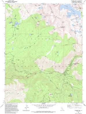
Pyramid Peak Topo Map California
To zoom in, hover over the map of Pyramid Peak
USGS Topo Quad 38120g2 - 1:24,000 scale
| Topo Map Name: | Pyramid Peak |
| USGS Topo Quad ID: | 38120g2 |
| Print Size: | ca. 21 1/4" wide x 27" high |
| Southeast Coordinates: | 38.75° N latitude / 120.125° W longitude |
| Map Center Coordinates: | 38.8125° N latitude / 120.1875° W longitude |
| U.S. State: | CA |
| Filename: | o38120g2.jpg |
| Download Map JPG Image: | Pyramid Peak topo map 1:24,000 scale |
| Map Type: | Topographic |
| Topo Series: | 7.5´ |
| Map Scale: | 1:24,000 |
| Source of Map Images: | United States Geological Survey (USGS) |
| Alternate Map Versions: |
Pyramid Peak CA 1955, updated 1956 Download PDF Buy paper map Pyramid Peak CA 1955, updated 1959 Download PDF Buy paper map Pyramid Peak CA 1955, updated 1971 Download PDF Buy paper map Pyramid Peak CA 1955, updated 1974 Download PDF Buy paper map Pyramid Peak CA 1992, updated 1994 Download PDF Buy paper map Pyramid Peak CA 1992, updated 1994 Download PDF Buy paper map Pyramid Peak CA 2012 Download PDF Buy paper map Pyramid Peak CA 2015 Download PDF Buy paper map |
| FStopo: | US Forest Service topo Pyramid Peak is available: Download FStopo PDF Download FStopo TIF |
1:24,000 Topo Quads surrounding Pyramid Peak
> Back to 38120e1 at 1:100,000 scale
> Back to 38120a1 at 1:250,000 scale
> Back to U.S. Topo Maps home
Pyramid Peak topo map: Gazetteer
Pyramid Peak: Basins
Desolation Valley elevation 2471m 8106′Pyramid Peak: Cliffs
Lovers Leap elevation 2063m 6768′Pyramid Peak: Dams
Medley Lakes 97-057 Dam elevation 2475m 8120′Smith Lake 1-028 Dam elevation 2649m 8690′
Pyramid Peak: Flats
Chimney Flat elevation 2031m 6663′Fourth of July Flat elevation 2130m 6988′
Mortimer Flat elevation 2160m 7086′
Pyramid Peak: Lakes
American Lake elevation 2474m 8116′Beauty Lake elevation 2140m 7020′
Bloodsucker Lake elevation 2260m 7414′
Boomerang Lake elevation 2457m 8061′
Channel Lake elevation 2470m 8103′
Cody Lake elevation 2190m 7185′
Dark Lake elevation 2104m 6902′
Desolation Lake elevation 2435m 7988′
Dry Lake elevation 2092m 6863′
Forni Lake elevation 2329m 7641′
Gefo Lake elevation 2399m 7870′
Grouse Lake elevation 2483m 8146′
Hemlock Lake elevation 2560m 8398′
Lake Le Conte elevation 2493m 8179′
Lake Sylvia elevation 2461m 8074′
Lyons Lake elevation 2552m 8372′
Osma Lake elevation 2338m 7670′
Pitt Lake elevation 2289m 7509′
Pyramid Lake elevation 2459m 8067′
Ropi Lake elevation 2323m 7621′
Secret Lake elevation 2530m 8300′
Toem Lake elevation 2328m 7637′
Twin Lakes elevation 2435m 7988′
Umpa Lake elevation 2412m 7913′
Waca Lake elevation 2493m 8179′
Wrights Lake elevation 2122m 6961′
Pyramid Peak: Populated Places
Lower Forni elevation 2112m 6929′Sciots Camp elevation 1725m 5659′
Strawberry elevation 1749m 5738′
Upper Forni elevation 2290m 7513′
Pyramid Peak: Reservoirs
Lake Aloha elevation 2475m 8120′Smith Lake elevation 2649m 8690′
Pyramid Peak: Streams
Cody Creek elevation 1754m 5754′Forni Creek elevation 1665m 5462′
Packsaddle Pass elevation 1889m 6197′
Pyramid Creek elevation 1793m 5882′
Station Creek elevation 1637m 5370′
Strawberry Creek elevation 1699m 5574′
Pyramid Peak: Summits
Bald Mountain elevation 2131m 6991′Blue Mountain elevation 2657m 8717′
Cracked Crag elevation 2667m 8750′
Mount Price elevation 3003m 9852′
Pyramid Peak elevation 3035m 9957′
Pyramid Peak: Valleys
Rocky Canyon elevation 1783m 5849′Pyramid Peak digital topo map on disk
Buy this Pyramid Peak topo map showing relief, roads, GPS coordinates and other geographical features, as a high-resolution digital map file on DVD:


