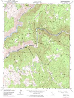
Greenwood Topo Map California
To zoom in, hover over the map of Greenwood
USGS Topo Quad 38120h8 - 1:24,000 scale
| Topo Map Name: | Greenwood |
| USGS Topo Quad ID: | 38120h8 |
| Print Size: | ca. 21 1/4" wide x 27" high |
| Southeast Coordinates: | 38.875° N latitude / 120.875° W longitude |
| Map Center Coordinates: | 38.9375° N latitude / 120.9375° W longitude |
| U.S. State: | CA |
| Filename: | o38120h8.jpg |
| Download Map JPG Image: | Greenwood topo map 1:24,000 scale |
| Map Type: | Topographic |
| Topo Series: | 7.5´ |
| Map Scale: | 1:24,000 |
| Source of Map Images: | United States Geological Survey (USGS) |
| Alternate Map Versions: |
Greenwood CA 1949, updated 1957 Download PDF Buy paper map Greenwood CA 1949, updated 1967 Download PDF Buy paper map Greenwood CA 1949, updated 1977 Download PDF Buy paper map Greenwood CA 1950, updated 1950 Download PDF Buy paper map Greenwood CA 2012 Download PDF Buy paper map Greenwood CA 2015 Download PDF Buy paper map |
| FStopo: | US Forest Service topo Greenwood is available: Download FStopo PDF Download FStopo TIF |
1:24,000 Topo Quads surrounding Greenwood
> Back to 38120e1 at 1:100,000 scale
> Back to 38120a1 at 1:250,000 scale
> Back to U.S. Topo Maps home
Greenwood topo map: Gazetteer
Greenwood: Bars
Browns Bar elevation 195m 639′Buckeye Bar elevation 200m 656′
Cherokee Bar elevation 216m 708′
Hoosier Bar elevation 190m 623′
Kennebeck Bar elevation 193m 633′
Maine Bar elevation 200m 656′
Oregon Bar elevation 216m 708′
Philadelphia Bar elevation 202m 662′
Poverty Bar elevation 207m 679′
Sardine Bar elevation 198m 649′
Texas Bar elevation 193m 633′
Greenwood: Bridges
Greenwood Bridge elevation 219m 718′Greenwood: Cliffs
Long Point elevation 364m 1194′Greenwood: Dams
Auburn Lake Trails 3467 Dam elevation 560m 1837′Boole 1320 Dam elevation 580m 1902′
Niegel 2462 Dam elevation 427m 1400′
Greenwood: Falls
Codfish Falls elevation 267m 875′Greenwood: Flats
Cherokee Flat elevation 388m 1272′Drivers Flat elevation 570m 1870′
Squaw Flat elevation 468m 1535′
Greenwood: Mines
Argonaut Mine elevation 573m 1879′Bowman Mine elevation 637m 2089′
Centennial Mine elevation 315m 1033′
French Hill Mine elevation 609m 1998′
Grit Mine elevation 588m 1929′
Heinz Gilbert Mine elevation 314m 1030′
Maltby Mine elevation 573m 1879′
Shenanigan Mine elevation 597m 1958′
Sliger Mine elevation 376m 1233′
Greenwood: Populated Places
Auburn Lake Trails elevation 584m 1916′Greenwood elevation 490m 1607′
Greenwood: Post Offices
Applegate Post Office elevation 608m 1994′Greenwood: Rapids
Ruck-A-Chucky Rapids elevation 225m 738′Greenwood: Streams
Canyon Creek elevation 240m 787′Codfish Creek elevation 240m 787′
Georgetown Creek elevation 477m 1564′
Mile Hill Creek elevation 220m 721′
Penobscot Creek elevation 426m 1397′
Todd Creek elevation 233m 764′
Greenwood: Summits
French Hill elevation 646m 2119′Stony Hill elevation 580m 1902′
Summit Hill elevation 650m 2132′
Greenwood: Valleys
American Canyon elevation 204m 669′Big Snyder Gulch elevation 238m 780′
Browns Bar Canyon elevation 190m 623′
Brushy Mountain Canyon elevation 199m 652′
Buckeye Canyon elevation 216m 708′
Coloma Canyon elevation 479m 1571′
Gas Canyon elevation 224m 734′
Hoboken Canyon elevation 303m 994′
Maine Bar Canyon elevation 204m 669′
New Orleans Gulch elevation 239m 784′
Paradise Canyon elevation 227m 744′
Sharps Ravine elevation 207m 679′
Slug Gulch elevation 238m 780′
Spring Garden Ravine elevation 681m 2234′
Squaw Gulch elevation 239m 784′
United States Canyon elevation 215m 705′
Wildcat Canyon elevation 193m 633′
Greenwood digital topo map on disk
Buy this Greenwood topo map showing relief, roads, GPS coordinates and other geographical features, as a high-resolution digital map file on DVD:


