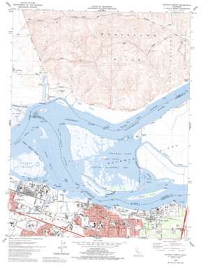
Antioch North Topo Map California
To zoom in, hover over the map of Antioch North
USGS Topo Quad 38121a7 - 1:24,000 scale
| Topo Map Name: | Antioch North |
| USGS Topo Quad ID: | 38121a7 |
| Print Size: | ca. 21 1/4" wide x 27" high |
| Southeast Coordinates: | 38° N latitude / 121.75° W longitude |
| Map Center Coordinates: | 38.0625° N latitude / 121.8125° W longitude |
| U.S. State: | CA |
| Filename: | o38121a7.jpg |
| Download Map JPG Image: | Antioch North topo map 1:24,000 scale |
| Map Type: | Topographic |
| Topo Series: | 7.5´ |
| Map Scale: | 1:24,000 |
| Source of Map Images: | United States Geological Survey (USGS) |
| Alternate Map Versions: |
Antioch North CA 1953, updated 1955 Download PDF Buy paper map Antioch North CA 1953, updated 1960 Download PDF Buy paper map Antioch North CA 1953, updated 1969 Download PDF Buy paper map Antioch North CA 1953, updated 1969 Download PDF Buy paper map Antioch North CA 1978, updated 1978 Download PDF Buy paper map Antioch North CA 1978, updated 1978 Download PDF Buy paper map Antioch North CA 1978, updated 1986 Download PDF Buy paper map Antioch North CA 1978, updated 1995 Download PDF Buy paper map Antioch North CA 2012 Download PDF Buy paper map Antioch North CA 2015 Download PDF Buy paper map |
1:24,000 Topo Quads surrounding Antioch North
> Back to 38121a1 at 1:100,000 scale
> Back to 38120a1 at 1:250,000 scale
> Back to U.S. Topo Maps home
Antioch North topo map: Gazetteer
Antioch North: Areas
Sacramento-San Joaquin Delta elevation -8m -27′Antioch North: Bars
Fraser Shoal elevation 0m 0′Antioch North: Bays
Broad Slough elevation 0m 0′Dowest Slough elevation 2m 6′
Antioch North: Bridges
Antioch Bridge elevation 0m 0′Antioch North: Canals
Mayberry Cut elevation 1m 3′Antioch North: Capes
Antioch Point elevation 1m 3′Pittsburg Point elevation 1m 3′
Point Beenar elevation 0m 0′
Point Sacramento elevation 3m 9′
Point San Joaquin elevation 1m 3′
Antioch North: Channels
Antioch Reach elevation 0m 0′East Reach elevation 0m 0′
Middle Slough elevation 0m 0′
New York Slough elevation 0m 0′
Antioch North: Crossings
Exit 1 elevation 4m 13′Exit 24 elevation 15m 49′
Exit 26 elevation 20m 65′
Exit 31 elevation 20m 65′
Antioch North: Gaps
Marshall Cut elevation 1m 3′Antioch North: Guts
Mayberry Slough elevation 0m 0′Antioch North: Harbors
Lloyds Holiday Harbor elevation 0m 0′San Joaquin Harbor elevation 1m 3′
Antioch North: Islands
Browns Island elevation 1m 3′Chain Island elevation 1m 3′
Kimball Island elevation 1m 3′
Lone Tree Island (historical) elevation -3m -10′
Montezuma Island elevation 2m 6′
Spinner Island elevation 0m 0′
West Island elevation 2m 6′
Winter Island elevation 1m 3′
Antioch North: Lakes
Donlon Lake elevation 3m 9′Sherman Lake elevation 0m 0′
Antioch North: Oilfields
Sherman Island Gas Field elevation 44m 144′Antioch North: Parks
Almondridge Park elevation 20m 65′Antioch City Park elevation 7m 22′
Antioch Dunes National Wildlife Refuge elevation 10m 32′
Browns Island Regional Shoreline elevation 1m 3′
Central Addition Park elevation 13m 42′
Contra Costa County Fairgrounds elevation 7m 22′
Contra Loma Park elevation 16m 52′
Dow Wetlands Preserve elevation 2m 6′
Fairview Park elevation 7m 22′
Marchetti Park elevation 29m 95′
Marina Park elevation 2m 6′
Meadowbrook Park elevation 4m 13′
Sandy Beach Park elevation 3m 9′
Sherman Island Waterfowl Management Area elevation 0m 0′
Sixth Street Park elevation 5m 16′
Antioch North: Populated Places
Antioch elevation 13m 42′Bridgehead elevation 11m 36′
Collinsville elevation 1m 3′
Empire (historical) elevation 16m 52′
Hooper (historical) elevation 5m 16′
Los Medanos elevation 12m 39′
Montezuma elevation 2m 6′
Toland Landing elevation 12m 39′
Antioch North: Post Offices
Rivertown Station Antioch Post Office elevation 8m 26′Antioch North: Ranges
Montezuma Hills elevation 85m 278′Antioch North: Reservoirs
Lake Alhambra elevation 2m 6′Antioch North: Streams
Cabin Slough elevation 0m 0′Kirker Creek elevation 1m 3′
Sacramento River elevation -3m -10′
San Joaquin River elevation 0m 0′
Antioch North: Valleys
Clank Hollow elevation 20m 65′Sacramento Valley elevation 0m 0′
Antioch North digital topo map on disk
Buy this Antioch North topo map showing relief, roads, GPS coordinates and other geographical features, as a high-resolution digital map file on DVD:


