Clements Topo Map California
To zoom in, hover over the map of Clements
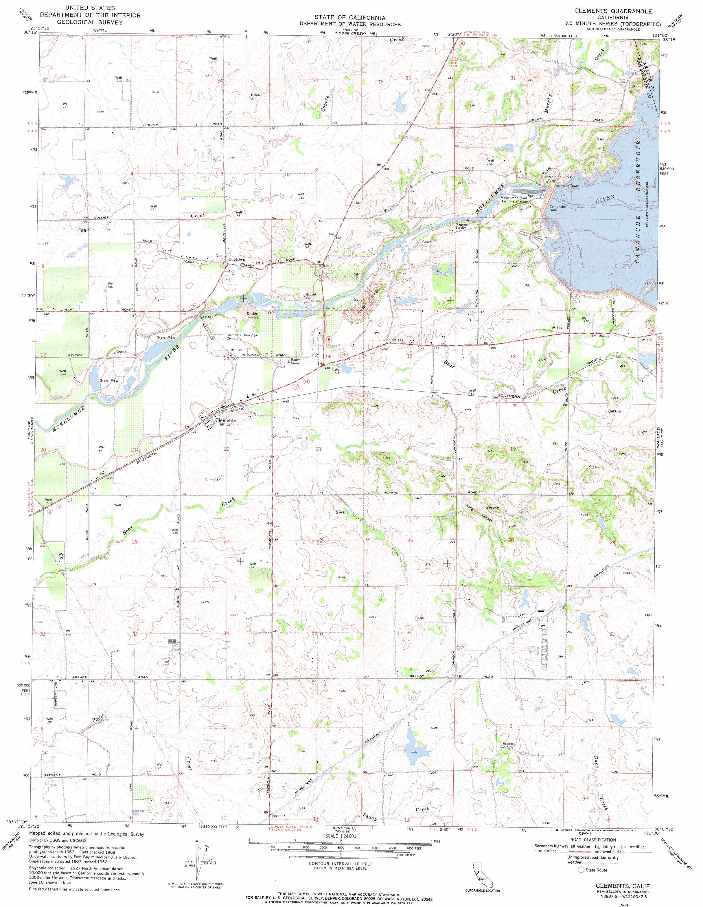
USGS Topo Quad 38121b1 - 1:24,000 scale
| Topo Map Name: | Clements |
| USGS Topo Quad ID: | 38121b1 |
| Print Size: | ca. 21 1/4" wide x 27" high |
| Southeast Coordinates: | 38.125° N latitude / 121° W longitude |
| Map Center Coordinates: | 38.1875° N latitude / 121.0625° W longitude |
| U.S. State: | CA |
| Filename: | o38121b1.jpg |
| Download Map JPG Image: | Clements topo map 1:24,000 scale |
| Map Type: | Topographic |
| Topo Series: | 7.5´ |
| Map Scale: | 1:24,000 |
| Source of Map Images: | United States Geological Survey (USGS) |
| Alternate Map Versions: |
Clements CA 1952, updated 1954 Download PDF Buy paper map Clements CA 1952, updated 1954 Download PDF Buy paper map Clements CA 1968, updated 1972 Download PDF Buy paper map Clements CA 1968, updated 1972 Download PDF Buy paper map Clements CA 1968, updated 1993 Download PDF Buy paper map Clements CA 2012 Download PDF Buy paper map Clements CA 2015 Download PDF Buy paper map |
1:24,000 Topo Quads surrounding Clements
Elk Grove |
Sloughhouse |
Carbondale |
Irish Hill |
Amador City |
Galt |
Clay |
Goose Creek |
Ione |
Jackson |
Lodi North |
Lockeford |
Clements |
Wallace |
Valley Springs |
Lodi South |
Waterloo |
Linden |
Valley Springs Sw |
Jenny Lind |
Stockton West |
Stockton East |
Peters |
Farmington |
Bachelor Valley |
> Back to 38121a1 at 1:100,000 scale
> Back to 38120a1 at 1:250,000 scale
> Back to U.S. Topo Maps home
Clements topo map: Gazetteer
Clements: Beaches
Mokelumne Beach elevation 27m 88′Clements: Dams
Camanche 31-016 Dam elevation 34m 111′Camanche Dam elevation 75m 246′
Clements: Parks
Stillman Magee Park elevation 27m 88′Clements: Populated Places
Clements elevation 42m 137′Dogtown elevation 46m 150′
Clements: Post Offices
Clements Post Office elevation 42m 137′Clements: Reservoirs
Camanche Reservoir elevation 80m 262′Clements: Streams
Murphy Creek elevation 35m 114′Clements digital topo map on disk
Buy this Clements topo map showing relief, roads, GPS coordinates and other geographical features, as a high-resolution digital map file on DVD: