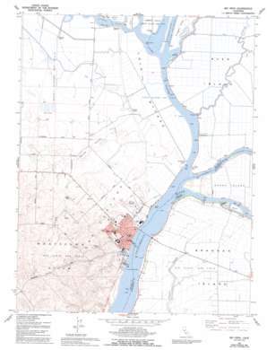
Rio Vista Topo Map California
To zoom in, hover over the map of Rio Vista
USGS Topo Quad 38121b6 - 1:24,000 scale
| Topo Map Name: | Rio Vista |
| USGS Topo Quad ID: | 38121b6 |
| Print Size: | ca. 21 1/4" wide x 27" high |
| Southeast Coordinates: | 38.125° N latitude / 121.625° W longitude |
| Map Center Coordinates: | 38.1875° N latitude / 121.6875° W longitude |
| U.S. State: | CA |
| Filename: | o38121b6.jpg |
| Download Map JPG Image: | Rio Vista topo map 1:24,000 scale |
| Map Type: | Topographic |
| Topo Series: | 7.5´ |
| Map Scale: | 1:24,000 |
| Source of Map Images: | United States Geological Survey (USGS) |
| Alternate Map Versions: |
Rio Vista CA 1953, updated 1955 Download PDF Buy paper map Rio Vista CA 1953, updated 1964 Download PDF Buy paper map Rio Vista CA 1953, updated 1969 Download PDF Buy paper map Rio Vista CA 1978, updated 1978 Download PDF Buy paper map Rio Vista CA 1978, updated 1984 Download PDF Buy paper map Rio Vista CA 1978, updated 1993 Download PDF Buy paper map Rio Vista CA 2012 Download PDF Buy paper map Rio Vista CA 2015 Download PDF Buy paper map |
1:24,000 Topo Quads surrounding Rio Vista
> Back to 38121a1 at 1:100,000 scale
> Back to 38120a1 at 1:250,000 scale
> Back to U.S. Topo Maps home
Rio Vista topo map: Gazetteer
Rio Vista: Airports
Rio Vista Municipal Airport elevation 14m 45′Rio Vista: Bridges
Rio Vista Bridge elevation 1m 3′Rio Vista: Crossings
Hastings Ferry elevation 1m 3′Rio Vista: Guts
Jackson Slough elevation -1m -4′Tomato Slough elevation -3m -10′
Rio Vista: Islands
Brannan Island elevation -4m -14′Ida Island elevation 1m 3′
Ryer Island elevation -2m -7′
Rio Vista: Oilfields
Cache Slough Gas Field elevation 0m 0′Liberty Island Gas Field elevation 0m 0′
Lindsey Slough Gas Field elevation 2m 6′
Rio Vista Gas Field elevation -4m -14′
Rio Vista Gas Field elevation 46m 150′
Rio Vista: Parks
Bruna Vista Park elevation 15m 49′Bruning Park elevation 10m 32′
Cliff House Fishing Access Area elevation 1m 3′
Sandy Beach Park elevation 7m 22′
Rio Vista: Populated Places
Newtown elevation 4m 13′Rio Vista elevation 6m 19′
Rio Vista: Streams
Cache Slough elevation 1m 3′Elkhorn Slough elevation 1m 3′
Lindsey Slough elevation 1m 3′
Miner Slough elevation 1m 3′
Prospect Slough elevation 1m 3′
Steamboat Slough elevation 1m 3′
Rio Vista: Valleys
Watson Hollow elevation 0m 0′Rio Vista digital topo map on disk
Buy this Rio Vista topo map showing relief, roads, GPS coordinates and other geographical features, as a high-resolution digital map file on DVD:


