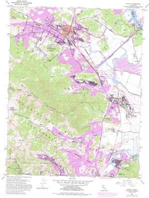
Novato Topo Map California
To zoom in, hover over the map of Novato
USGS Topo Quad 38122a5 - 1:24,000 scale
| Topo Map Name: | Novato |
| USGS Topo Quad ID: | 38122a5 |
| Print Size: | ca. 21 1/4" wide x 27" high |
| Southeast Coordinates: | 38° N latitude / 122.5° W longitude |
| Map Center Coordinates: | 38.0625° N latitude / 122.5625° W longitude |
| U.S. State: | CA |
| Filename: | o38122a5.jpg |
| Download Map JPG Image: | Novato topo map 1:24,000 scale |
| Map Type: | Topographic |
| Topo Series: | 7.5´ |
| Map Scale: | 1:24,000 |
| Source of Map Images: | United States Geological Survey (USGS) |
| Alternate Map Versions: |
Novato CA 1954, updated 1955 Download PDF Buy paper map Novato CA 1954, updated 1961 Download PDF Buy paper map Novato CA 1954, updated 1969 Download PDF Buy paper map Novato CA 1954, updated 1981 Download PDF Buy paper map Novato CA 1954, updated 1985 Download PDF Buy paper map Novato CA 1954, updated 1985 Download PDF Buy paper map Novato CA 2012 Download PDF Buy paper map Novato CA 2015 Download PDF Buy paper map |
1:24,000 Topo Quads surrounding Novato
> Back to 38122a1 at 1:100,000 scale
> Back to 38122a1 at 1:250,000 scale
> Back to U.S. Topo Maps home
Novato topo map: Gazetteer
Novato: Airports
Hamilton Field elevation -2m -7′Marin Ranch Airport elevation 4m 13′
Novato: Beaches
Gallinas Beach elevation 12m 39′Novato: Capes
Long Point elevation 13m 42′Novato: Islands
Childrens Island elevation 8m 26′Deer Island elevation 48m 157′
Novato: Parks
Arroyo Avichi Park elevation 17m 55′Deer Island Preserve elevation 53m 173′
Hamann Field elevation 12m 39′
Hill Park elevation 9m 29′
Ignacio Valley Preserve elevation 201m 659′
Indian Valley Preserve elevation 178m 583′
Jerry Russom Memorial Park elevation 90m 295′
John F McInnis County Park elevation 4m 13′
Josef Hoog Park elevation 34m 111′
Lagoon Park elevation 10m 32′
Lee Garner Park elevation 8m 26′
Lois Curtin Park elevation 15m 49′
Loma Alta Preserve elevation 219m 718′
Loma Verde Preserve elevation 129m 423′
Lucas Valley Preserve elevation 210m 688′
Lynwood Hill Park elevation 53m 173′
Lynwood Park elevation 4m 13′
Maria B Freitas Memorial Park elevation 36m 118′
Marin Highlands Park elevation 89m 291′
Marinwood Park elevation 25m 82′
Marion Park elevation 10m 32′
Miwok Park elevation 73m 239′
Mont Marin Park elevation 71m 232′
Munson Park elevation 9m 29′
Neil O'Hara Park elevation 30m 98′
Oleander Park elevation 7m 22′
Olive Park elevation 15m 49′
Pacheco Valley Preserve elevation 82m 269′
Pioneer Park elevation 15m 49′
Pleasant Valley Park elevation 46m 150′
Santa Margarita Island Preserve elevation 5m 16′
Santa Margarita Valley Park elevation 71m 232′
Santa Venetia Marsh Preserve elevation 8m 26′
Slade Park elevation 5m 16′
Stafford Grove Park elevation 11m 36′
Sutton Park elevation 9m 29′
Terra Linda Park elevation 19m 62′
Terra Linda-Sleepy Hollow Divide Northern Preserve elevation 199m 652′
Verissimo Hills Preserve elevation 131m 429′
Novato: Pillars
Big Rock elevation 203m 666′Novato: Populated Places
Bel Marin Keys elevation 3m 9′Black Point elevation 12m 39′
Bothin (historical) elevation 89m 291′
Dewitt elevation 11m 36′
Forbes (historical) elevation 10m 32′
Gallinas elevation 11m 36′
Golf (historical) elevation 7m 22′
Ignacio elevation 9m 29′
Las Gallinas elevation 8m 26′
Lucas Valley elevation 33m 108′
Marinwood elevation 42m 137′
Miller (historical) elevation 7m 22′
Novato elevation 9m 29′
Old Town elevation 4m 13′
Rafael Village elevation 15m 49′
Saint Vincent elevation 12m 39′
Sleepy Hollow elevation 54m 177′
Terra Linda elevation 52m 170′
Terra Lindo elevation 7m 22′
Novato: Post Offices
Novato Post Office elevation 4m 13′Novato: Reservoirs
Scottsdale Pond elevation 4m 13′Novato: Ridges
Big Rock Ridge elevation 575m 1886′Novato: Streams
Arroyo Avichi elevation 5m 16′Arroyo Jan Jose elevation 3m 9′
South Fork Gallinas Creek elevation 4m 13′
Novato: Summits
Cherry Hill elevation 138m 452′Loma Alta elevation 484m 1587′
Novato Heights elevation 125m 410′
Pacheco Hill elevation 129m 423′
Novato: Trails
Bay View Trail elevation 142m 465′Novato: Valleys
Gallinas Valley elevation 12m 39′Indian Valley elevation 31m 101′
Novato Valley elevation 7m 22′
Santa Margarita Valley elevation 9m 29′
Novato digital topo map on disk
Buy this Novato topo map showing relief, roads, GPS coordinates and other geographical features, as a high-resolution digital map file on DVD:


