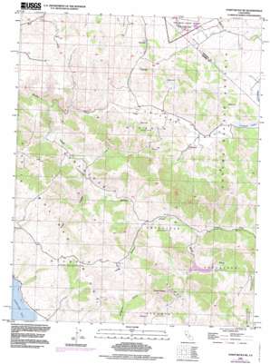
Point Reyes Ne Topo Map California
To zoom in, hover over the map of Point Reyes Ne
USGS Topo Quad 38122b7 - 1:24,000 scale
| Topo Map Name: | Point Reyes Ne |
| USGS Topo Quad ID: | 38122b7 |
| Print Size: | ca. 21 1/4" wide x 27" high |
| Southeast Coordinates: | 38.125° N latitude / 122.75° W longitude |
| Map Center Coordinates: | 38.1875° N latitude / 122.8125° W longitude |
| U.S. State: | CA |
| Filename: | o38122b7.jpg |
| Download Map JPG Image: | Point Reyes Ne topo map 1:24,000 scale |
| Map Type: | Topographic |
| Topo Series: | 7.5´ |
| Map Scale: | 1:24,000 |
| Source of Map Images: | United States Geological Survey (USGS) |
| Alternate Map Versions: |
Point Reyes NE CA 1954, updated 1955 Download PDF Buy paper map Point Reyes NE CA 1954, updated 1964 Download PDF Buy paper map Point Reyes NE CA 1954, updated 1971 Download PDF Buy paper map Point Reyes NE CA 1954, updated 1972 Download PDF Buy paper map Point Reyes NE CA 1954, updated 1980 Download PDF Buy paper map Point Reyes NE CA 1954, updated 1985 Download PDF Buy paper map Point Reyes NE CA 1995, updated 1998 Download PDF Buy paper map Point Reyes NE CA 2012 Download PDF Buy paper map Point Reyes NE CA 2015 Download PDF Buy paper map |
1:24,000 Topo Quads surrounding Point Reyes Ne
> Back to 38122a1 at 1:100,000 scale
> Back to 38122a1 at 1:250,000 scale
> Back to U.S. Topo Maps home
Point Reyes Ne topo map: Gazetteer
Point Reyes Ne: Dams
Soulajule 33-009 Dam elevation 79m 259′Point Reyes Ne: Reservoirs
Arroyo Sausal Reservoir elevation 77m 252′Soulajule Reservoir elevation 73m 239′
Point Reyes Ne: Streams
Arroyo Sausal elevation 61m 200′Chileno Creek elevation 22m 72′
Salmon Creek elevation 61m 200′
Point Reyes Ne: Summits
Three Peaks elevation 340m 1115′Point Reyes Ne: Valleys
Chileno Valley elevation 44m 144′Frink Canyon elevation 45m 147′
Verde Canyon elevation 57m 187′
Point Reyes Ne digital topo map on disk
Buy this Point Reyes Ne topo map showing relief, roads, GPS coordinates and other geographical features, as a high-resolution digital map file on DVD:


