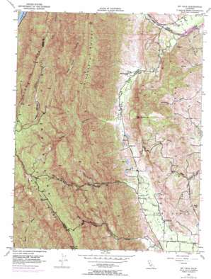
Mount Vaca Topo Map California
To zoom in, hover over the map of Mount Vaca
USGS Topo Quad 38122d1 - 1:24,000 scale
| Topo Map Name: | Mount Vaca |
| USGS Topo Quad ID: | 38122d1 |
| Print Size: | ca. 21 1/4" wide x 27" high |
| Southeast Coordinates: | 38.375° N latitude / 122° W longitude |
| Map Center Coordinates: | 38.4375° N latitude / 122.0625° W longitude |
| U.S. State: | CA |
| Filename: | o38122d1.jpg |
| Download Map JPG Image: | Mount Vaca topo map 1:24,000 scale |
| Map Type: | Topographic |
| Topo Series: | 7.5´ |
| Map Scale: | 1:24,000 |
| Source of Map Images: | United States Geological Survey (USGS) |
| Alternate Map Versions: |
Mt. Vaca CA 1951, updated 1963 Download PDF Buy paper map Mt. Vaca CA 1951, updated 1969 Download PDF Buy paper map Mount Vaca CA 2012 Download PDF Buy paper map Mount Vaca CA 2015 Download PDF Buy paper map |
1:24,000 Topo Quads surrounding Mount Vaca
> Back to 38122a1 at 1:100,000 scale
> Back to 38122a1 at 1:250,000 scale
> Back to U.S. Topo Maps home
Mount Vaca topo map: Gazetteer
Mount Vaca: Airports
Blake Sky Park elevation 156m 511′Mount Vaca: Dams
Giles 448 Dam elevation 79m 259′Putah Diversion Dam elevation 44m 144′
Mount Vaca: Populated Places
Bucktown elevation 86m 282′Mount Vaca: Ranges
English Hills elevation 252m 826′Vaca Mountains elevation 859m 2818′
Mount Vaca: Ridges
Blue Ridge elevation 849m 2785′Pleasants Ridge elevation 584m 1916′
Mount Vaca: Streams
Miller Canyon Creek elevation 86m 282′Pleasants Creek elevation 39m 127′
South Fork English Creek elevation 79m 259′
Mount Vaca: Summits
Dunns Peak elevation 241m 790′Mount Vaca elevation 857m 2811′
Putnam Peak elevation 349m 1145′
Signal Hill elevation 726m 2381′
Steiger Hill elevation 195m 639′
Mount Vaca: Valleys
Gates Canyon elevation 100m 328′Miller Canyon elevation 103m 337′
Pleasants Valley elevation 44m 144′
Weldon Canyon elevation 121m 396′
Wild Horse Canyon elevation 185m 606′
Mount Vaca digital topo map on disk
Buy this Mount Vaca topo map showing relief, roads, GPS coordinates and other geographical features, as a high-resolution digital map file on DVD:


