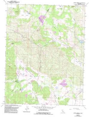
Aetna Springs Topo Map California
To zoom in, hover over the map of Aetna Springs
USGS Topo Quad 38122f4 - 1:24,000 scale
| Topo Map Name: | Aetna Springs |
| USGS Topo Quad ID: | 38122f4 |
| Print Size: | ca. 21 1/4" wide x 27" high |
| Southeast Coordinates: | 38.625° N latitude / 122.375° W longitude |
| Map Center Coordinates: | 38.6875° N latitude / 122.4375° W longitude |
| U.S. State: | CA |
| Filename: | o38122f4.jpg |
| Download Map JPG Image: | Aetna Springs topo map 1:24,000 scale |
| Map Type: | Topographic |
| Topo Series: | 7.5´ |
| Map Scale: | 1:24,000 |
| Source of Map Images: | United States Geological Survey (USGS) |
| Alternate Map Versions: |
Aetna Springs CA 1958, updated 1961 Download PDF Buy paper map Aetna Springs CA 1958, updated 1970 Download PDF Buy paper map Aetna Springs CA 1958, updated 1970 Download PDF Buy paper map Aetna Springs CA 1958, updated 1982 Download PDF Buy paper map Aetna Springs CA 1958, updated 1982 Download PDF Buy paper map Aetna Springs CA 1958, updated 1993 Download PDF Buy paper map Aetna Springs CA 1998, updated 2002 Download PDF Buy paper map Aetna Springs CA 2012 Download PDF Buy paper map Aetna Springs CA 2015 Download PDF Buy paper map |
1:24,000 Topo Quads surrounding Aetna Springs
> Back to 38122e1 at 1:100,000 scale
> Back to 38122a1 at 1:250,000 scale
> Back to U.S. Topo Maps home
Aetna Springs topo map: Gazetteer
Aetna Springs: Basins
Big Basin elevation 184m 603′Aetna Springs: Dams
Blanchard-Offner 2416 Dam elevation 234m 767′Burns 1419 Dam elevation 260m 853′
Davis 1416 Dam elevation 217m 711′
Deer Creek 3414 Dam elevation 195m 639′
Dick Week 418 Dam elevation 196m 643′
Duvall 414 Dam elevation 224m 734′
Upper Bohn 3410 Dam elevation 342m 1122′
Aetna Springs: Mines
Aetna Mine elevation 289m 948′White Rock Mine elevation 318m 1043′
Aetna Springs: Populated Places
Aetna Springs elevation 236m 774′Aetna Springs: Post Offices
Aetna Springs Post Office (historical) elevation 235m 770′Aetna Springs: Reservoirs
Duvall Lake elevation 229m 751′Lower Bohn Lake elevation 306m 1003′
Upper Bohn Lake elevation 339m 1112′
Weeks Lake elevation 209m 685′
Aetna Springs: Streams
Butts Creek elevation 135m 442′James Creek elevation 221m 725′
Routan Creek elevation 157m 515′
Snell Creek elevation 171m 561′
Swartz Creek elevation 205m 672′
Aetna Springs: Summits
Devils Head Peak elevation 269m 882′Goat Hill elevation 534m 1751′
Snell Peak elevation 548m 1797′
Aetna Springs: Valleys
Bohn Valley elevation 305m 1000′Butts Canyon elevation 195m 639′
Snell Valley elevation 166m 544′
Aetna Springs digital topo map on disk
Buy this Aetna Springs topo map showing relief, roads, GPS coordinates and other geographical features, as a high-resolution digital map file on DVD:


