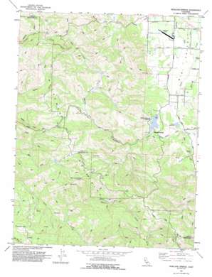
Highland Springs Topo Map California
To zoom in, hover over the map of Highland Springs
USGS Topo Quad 38122h8 - 1:24,000 scale
| Topo Map Name: | Highland Springs |
| USGS Topo Quad ID: | 38122h8 |
| Print Size: | ca. 21 1/4" wide x 27" high |
| Southeast Coordinates: | 38.875° N latitude / 122.875° W longitude |
| Map Center Coordinates: | 38.9375° N latitude / 122.9375° W longitude |
| U.S. State: | CA |
| Filename: | o38122h8.jpg |
| Download Map JPG Image: | Highland Springs topo map 1:24,000 scale |
| Map Type: | Topographic |
| Topo Series: | 7.5´ |
| Map Scale: | 1:24,000 |
| Source of Map Images: | United States Geological Survey (USGS) |
| Alternate Map Versions: |
Highland Springs CA 1959, updated 1961 Download PDF Buy paper map Highland Springs CA 1959, updated 1965 Download PDF Buy paper map Highland Springs CA 1959, updated 1978 Download PDF Buy paper map Highland Springs CA 1977, updated 1979 Download PDF Buy paper map Highland Springs CA 1977, updated 1980 Download PDF Buy paper map Highland Springs CA 1993, updated 1993 Download PDF Buy paper map Highland Springs CA 2012 Download PDF Buy paper map Highland Springs CA 2015 Download PDF Buy paper map |
1:24,000 Topo Quads surrounding Highland Springs
> Back to 38122e1 at 1:100,000 scale
> Back to 38122a1 at 1:250,000 scale
> Back to U.S. Topo Maps home
Highland Springs topo map: Gazetteer
Highland Springs: Airports
Lampson Field elevation 420m 1377′Highland Springs: Basins
High Valley elevation 798m 2618′Highland Springs: Dams
Adobe Creek 1011 Dam elevation 515m 1689′Graham 395 Dam elevation 549m 1801′
Highland Creek 1011-002 Dam elevation 438m 1437′
Highland Springs: Flats
Cow Glade elevation 826m 2709′Highland Springs: Populated Places
Highland Springs elevation 452m 1482′Highland Springs: Reservoirs
Adobe Reservoir elevation 435m 1427′Highland Springs Reservoir elevation 446m 1463′
Highland Springs: Streams
Donovan Valley elevation 524m 1719′Highland Creek elevation 430m 1410′
Hoil Creek elevation 651m 2135′
Manning Creek elevation 418m 1371′
Tyler Creek elevation 505m 1656′
Highland Springs: Summits
Cloverdale Peak elevation 890m 2919′Doe Rock elevation 606m 1988′
Gilliam Rock elevation 720m 2362′
Monument Peak elevation 1001m 3284′
Red Rock elevation 981m 3218′
Highland Springs: Valleys
Tyler Valley elevation 679m 2227′Highland Springs digital topo map on disk
Buy this Highland Springs topo map showing relief, roads, GPS coordinates and other geographical features, as a high-resolution digital map file on DVD:


