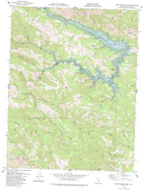
Warm Springs Dam Topo Map California
To zoom in, hover over the map of Warm Springs Dam
USGS Topo Quad 38123f1 - 1:24,000 scale
| Topo Map Name: | Warm Springs Dam |
| USGS Topo Quad ID: | 38123f1 |
| Print Size: | ca. 21 1/4" wide x 27" high |
| Southeast Coordinates: | 38.625° N latitude / 123° W longitude |
| Map Center Coordinates: | 38.6875° N latitude / 123.0625° W longitude |
| U.S. State: | CA |
| Filename: | o38123f1.jpg |
| Download Map JPG Image: | Warm Springs Dam topo map 1:24,000 scale |
| Map Type: | Topographic |
| Topo Series: | 7.5´ |
| Map Scale: | 1:24,000 |
| Source of Map Images: | United States Geological Survey (USGS) |
| Alternate Map Versions: |
Skaggs Springs CA 1943, updated 1956 Download PDF Buy paper map Warm Springs Dam CA 1978, updated 1985 Download PDF Buy paper map Warm Springs Dam CA 2012 Download PDF Buy paper map Warm Springs Dam CA 2015 Download PDF Buy paper map |
1:24,000 Topo Quads surrounding Warm Springs Dam
> Back to 38123e1 at 1:100,000 scale
> Back to 38122a1 at 1:250,000 scale
> Back to U.S. Topo Maps home
Warm Springs Dam topo map: Gazetteer
Warm Springs Dam: Dams
Warm Springs Dam elevation 77m 252′Warm Springs Dam: Gaps
Reese Gap elevation 277m 908′Warm Springs Dam: Pillars
Buzzard Rock elevation 195m 639′Eagle Rock elevation 507m 1663′
Warm Springs Dam: Reservoirs
Lake Sonoma elevation 61m 200′Warm Springs Dam: Ridges
Walbridge Ridge elevation 669m 2194′Warm Springs Dam: Springs
Skaggs Springs elevation 103m 337′Willow Spring elevation 583m 1912′
Warm Springs Dam: Streams
Bear Creek elevation 120m 393′Bearpen Creek elevation 272m 892′
Black Sulfur Creek elevation 195m 639′
Boyer Creek elevation 104m 341′
Fall Creek elevation 268m 879′
Little Rancheria Creek elevation 169m 554′
Little Strawberry Creek elevation 209m 685′
Little Warm Springs Creek elevation 96m 314′
Pechaco Creek elevation 106m 347′
Picnic Creek elevation 102m 334′
Rancheria Creek elevation 149m 488′
Redwood Log Creek elevation 134m 439′
Seven Oaks Creek elevation 112m 367′
Strawberry Creek elevation 155m 508′
Sweetwater Creek elevation 118m 387′
Warm Springs Creek elevation 61m 200′
Wild Cattle Creek elevation 222m 728′
Willow Springs Creek elevation 220m 721′
Woods Creek elevation 145m 475′
Warm Springs Dam: Summits
Bummer Peak elevation 347m 1138′Oak Knolls elevation 338m 1108′
Pritchett Peaks elevation 517m 1696′
Warm Springs Dam: Valleys
Redwood Canyon elevation 130m 426′Wildcat Canyon elevation 169m 554′
Warm Springs Dam digital topo map on disk
Buy this Warm Springs Dam topo map showing relief, roads, GPS coordinates and other geographical features, as a high-resolution digital map file on DVD:


