Big Foot Mountain Topo Map California
To zoom in, hover over the map of Big Foot Mountain
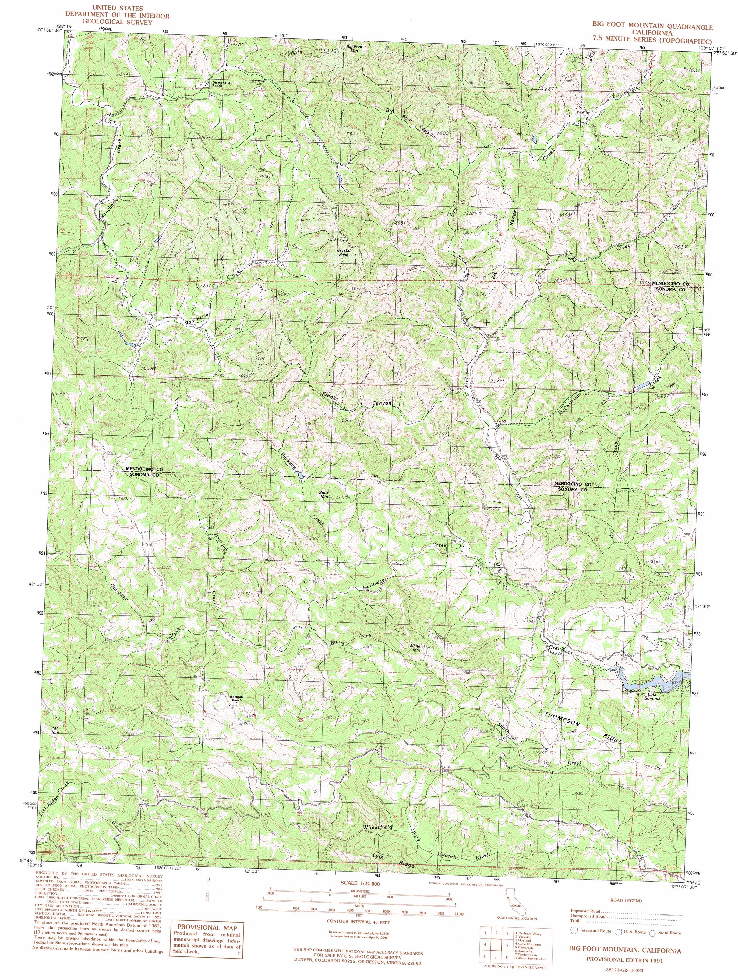
USGS Topo Quad 38123g2 - 1:24,000 scale
| Topo Map Name: | Big Foot Mountain |
| USGS Topo Quad ID: | 38123g2 |
| Print Size: | ca. 21 1/4" wide x 27" high |
| Southeast Coordinates: | 38.75° N latitude / 123.125° W longitude |
| Map Center Coordinates: | 38.8125° N latitude / 123.1875° W longitude |
| U.S. State: | CA |
| Filename: | o38123g2.jpg |
| Download Map JPG Image: | Big Foot Mountain topo map 1:24,000 scale |
| Map Type: | Topographic |
| Topo Series: | 7.5´ |
| Map Scale: | 1:24,000 |
| Source of Map Images: | United States Geological Survey (USGS) |
| Alternate Map Versions: |
Big Foot Mountain CA 1991, updated 1991 Download PDF Buy paper map Big Foot Mountain CA 2012 Download PDF Buy paper map Big Foot Mountain CA 2015 Download PDF Buy paper map |
1:24,000 Topo Quads surrounding Big Foot Mountain
Philo |
Boonville |
Elledge Peak |
Purdys Gardens |
Lakeport |
Zeni Ridge |
Ornbaun Valley |
Yorkville |
Hopland |
Highland Springs |
Mcguire Ridge |
Gube Mountain |
Big Foot Mountain |
Cloverdale |
Asti |
Stewarts Point |
Annapolis |
Tombs Creek |
Warm Springs Dam |
Geyserville |
Plantation |
Fort Ross |
Cazadero |
Guerneville |
> Back to 38123e1 at 1:100,000 scale
> Back to 38122a1 at 1:250,000 scale
> Back to U.S. Topo Maps home
Big Foot Mountain topo map: Gazetteer
Big Foot Mountain: Ridges
Elk Range elevation 377m 1236′Thompson Ridge elevation 437m 1433′
Big Foot Mountain: Streams
Boulder Creek elevation 215m 705′Buckeye Creek elevation 203m 666′
Elkhorn Creek elevation 291m 954′
Galloway Creek elevation 160m 524′
McChristian Creek elevation 179m 587′
Rail Creek elevation 161m 528′
Soda Spring Creek elevation 184m 603′
White Creek elevation 199m 652′
Big Foot Mountain: Summits
Big Foot Mountain elevation 627m 2057′Buck Mountain elevation 450m 1476′
Crystal Peak elevation 553m 1814′
Mount Tom elevation 757m 2483′
White Mountain elevation 564m 1850′
Big Foot Mountain: Valleys
Big Foot Canyon elevation 205m 672′Franks Canyon elevation 182m 597′
Redwood Gulch elevation 171m 561′
Big Foot Mountain digital topo map on disk
Buy this Big Foot Mountain topo map showing relief, roads, GPS coordinates and other geographical features, as a high-resolution digital map file on DVD: