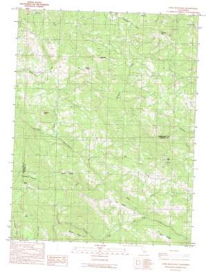
Gube Mountain Topo Map California
To zoom in, hover over the map of Gube Mountain
USGS Topo Quad 38123g3 - 1:24,000 scale
| Topo Map Name: | Gube Mountain |
| USGS Topo Quad ID: | 38123g3 |
| Print Size: | ca. 21 1/4" wide x 27" high |
| Southeast Coordinates: | 38.75° N latitude / 123.25° W longitude |
| Map Center Coordinates: | 38.8125° N latitude / 123.3125° W longitude |
| U.S. State: | CA |
| Filename: | o38123g3.jpg |
| Download Map JPG Image: | Gube Mountain topo map 1:24,000 scale |
| Map Type: | Topographic |
| Topo Series: | 7.5´ |
| Map Scale: | 1:24,000 |
| Source of Map Images: | United States Geological Survey (USGS) |
| Alternate Map Versions: |
Gube Mountain CA 1991, updated 1991 Download PDF Buy paper map Gube Mountain CA 2012 Download PDF Buy paper map Gube Mountain CA 2015 Download PDF Buy paper map |
1:24,000 Topo Quads surrounding Gube Mountain
> Back to 38123e1 at 1:100,000 scale
> Back to 38122a1 at 1:250,000 scale
> Back to U.S. Topo Maps home
Gube Mountain topo map: Gazetteer
Gube Mountain: Ridges
Burnt Ridge elevation 435m 1427′Flat Ridge elevation 382m 1253′
Gube Mountain: Streams
Burnt Ridge Creek elevation 136m 446′Flat Ridge Creek elevation 135m 442′
Newton Creek elevation 337m 1105′
North Fork Buckeye Creek elevation 108m 354′
Osser Creek elevation 157m 515′
Roy Creek elevation 224m 734′
Gube Mountain: Summits
Black Mountain elevation 781m 2562′Gube Mountain elevation 765m 2509′
Pardaloe Peak elevation 713m 2339′
Rockpile Peak elevation 516m 1692′
Snook Mountain elevation 743m 2437′
Gube Mountain digital topo map on disk
Buy this Gube Mountain topo map showing relief, roads, GPS coordinates and other geographical features, as a high-resolution digital map file on DVD:


