Heislerville Topo Map New Jersey
To zoom in, hover over the map of Heislerville
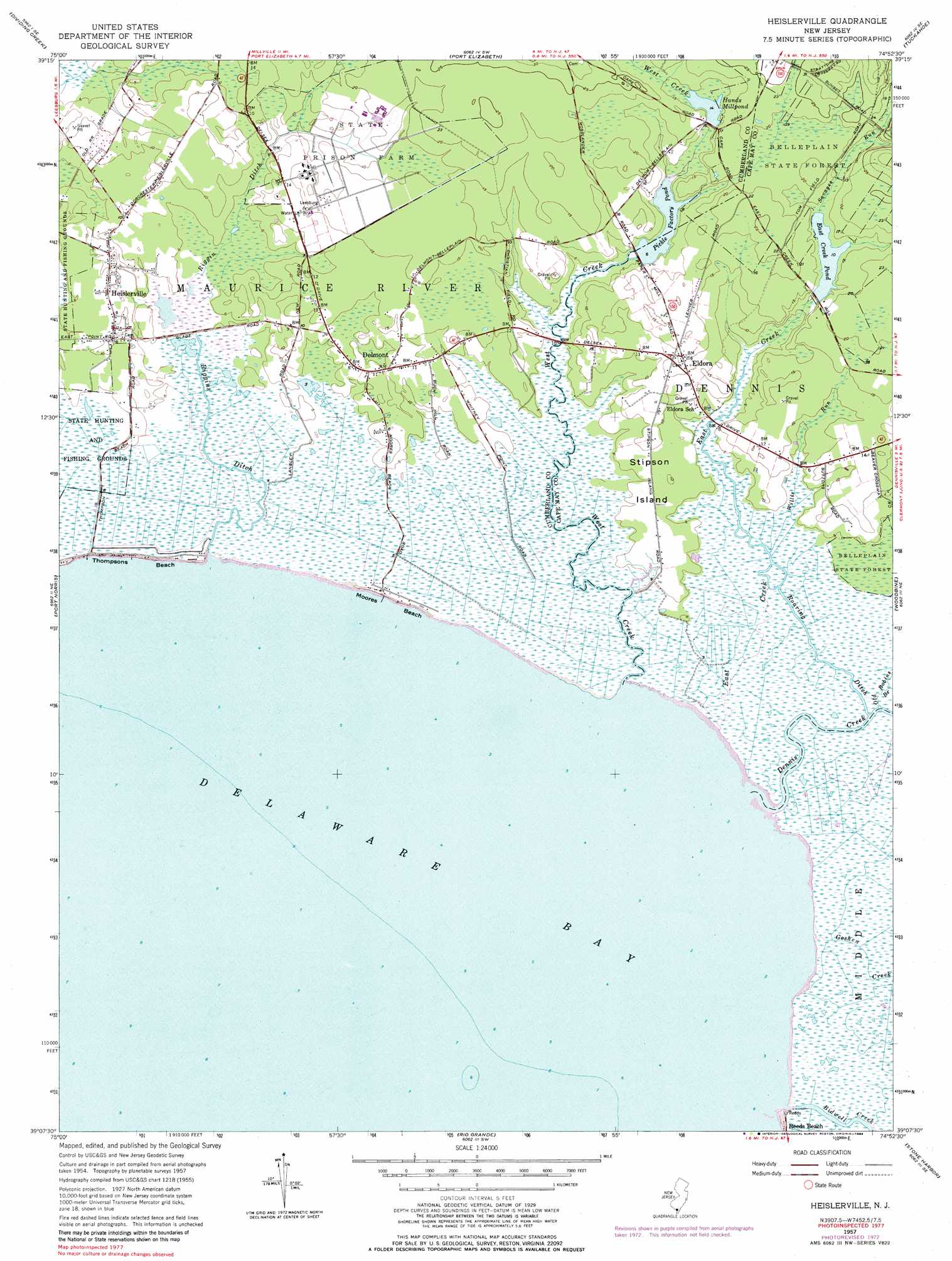
USGS Topo Quad 39074b8 - 1:24,000 scale
| Topo Map Name: | Heislerville |
| USGS Topo Quad ID: | 39074b8 |
| Print Size: | ca. 21 1/4" wide x 27" high |
| Southeast Coordinates: | 39.125° N latitude / 74.875° W longitude |
| Map Center Coordinates: | 39.1875° N latitude / 74.9375° W longitude |
| U.S. State: | NJ |
| Filename: | o39074b8.jpg |
| Download Map JPG Image: | Heislerville topo map 1:24,000 scale |
| Map Type: | Topographic |
| Topo Series: | 7.5´ |
| Map Scale: | 1:24,000 |
| Source of Map Images: | United States Geological Survey (USGS) |
| Alternate Map Versions: |
Heislerville NJ 1957, updated 1958 Download PDF Buy paper map Heislerville NJ 1957, updated 1972 Download PDF Buy paper map Heislerville NJ 1957, updated 1979 Download PDF Buy paper map Heislerville NJ 1957, updated 1984 Download PDF Buy paper map Heislerville NJ 2011 Download PDF Buy paper map Heislerville NJ 2014 Download PDF Buy paper map Heislerville NJ 2016 Download PDF Buy paper map |
1:24,000 Topo Quads surrounding Heislerville
Bridgeton |
Millville |
Five Points |
Dorothy |
Mays Landing |
Cedarville |
Dividing Creek |
Port Elizabeth |
Tuckahoe |
Marmora |
Fortescue |
Port Norris |
Heislerville |
Woodbine |
Sea Isle City |
Rio Grande |
Stone Harbor |
Avalon |
||
Cape May |
Wildwood |
> Back to 39074a1 at 1:100,000 scale
> Back to 39074a1 at 1:250,000 scale
> Back to U.S. Topo Maps home
Heislerville topo map: Gazetteer
Heislerville: Beaches
Moores Beach elevation 1m 3′Thompsons Beach elevation 1m 3′
Heislerville: Canals
Riggin Ditch elevation 1m 3′Heislerville: Dams
East Creek Pond Dam elevation 3m 9′Hands Mill Pond Dam elevation 3m 9′
Victory Lakes Dam Number One elevation -3m -10′
Heislerville: Guts
Bills Gut elevation 0m 0′Heislerville: Islands
Stipson Island elevation 2m 6′Heislerville: Populated Places
Delmont elevation 3m 9′Eldora elevation 5m 16′
Heislerville elevation 3m 9′
Heislerville: Reservoirs
East Creek Pond elevation 3m 9′Hands Mill Pond elevation 3m 9′
Pickle Factory Pond elevation 1m 3′
Heislerville: Streams
Bidwell Creek elevation 0m 0′Dennis Creek elevation -2m -7′
East Creek elevation 1m 3′
Goshen Creek elevation 0m 0′
Old Robins Branch elevation 1m 3′
Roaring Ditch elevation 0m 0′
Savages Run elevation 4m 13′
West Creek elevation 0m 0′
Wilsons Run elevation 1m 3′
Heislerville digital topo map on disk
Buy this Heislerville topo map showing relief, roads, GPS coordinates and other geographical features, as a high-resolution digital map file on DVD:
Atlantic Coast (NY, NJ, PA, DE, MD, VA, NC)
Buy digital topo maps: Atlantic Coast (NY, NJ, PA, DE, MD, VA, NC)
 map DVD")