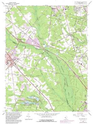
Williamstown Topo Map New Jersey
To zoom in, hover over the map of Williamstown
USGS Topo Quad 39074f8 - 1:24,000 scale
| Topo Map Name: | Williamstown |
| USGS Topo Quad ID: | 39074f8 |
| Print Size: | ca. 21 1/4" wide x 27" high |
| Southeast Coordinates: | 39.625° N latitude / 74.875° W longitude |
| Map Center Coordinates: | 39.6875° N latitude / 74.9375° W longitude |
| U.S. State: | NJ |
| Filename: | o39074f8.jpg |
| Download Map JPG Image: | Williamstown topo map 1:24,000 scale |
| Map Type: | Topographic |
| Topo Series: | 7.5´ |
| Map Scale: | 1:24,000 |
| Source of Map Images: | United States Geological Survey (USGS) |
| Alternate Map Versions: |
Williamstown NJ 1953, updated 1954 Download PDF Buy paper map Williamstown NJ 1966, updated 1968 Download PDF Buy paper map Williamstown NJ 1966, updated 1982 Download PDF Buy paper map Williamstown NJ 1966, updated 1982 Download PDF Buy paper map Williamstown NJ 2011 Download PDF Buy paper map Williamstown NJ 2014 Download PDF Buy paper map Williamstown NJ 2016 Download PDF Buy paper map |
1:24,000 Topo Quads surrounding Williamstown
> Back to 39074e1 at 1:100,000 scale
> Back to 39074a1 at 1:250,000 scale
> Back to U.S. Topo Maps home
Williamstown topo map: Gazetteer
Williamstown: Airports
AT and T Cedarbrook Heliport elevation 50m 164′Geiserts Strip elevation 34m 111′
New Freedom Switching Station Heliport elevation 42m 137′
Williamstown: Dams
New Brooklyn Dam elevation 33m 108′Spruce Lake Dam elevation 30m 98′
Sunset Lake Dam elevation 31m 101′
Timber Lakes Dam elevation 29m 95′
Victory Lakes Dam Number Two elevation 31m 101′
Williamstown: Lakes
Blue Hole elevation 24m 78′Virginia Lake elevation 41m 134′
Williamstown: Parks
New Brooklyn County Park elevation 33m 108′Winslow Fish and Wildlife Management Area elevation 30m 98′
Williamstown: Populated Places
Andrews elevation 37m 121′Blue Anchor elevation 42m 137′
Braddock elevation 40m 131′
Broad Lane elevation 33m 108′
Cecil elevation 39m 127′
Cedar Brook elevation 37m 121′
Chesilhurst elevation 51m 167′
Florence elevation 42m 137′
New Brooklyn elevation 33m 108′
Sicklerville elevation 43m 141′
Victory Lakes elevation 36m 118′
West Atco elevation 54m 177′
Williamstown elevation 44m 144′
Williamstown Junction elevation 45m 147′
Williamstown: Reservoirs
New Brooklyn Lake elevation 33m 108′Spruce Lake elevation 30m 98′
Sunset Lake elevation 31m 101′
Timber Lakes elevation 29m 95′
Victory Lakes elevation 30m 98′
Williamstown: Streams
Big Bridge Branch elevation 24m 78′Ducks Nest Stream elevation 30m 98′
Fourmile Branch elevation 30m 98′
Hedges Branch elevation 32m 104′
Kay Branch elevation 35m 114′
Oakland Brook elevation 33m 108′
Squankum Branch elevation 24m 78′
Whitehall Branch elevation 29m 95′
Williamstown digital topo map on disk
Buy this Williamstown topo map showing relief, roads, GPS coordinates and other geographical features, as a high-resolution digital map file on DVD:
Atlantic Coast (NY, NJ, PA, DE, MD, VA, NC)
Buy digital topo maps: Atlantic Coast (NY, NJ, PA, DE, MD, VA, NC)


