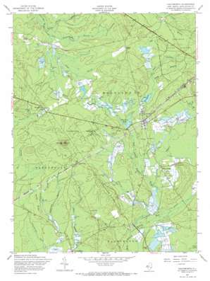
Chatsworth Topo Map New Jersey
To zoom in, hover over the map of Chatsworth
USGS Topo Quad 39074g5 - 1:24,000 scale
| Topo Map Name: | Chatsworth |
| USGS Topo Quad ID: | 39074g5 |
| Print Size: | ca. 21 1/4" wide x 27" high |
| Southeast Coordinates: | 39.75° N latitude / 74.5° W longitude |
| Map Center Coordinates: | 39.8125° N latitude / 74.5625° W longitude |
| U.S. State: | NJ |
| Filename: | o39074g5.jpg |
| Download Map JPG Image: | Chatsworth topo map 1:24,000 scale |
| Map Type: | Topographic |
| Topo Series: | 7.5´ |
| Map Scale: | 1:24,000 |
| Source of Map Images: | United States Geological Survey (USGS) |
| Alternate Map Versions: |
Chatsworth NJ 1951 Download PDF Buy paper map Chatsworth NJ 1957, updated 1960 Download PDF Buy paper map Chatsworth NJ 1957, updated 1965 Download PDF Buy paper map Chatsworth NJ 1957, updated 1973 Download PDF Buy paper map Chatsworth NJ 1957, updated 1984 Download PDF Buy paper map Chatsworth NJ 1995, updated 2000 Download PDF Buy paper map Chatsworth NJ 2011 Download PDF Buy paper map Chatsworth NJ 2014 Download PDF Buy paper map Chatsworth NJ 2016 Download PDF Buy paper map |
1:24,000 Topo Quads surrounding Chatsworth
> Back to 39074e1 at 1:100,000 scale
> Back to 39074a1 at 1:250,000 scale
> Back to U.S. Topo Maps home
Chatsworth topo map: Gazetteer
Chatsworth: Dams
Chatsworth Lake Dam elevation 25m 82′Chatsworth: Populated Places
Butlers Place elevation 39m 127′Chatsworth elevation 29m 95′
Dukes Bridge elevation 24m 78′
Eagle elevation 25m 82′
Friendship elevation 18m 59′
Johnson Place elevation 36m 118′
Jones Mill elevation 23m 75′
Pine Crest elevation 29m 95′
South Park elevation 32m 104′
Speedwell elevation 22m 72′
Chatsworth: Post Offices
Chatsworth Post Office elevation 29m 95′Chatsworth: Reservoirs
Chatsworth Lake elevation 25m 82′Chatsworth: Ridges
Sandy Ridge elevation 23m 75′Chatsworth: Streams
Burnt Bridge Branch elevation 24m 78′Gates Branch elevation 29m 95′
Gum Spring elevation 23m 75′
Ore Spung elevation 18m 59′
Pole Branch elevation 18m 59′
Reeds Branch elevation 27m 88′
Risley Branch elevation 21m 68′
Shane Branch elevation 18m 59′
Shoal Branch elevation 18m 59′
Slab Causeway Branch elevation 24m 78′
South Branch Burrs Mill Brook elevation 24m 78′
Tibbs Branch elevation 31m 101′
Chatsworth: Summits
Apple Pie Hill elevation 56m 183′Chatsworth: Woods
Chatsworth Woods elevation 32m 104′Chatsworth digital topo map on disk
Buy this Chatsworth topo map showing relief, roads, GPS coordinates and other geographical features, as a high-resolution digital map file on DVD:
Atlantic Coast (NY, NJ, PA, DE, MD, VA, NC)
Buy digital topo maps: Atlantic Coast (NY, NJ, PA, DE, MD, VA, NC)


