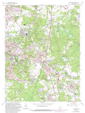
Clementon Topo Map New Jersey
To zoom in, hover over the map of Clementon
USGS Topo Quad 39074g8 - 1:24,000 scale
| Topo Map Name: | Clementon |
| USGS Topo Quad ID: | 39074g8 |
| Print Size: | ca. 21 1/4" wide x 27" high |
| Southeast Coordinates: | 39.75° N latitude / 74.875° W longitude |
| Map Center Coordinates: | 39.8125° N latitude / 74.9375° W longitude |
| U.S. State: | NJ |
| Filename: | o39074g8.jpg |
| Download Map JPG Image: | Clementon topo map 1:24,000 scale |
| Map Type: | Topographic |
| Topo Series: | 7.5´ |
| Map Scale: | 1:24,000 |
| Source of Map Images: | United States Geological Survey (USGS) |
| Alternate Map Versions: |
Clementon NJ 1953, updated 1954 Download PDF Buy paper map Clementon NJ 1953, updated 1954 Download PDF Buy paper map Clementon NJ 1953, updated 1965 Download PDF Buy paper map Clementon NJ 1967, updated 1968 Download PDF Buy paper map Clementon NJ 1967, updated 1982 Download PDF Buy paper map Clementon NJ 1967, updated 1988 Download PDF Buy paper map Clementon NJ 1967, updated 1988 Download PDF Buy paper map Clementon NJ 2011 Download PDF Buy paper map Clementon NJ 2014 Download PDF Buy paper map Clementon NJ 2016 Download PDF Buy paper map |
1:24,000 Topo Quads surrounding Clementon
> Back to 39074e1 at 1:100,000 scale
> Back to 39074a1 at 1:250,000 scale
> Back to U.S. Topo Maps home
Clementon topo map: Gazetteer
Clementon: Airports
Albion elevation 48m 157′Camden County Airport elevation 42m 137′
Camden-Burlington County elevation 42m 137′
S and C Echelon Heliport elevation 27m 88′
Clementon: Dams
Atco Lake Dam elevation 34m 111′Cedar Lake Dam elevation 26m 85′
Clementon Lake Dam elevation 15m 49′
Kenilworth Lake Dam elevation 25m 82′
Marlton Lakes Upper Dam elevation 36m 118′
New Camp Site Dam elevation 24m 78′
Pachoango Dam elevation 31m 101′
Tomlinsons Mill Dam elevation 18m 59′
Clementon: Lakes
Bottom Lake elevation 17m 55′Clement Lake elevation 29m 95′
Edgewood Lake elevation 24m 78′
Harmony Lake elevation 27m 88′
Jennings Lake elevation 18m 59′
Kresson Lake elevation 26m 85′
Lake Worth elevation 30m 98′
Linden Lake elevation 21m 68′
Lion Lake elevation 27m 88′
Pilling Lake elevation 19m 62′
Pine Lake elevation 19m 62′
Rowand Lake elevation 22m 72′
Silver Lake elevation 20m 65′
Silver Lake elevation 29m 95′
Sunshine Park Lake elevation 35m 114′
Watson Lake elevation 23m 75′
Woodland Lake elevation 38m 124′
Clementon: Mines
Berlin Quarry elevation 49m 160′Clementon: Parks
Berlin Park elevation 43m 141′Clementon: Populated Places
Albion elevation 43m 141′Alluvium elevation 42m 137′
Atco elevation 45m 147′
Berlin elevation 50m 164′
Berlin Heights elevation 37m 121′
Bishops elevation 46m 150′
Clementon elevation 27m 88′
Coffins Corner elevation 32m 104′
Crowfoot elevation 45m 147′
Dicktown elevation 44m 144′
East Berlin elevation 48m 157′
Echelon elevation 26m 85′
Gibbsboro elevation 31m 101′
Glendale elevation 31m 101′
Haines Corner elevation 34m 111′
Ivystone Farms elevation 45m 147′
Kirkwood elevation 21m 68′
Kresson elevation 27m 88′
Lindenwold elevation 29m 95′
Lucaston elevation 37m 121′
Marlton Lakes elevation 42m 137′
New Freedom elevation 54m 177′
Overbrook elevation 22m 72′
Penbryn elevation 47m 154′
Pine Hill elevation 49m 160′
Pine Valley elevation 51m 167′
Reed Crossing elevation 48m 157′
Sharps Corner elevation 46m 150′
Tansboro elevation 50m 164′
Tomlinson Mill elevation 19m 62′
Union Mills elevation 23m 75′
West Berlin elevation 51m 167′
Willow Ridge elevation 21m 68′
Woodcrest elevation 21m 68′
Woodcrest Acres elevation 27m 88′
Clementon: Reservoirs
Atco Lake elevation 34m 111′Bridgewood Lake elevation 23m 75′
Cedar Lake elevation 26m 85′
Clementon Lake elevation 15m 49′
Kenilworth Lake elevation 25m 82′
Lake Lekau elevation 24m 78′
Lake Pachoango elevation 31m 101′
Marlton Lakes elevation 38m 124′
Oles Lake elevation 30m 98′
Upper Marlton Lake elevation 36m 118′
Clementon: Streams
Haney Run Branch elevation 24m 78′Millard Creek elevation 18m 59′
Nicholson Branch elevation 20m 65′
Sharps Branch elevation 39m 127′
Tinkers Branch elevation 42m 137′
Trout Run elevation 11m 36′
Clementon: Summits
Hutton Hill elevation 48m 157′Pine Hill elevation 61m 200′
Clementon digital topo map on disk
Buy this Clementon topo map showing relief, roads, GPS coordinates and other geographical features, as a high-resolution digital map file on DVD:
Atlantic Coast (NY, NJ, PA, DE, MD, VA, NC)
Buy digital topo maps: Atlantic Coast (NY, NJ, PA, DE, MD, VA, NC)


