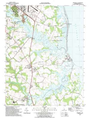
Frederica Topo Map Delaware
To zoom in, hover over the map of Frederica
USGS Topo Quad 39075a4 - 1:24,000 scale
| Topo Map Name: | Frederica |
| USGS Topo Quad ID: | 39075a4 |
| Print Size: | ca. 21 1/4" wide x 27" high |
| Southeast Coordinates: | 39° N latitude / 75.375° W longitude |
| Map Center Coordinates: | 39.0625° N latitude / 75.4375° W longitude |
| U.S. State: | DE |
| Filename: | o39075a4.jpg |
| Download Map JPG Image: | Frederica topo map 1:24,000 scale |
| Map Type: | Topographic |
| Topo Series: | 7.5´ |
| Map Scale: | 1:24,000 |
| Source of Map Images: | United States Geological Survey (USGS) |
| Alternate Map Versions: |
Frederica DE 1949 Download PDF Buy paper map Frederica DE 1949 Download PDF Buy paper map Frederica DE 1956, updated 1957 Download PDF Buy paper map Frederica DE 1956, updated 1971 Download PDF Buy paper map Frederica DE 1956, updated 1982 Download PDF Buy paper map Frederica DE 1993, updated 1993 Download PDF Buy paper map Frederica DE 2011 Download PDF Buy paper map Frederica DE 2014 Download PDF Buy paper map Frederica DE 2016 Download PDF Buy paper map |
1:24,000 Topo Quads surrounding Frederica
> Back to 39075a1 at 1:100,000 scale
> Back to 39074a1 at 1:250,000 scale
> Back to U.S. Topo Maps home
Frederica topo map: Gazetteer
Frederica: Airports
Johnson Airport elevation 12m 39′Frederica: Areas
Ted Harvey Conservation Area Logan Lane Tract elevation 1m 3′Frederica: Bars
Shirleys Bar elevation 0m 0′Frederica: Beaches
Bowers Beach elevation 1m 3′Frederica: Bridges
Barkers Landing Bridge elevation 5m 16′Lebanon Bridge elevation 2m 6′
Frederica: Capes
Milford Neck elevation 3m 9′Murderkill Neck elevation 4m 13′
Saint Jones Neck elevation 4m 13′
Frederica: Guts
Brockonbridge Gut elevation 1m 3′Sand Ditch elevation 0m 0′
Trunk Ditch elevation 1m 3′
Frederica: Islands
Kitts Hummock elevation 1m 3′Frederica: Lakes
Cypress Pond elevation 1m 3′Frederica: Parks
Lindale House elevation 9m 29′Little Creek Wildlife Area Logan Tract elevation 1m 3′
Logan School elevation 4m 13′
Milford Neck Wildlife Area elevation 1m 3′
Town Point elevation 4m 13′
Frederica: Populated Places
Barkers Landing elevation 5m 16′Barkers Landing Estates elevation 9m 29′
Bay View Heights elevation 1m 3′
Bayview Heights elevation 1m 3′
Bowers Beach elevation 1m 3′
Bowers Landing elevation 6m 19′
Brookdale Heights elevation 9m 29′
Brookhaven Estates elevation 10m 32′
Church Creek elevation 5m 16′
Cypress Gardens elevation 7m 22′
Eagle Heights elevation 9m 29′
Florence elevation 4m 13′
Frederica elevation 5m 16′
George Meyers Development elevation 5m 16′
Grandview Meadows elevation 9m 29′
Hideaway Acres elevation 7m 22′
High Point Mobile Home Park elevation 9m 29′
Hunters Ridge elevation 10m 32′
Kitts Hummock elevation 1m 3′
Little Heaven elevation 9m 29′
Locustville elevation 10m 32′
Magnolia elevation 8m 26′
Magnolia Mobile Home Park elevation 11m 36′
Misty Pines elevation 8m 26′
Otters Run elevation 7m 22′
Silver Maple Mobile Home Park elevation 4m 13′
South Bowers elevation 1m 3′
Warren Landing elevation 3m 9′
Webb Landing elevation 1m 3′
White House Landing elevation 1m 3′
Wickham Woods elevation 10m 32′
Frederica: Post Offices
Magnolia Post Office elevation 7m 22′Frederica: Streams
Beaver Gut Ditch elevation 1m 3′Cypress Branch elevation 1m 3′
Double Run elevation 1m 3′
Hudson Branch elevation 1m 3′
Murderkill River elevation 1m 3′
Pratt Branch elevation 1m 3′
Saint Jones River elevation 0m 0′
Spring Creek elevation 1m 3′
Thorndyk Branch elevation 4m 13′
Tidbury Creek elevation 1m 3′
Frederica: Summits
Kitts Hummock elevation 1m 3′Frederica digital topo map on disk
Buy this Frederica topo map showing relief, roads, GPS coordinates and other geographical features, as a high-resolution digital map file on DVD:
Atlantic Coast (NY, NJ, PA, DE, MD, VA, NC)
Buy digital topo maps: Atlantic Coast (NY, NJ, PA, DE, MD, VA, NC)


