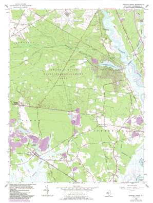
Dividing Creek Topo Map New Jersey
To zoom in, hover over the map of Dividing Creek
USGS Topo Quad 39075c1 - 1:24,000 scale
| Topo Map Name: | Dividing Creek |
| USGS Topo Quad ID: | 39075c1 |
| Print Size: | ca. 21 1/4" wide x 27" high |
| Southeast Coordinates: | 39.25° N latitude / 75° W longitude |
| Map Center Coordinates: | 39.3125° N latitude / 75.0625° W longitude |
| U.S. State: | NJ |
| Filename: | o39075c1.jpg |
| Download Map JPG Image: | Dividing Creek topo map 1:24,000 scale |
| Map Type: | Topographic |
| Topo Series: | 7.5´ |
| Map Scale: | 1:24,000 |
| Source of Map Images: | United States Geological Survey (USGS) |
| Alternate Map Versions: |
Dividing Creek NJ 1956, updated 1957 Download PDF Buy paper map Dividing Creek NJ 1956, updated 1968 Download PDF Buy paper map Dividing Creek NJ 1956, updated 1972 Download PDF Buy paper map Dividing Creek NJ 1956, updated 1973 Download PDF Buy paper map Dividing Creek NJ 1956, updated 1987 Download PDF Buy paper map Dividing Creek NJ 1956, updated 1987 Download PDF Buy paper map Dividing Creek NJ 2011 Download PDF Buy paper map Dividing Creek NJ 2014 Download PDF Buy paper map Dividing Creek NJ 2016 Download PDF Buy paper map |
1:24,000 Topo Quads surrounding Dividing Creek
> Back to 39075a1 at 1:100,000 scale
> Back to 39074a1 at 1:250,000 scale
> Back to U.S. Topo Maps home
Dividing Creek topo map: Gazetteer
Dividing Creek: Airports
Millville Municipal Airport elevation 21m 68′Dividing Creek: Bridges
Toms Bridge elevation -1m -4′Dividing Creek: Dams
Beaver Dam elevation 3m 9′Laurel Lake Dam elevation 0m 0′
Dividing Creek: Guts
Cranberry Gut elevation 2m 6′Dividing Creek: Lakes
Laurel Lake elevation 3m 9′Dividing Creek: Parks
Edward G Bevan Fish and Wildlife Management Area elevation 16m 52′Menantico Ponds Fish and Wildlife Management Area elevation 8m 26′
Owls Nest Field elevation 3m 9′
Dividing Creek: Populated Places
Baileytown elevation 19m 62′Buckshutem elevation 6m 19′
Centre Grove elevation 21m 68′
Clarks Mill elevation 6m 19′
Dividing Creek elevation 3m 9′
Dragston elevation 3m 9′
Haleyville elevation 9m 29′
Laurel Lake elevation 7m 22′
Lores Mill elevation 3m 9′
New Italy elevation 3m 9′
North Port Norris elevation 4m 13′
Paynters Crossing elevation 12m 39′
Dividing Creek: Reservoirs
Beaver Lake elevation 3m 9′Ladow Millpond elevation 2m 6′
Laurel Lake elevation 0m 0′
Dividing Creek: Streams
Bowkers Run elevation 3m 9′Buckshutem Creek elevation 0m 0′
Cedar Creek elevation 0m 0′
Clay Branch elevation 1m 3′
Gravelly Run elevation 3m 9′
Haleys Branch elevation 2m 6′
Iron Mine Branch elevation 0m 0′
Joshua Branch elevation 13m 42′
Lands Branch elevation 3m 9′
Maple Creek elevation 0m 0′
Menantico Creek elevation 0m 0′
Mill Creek elevation 0m 0′
Pine Branch elevation 13m 42′
Reubens Branch elevation 1m 3′
Sheppards Branch elevation 3m 9′
Steep Run elevation 0m 0′
Dividing Creek: Swamps
Buckshutem Swamp elevation 11m 36′Cub Swamp elevation 3m 9′
Dividing Creek digital topo map on disk
Buy this Dividing Creek topo map showing relief, roads, GPS coordinates and other geographical features, as a high-resolution digital map file on DVD:
Atlantic Coast (NY, NJ, PA, DE, MD, VA, NC)
Buy digital topo maps: Atlantic Coast (NY, NJ, PA, DE, MD, VA, NC)


