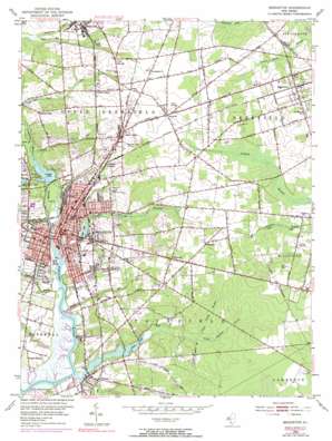
Bridgeton Topo Map New Jersey
To zoom in, hover over the map of Bridgeton
USGS Topo Quad 39075d2 - 1:24,000 scale
| Topo Map Name: | Bridgeton |
| USGS Topo Quad ID: | 39075d2 |
| Print Size: | ca. 21 1/4" wide x 27" high |
| Southeast Coordinates: | 39.375° N latitude / 75.125° W longitude |
| Map Center Coordinates: | 39.4375° N latitude / 75.1875° W longitude |
| U.S. State: | NJ |
| Filename: | o39075d2.jpg |
| Download Map JPG Image: | Bridgeton topo map 1:24,000 scale |
| Map Type: | Topographic |
| Topo Series: | 7.5´ |
| Map Scale: | 1:24,000 |
| Source of Map Images: | United States Geological Survey (USGS) |
| Alternate Map Versions: |
Bridgeton NJ 1953, updated 1955 Download PDF Buy paper map Bridgeton NJ 1953, updated 1964 Download PDF Buy paper map Bridgeton NJ 1953, updated 1972 Download PDF Buy paper map Bridgeton NJ 1953, updated 1972 Download PDF Buy paper map Bridgeton NJ 2011 Download PDF Buy paper map Bridgeton NJ 2014 Download PDF Buy paper map Bridgeton NJ 2016 Download PDF Buy paper map |
1:24,000 Topo Quads surrounding Bridgeton
> Back to 39075a1 at 1:100,000 scale
> Back to 39074a1 at 1:250,000 scale
> Back to U.S. Topo Maps home
Bridgeton topo map: Gazetteer
Bridgeton: Airports
Bridgeton Hospital elevation 14m 45′Bucks Airport elevation 31m 101′
City of Bridgeton Heliport elevation 12m 39′
Li Calzi Airport elevation 9m 29′
South Jersey Hospital System Heliport elevation 14m 45′
Bridgeton: Capes
Dutch Neck elevation 6m 19′Piney Point elevation 9m 29′
Bridgeton: Dams
Clarks Pond Dam elevation 6m 19′East Lake Dam elevation 6m 19′
Mary Elmer Lake Dam elevation 9m 29′
Silver Lake Dam elevation 15m 49′
Sunset Lake Dam elevation 3m 9′
Bridgeton: Lakes
Eddy Pond elevation 5m 16′Bridgeton: Parks
Bridgeton City Park elevation 12m 39′City Park elevation 9m 29′
Clarks Pond Fish and Wildlife Management Area elevation 0m 0′
Bridgeton: Populated Places
Big Oak elevation 32m 104′Bridgeton elevation 3m 9′
Bridgeton Junction elevation 27m 88′
Carlls Corner elevation 33m 108′
Fairton elevation 8m 26′
Finley elevation 33m 108′
Fordville elevation 30m 98′
Friendship elevation 34m 111′
Garton elevation 33m 108′
Gouldtown elevation 25m 82′
Orchard Center elevation 32m 104′
Rammel Mill elevation 26m 85′
Rosenhayn elevation 33m 108′
Tindells Landing elevation 6m 19′
Woodruff elevation 31m 101′
Bridgeton: Reservoirs
Clarks Pond elevation 6m 19′East Lake elevation 6m 19′
Mary Elmer Lake elevation 9m 29′
Silver Lake elevation 15m 49′
Sunset Lake elevation 3m 9′
Bridgeton: Streams
Bluebird Branch elevation 17m 55′Cornwell Run elevation 4m 13′
Foster Run elevation 17m 55′
Indian Fields Branch elevation 8m 26′
Island Branch elevation 0m 0′
Jackson Run elevation 7m 22′
Loper Run elevation 16m 52′
Maple Hollow Branch elevation 11m 36′
Mill Creek elevation 6m 19′
Muddy Run elevation 4m 13′
North Cape May Branch elevation 13m 42′
Rocaps Run elevation 1m 3′
Shaw Branch elevation 5m 16′
Bridgeton digital topo map on disk
Buy this Bridgeton topo map showing relief, roads, GPS coordinates and other geographical features, as a high-resolution digital map file on DVD:
Atlantic Coast (NY, NJ, PA, DE, MD, VA, NC)
Buy digital topo maps: Atlantic Coast (NY, NJ, PA, DE, MD, VA, NC)


