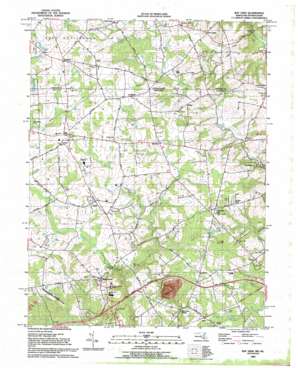
Bay View Topo Map Maryland
To zoom in, hover over the map of Bay View
USGS Topo Quad 39075f8 - 1:24,000 scale
| Topo Map Name: | Bay View |
| USGS Topo Quad ID: | 39075f8 |
| Print Size: | ca. 21 1/4" wide x 27" high |
| Southeast Coordinates: | 39.625° N latitude / 75.875° W longitude |
| Map Center Coordinates: | 39.6875° N latitude / 75.9375° W longitude |
| U.S. States: | MD, PA |
| Filename: | o39075f8.jpg |
| Download Map JPG Image: | Bay View topo map 1:24,000 scale |
| Map Type: | Topographic |
| Topo Series: | 7.5´ |
| Map Scale: | 1:24,000 |
| Source of Map Images: | United States Geological Survey (USGS) |
| Alternate Map Versions: |
Bay View MD 1953, updated 1954 Download PDF Buy paper map Bay View MD 1953, updated 1954 Download PDF Buy paper map Bay View MD 1953, updated 1967 Download PDF Buy paper map Bay View MD 1953, updated 1971 Download PDF Buy paper map Bay View MD 1953, updated 1972 Download PDF Buy paper map Bay View MD 1953, updated 1972 Download PDF Buy paper map Bay View MD 1953, updated 1981 Download PDF Buy paper map Bay View MD 1953, updated 1989 Download PDF Buy paper map Bay View MD 1992, updated 1993 Download PDF Buy paper map Bay View MD 1997, updated 1999 Download PDF Buy paper map Bay View MD 2011 Download PDF Buy paper map Bay View MD 2014 Download PDF Buy paper map Bay View MD 2016 Download PDF Buy paper map |
1:24,000 Topo Quads surrounding Bay View
> Back to 39075e1 at 1:100,000 scale
> Back to 39074a1 at 1:250,000 scale
> Back to U.S. Topo Maps home
Bay View topo map: Gazetteer
Bay View: Bridges
Gilpins Covered Bridge elevation 95m 311′Bay View: Crossings
Interchange 8 elevation 89m 291′Bay View: Falls
Gilpins Falls elevation 63m 206′Bay View: Populated Places
Bay View elevation 116m 380′Beulah Land elevation 104m 341′
Blake elevation 123m 403′
Blue Ball Village elevation 112m 367′
Blueball elevation 113m 370′
Boomdecker elevation 99m 324′
Calvert elevation 139m 456′
Calvert Acres elevation 119m 390′
Cedar Hill elevation 107m 351′
Chantilly Manor elevation 113m 370′
Chrome elevation 153m 501′
Eder elevation 43m 141′
Edgewood Hills elevation 97m 318′
Elk Mills elevation 102m 334′
Ewingville (historical) elevation 115m 377′
Fair Hill Meadows elevation 115m 377′
Fairfields elevation 129m 423′
Farmcrest elevation 112m 367′
Forest Green Court elevation 39m 127′
Forest Green Court elevation 36m 118′
Glen Hope (historical) elevation 90m 295′
Hickory Hill elevation 135m 442′
Highpoint elevation 97m 318′
Hillview Estates elevation 96m 314′
Leeds elevation 72m 236′
Lombard elevation 137m 449′
Lombard Acres elevation 140m 459′
Lum Estates elevation 77m 252′
Marley Village elevation 34m 111′
Mechanic Valley elevation 34m 111′
Middlecroft elevation 121m 396′
Nellys Corner (historical) elevation 142m 465′
Old Line Village of Fair Hill elevation 95m 311′
Pawnee Lake Hills elevation 100m 328′
Peacedale elevation 126m 413′
Pearl Estates elevation 123m 403′
Pleasant Hill elevation 117m 383′
Pleasant Hill Mobile Home Park elevation 116m 380′
Ponds Edge elevation 106m 347′
Providence elevation 62m 203′
Shah Valley elevation 114m 374′
Stony Chase Court elevation 100m 328′
Tailwinds Estates elevation 119m 390′
The Estates of Wyn Lea elevation 111m 364′
The Rock (historical) elevation 70m 229′
Union Valley elevation 82m 269′
Westminister elevation 121m 396′
Wyn Lea at Fair Hill elevation 112m 367′
Zion elevation 119m 390′
Zion Acres elevation 113m 370′
Bay View: Post Offices
Bay View Post Office (historical) elevation 115m 377′Blueball Post Office (historical) elevation 115m 377′
Calvery Post Office (historical) elevation 133m 436′
Mechanics Valley Post Office (historical) elevation 65m 213′
Zion Post Office (historical) elevation 119m 390′
Bay View: Streams
Barren Brook elevation 100m 328′Jordan Run elevation 103m 337′
West Branch Little Northeast Creek elevation 74m 242′
Bay View: Summits
Egg Hill elevation 125m 410′Bay View digital topo map on disk
Buy this Bay View topo map showing relief, roads, GPS coordinates and other geographical features, as a high-resolution digital map file on DVD:
Atlantic Coast (NY, NJ, PA, DE, MD, VA, NC)
Buy digital topo maps: Atlantic Coast (NY, NJ, PA, DE, MD, VA, NC)


