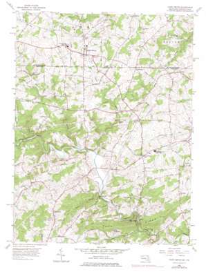
Fawn Grove Topo Map Maryland
To zoom in, hover over the map of Fawn Grove
USGS Topo Quad 39076f4 - 1:24,000 scale
| Topo Map Name: | Fawn Grove |
| USGS Topo Quad ID: | 39076f4 |
| Print Size: | ca. 21 1/4" wide x 27" high |
| Southeast Coordinates: | 39.625° N latitude / 76.375° W longitude |
| Map Center Coordinates: | 39.6875° N latitude / 76.4375° W longitude |
| U.S. States: | MD, PA |
| Filename: | o39076f4.jpg |
| Download Map JPG Image: | Fawn Grove topo map 1:24,000 scale |
| Map Type: | Topographic |
| Topo Series: | 7.5´ |
| Map Scale: | 1:24,000 |
| Source of Map Images: | United States Geological Survey (USGS) |
| Alternate Map Versions: |
Fawn Grove PA 1956, updated 1957 Download PDF Buy paper map Fawn Grove PA 1956, updated 1970 Download PDF Buy paper map Fawn Grove PA 1956, updated 1975 Download PDF Buy paper map Fawn Grove PA 1992, updated 1995 Download PDF Buy paper map Fawn Grove PA 2011 Download PDF Buy paper map Fawn Grove PA 2013 Download PDF Buy paper map Fawn Grove PA 2016 Download PDF Buy paper map |
1:24,000 Topo Quads surrounding Fawn Grove
> Back to 39076e1 at 1:100,000 scale
> Back to 39076a1 at 1:250,000 scale
> Back to U.S. Topo Maps home
Fawn Grove topo map: Gazetteer
Fawn Grove: Bridges
Clark Bridge elevation 70m 229′Fawn Grove: Dams
Little Deer Creek Watershed Site Number 1 Dam elevation 197m 646′Fawn Grove: Parks
Deer Creek State Park elevation 86m 282′Eden Mills Park elevation 118m 387′
Highland Park elevation 153m 501′
Stoneywood Nature Center elevation 78m 255′
Fawn Grove: Populated Places
Belle Farm Heritage elevation 126m 413′Bobs Flow elevation 151m 495′
Bushs Corner elevation 160m 524′
Cherry Hill elevation 151m 495′
Cherrywood Estates elevation 85m 278′
Chrome Hill Estates elevation 138m 452′
Coldstream elevation 209m 685′
Coventry Meadows elevation 153m 501′
Deer Meadows elevation 150m 492′
Dunsen Heights elevation 140m 459′
Eden Hills elevation 126m 413′
Fawn Grove elevation 222m 728′
Federal Hill elevation 183m 600′
Federal Hill Heights elevation 199m 652′
Five Forks elevation 160m 524′
Graceton elevation 182m 597′
Harford Heritage elevation 200m 656′
Harkins elevation 183m 600′
Highland Ridge elevation 164m 538′
Hoerr elevation 209m 685′
Madonna Hills elevation 155m 508′
McDermott elevation 182m 597′
Meadowlark Estates elevation 168m 551′
Midsummer Hill elevation 154m 505′
Minefield elevation 135m 442′
North Bend Heights elevation 190m 623′
North Harford Heights elevation 197m 646′
Northampton elevation 165m 541′
Quail Hills elevation 151m 495′
Rockridge Forest elevation 147m 482′
Rush Manor elevation 144m 472′
Spooners Creek elevation 185m 606′
Spring Meadows elevation 174m 570′
Street elevation 160m 524′
Twin Ridge Estates elevation 175m 574′
Whispering Woods elevation 160m 524′
Willwood elevation 209m 685′
Wilsons Choice elevation 193m 633′
Fawn Grove: Post Offices
Federal Hill Post Office (historical) elevation 180m 590′Street Post Office elevation 158m 518′
Fawn Grove: Reservoirs
Cattail Reservoir elevation 197m 646′Fawn Grove: Ridges
Rock Ridge elevation 192m 629′Fawn Grove: Springs
Four-H Camp Spring elevation 85m 278′Fawn Grove: Streams
Big Branch elevation 104m 341′Cattail Branch elevation 121m 396′
Falling Branch elevation 102m 334′
Falling Branch elevation 101m 331′
Gladden Branch elevation 82m 269′
Island Branch elevation 168m 551′
Island Branch elevation 111m 364′
Kellogg Branch elevation 79m 259′
Little Deer Creek elevation 97m 318′
Rock Hollow Branch elevation 96m 314′
Wet Stone Branch elevation 92m 301′
Fawn Grove: Summits
Kilgores Rocks elevation 123m 403′Fawn Grove digital topo map on disk
Buy this Fawn Grove topo map showing relief, roads, GPS coordinates and other geographical features, as a high-resolution digital map file on DVD:
Atlantic Coast (NY, NJ, PA, DE, MD, VA, NC)
Buy digital topo maps: Atlantic Coast (NY, NJ, PA, DE, MD, VA, NC)


