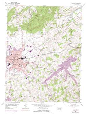
Hanover Topo Map Pennsylvania
To zoom in, hover over the map of Hanover
USGS Topo Quad 39076g8 - 1:24,000 scale
| Topo Map Name: | Hanover |
| USGS Topo Quad ID: | 39076g8 |
| Print Size: | ca. 21 1/4" wide x 27" high |
| Southeast Coordinates: | 39.75° N latitude / 76.875° W longitude |
| Map Center Coordinates: | 39.8125° N latitude / 76.9375° W longitude |
| U.S. State: | PA |
| Filename: | o39076g8.jpg |
| Download Map JPG Image: | Hanover topo map 1:24,000 scale |
| Map Type: | Topographic |
| Topo Series: | 7.5´ |
| Map Scale: | 1:24,000 |
| Source of Map Images: | United States Geological Survey (USGS) |
| Alternate Map Versions: |
Hanover PA 1954, updated 1956 Download PDF Buy paper map Hanover PA 1954, updated 1967 Download PDF Buy paper map Hanover PA 1954, updated 1969 Download PDF Buy paper map Hanover PA 1954, updated 1975 Download PDF Buy paper map Hanover PA 1954, updated 1991 Download PDF Buy paper map Hanover PA 1998, updated 2000 Download PDF Buy paper map Hanover PA 2010 Download PDF Buy paper map Hanover PA 2013 Download PDF Buy paper map Hanover PA 2016 Download PDF Buy paper map |
1:24,000 Topo Quads surrounding Hanover
> Back to 39076e1 at 1:100,000 scale
> Back to 39076a1 at 1:250,000 scale
> Back to U.S. Topo Maps home
Hanover topo map: Gazetteer
Hanover: Airports
Devener Airport elevation 186m 610′Hanover: Dams
Lake Marburg Dam elevation 157m 515′Lawrence Baker Sheppard Dam elevation 212m 695′
Upper Pigeon Hill Dam elevation 251m 823′
Hanover: Lakes
Glat Co Lake elevation 184m 603′Hanover: Parks
Codorus State Park elevation 207m 679′Dubs Picnic Grove elevation 218m 715′
State Game Propagation Area elevation 238m 780′
Wirt Park elevation 181m 593′
Hanover: Populated Places
Ambau elevation 151m 495′Blooming Grove elevation 231m 757′
Fuhrmans Mill elevation 202m 662′
Gnatstown elevation 230m 754′
Hanover elevation 183m 600′
Iron Ridge elevation 154m 505′
Jacobs Mills elevation 157m 515′
Kraft Mill elevation 158m 518′
Marburg elevation 192m 629′
Menges Mills elevation 147m 482′
Moulstown elevation 209m 685′
New Baltimore elevation 185m 606′
Parkville elevation 233m 764′
Penn Grove elevation 174m 570′
Pennville elevation 170m 557′
Pigeon Hills (historical) elevation 238m 780′
Porters Sideling elevation 160m 524′
Smiths Station elevation 177m 580′
Hanover: Ranges
Pigeon Hills elevation 296m 971′Hanover: Reservoirs
Lake Marburg elevation 188m 616′Lawrence Baker Sheppard Reservoir elevation 212m 695′
Upper Pigeon Hill Lake elevation 251m 823′
Hanover: Streams
Furnace Creek elevation 190m 623′Gitts Run elevation 162m 531′
Long Arm Creek elevation 179m 587′
Long Run elevation 190m 623′
Oil Creek elevation 140m 459′
Porters Creek elevation 148m 485′
West Branch Codorus Creek elevation 157m 515′
Hanover: Summits
High Rock elevation 353m 1158′Hanover: Valleys
Little Valley elevation 187m 613′Hanover digital topo map on disk
Buy this Hanover topo map showing relief, roads, GPS coordinates and other geographical features, as a high-resolution digital map file on DVD:
Atlantic Coast (NY, NJ, PA, DE, MD, VA, NC)
Buy digital topo maps: Atlantic Coast (NY, NJ, PA, DE, MD, VA, NC)


