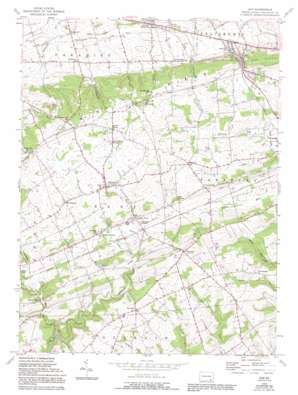
Gap Topo Map Pennsylvania
To zoom in, hover over the map of Gap
USGS Topo Quad 39076h1 - 1:24,000 scale
| Topo Map Name: | Gap |
| USGS Topo Quad ID: | 39076h1 |
| Print Size: | ca. 21 1/4" wide x 27" high |
| Southeast Coordinates: | 39.875° N latitude / 76° W longitude |
| Map Center Coordinates: | 39.9375° N latitude / 76.0625° W longitude |
| U.S. State: | PA |
| Filename: | o39076h1.jpg |
| Download Map JPG Image: | Gap topo map 1:24,000 scale |
| Map Type: | Topographic |
| Topo Series: | 7.5´ |
| Map Scale: | 1:24,000 |
| Source of Map Images: | United States Geological Survey (USGS) |
| Alternate Map Versions: |
Gap PA 1955, updated 1956 Download PDF Buy paper map Gap PA 1955, updated 1968 Download PDF Buy paper map Gap PA 1955, updated 1970 Download PDF Buy paper map Gap PA 1955, updated 1977 Download PDF Buy paper map Gap PA 1955, updated 1989 Download PDF Buy paper map Gap PA 1955, updated 1994 Download PDF Buy paper map Gap PA 2010 Download PDF Buy paper map Gap PA 2013 Download PDF Buy paper map Gap PA 2016 Download PDF Buy paper map |
1:24,000 Topo Quads surrounding Gap
> Back to 39076e1 at 1:100,000 scale
> Back to 39076a1 at 1:250,000 scale
> Back to U.S. Topo Maps home
Gap topo map: Gazetteer
Gap: Populated Places
Bartville elevation 208m 682′Bellemont elevation 118m 387′
Conners Mill elevation 151m 495′
Coopersville elevation 197m 646′
Gap elevation 166m 544′
Georgetown elevation 205m 672′
Jacksonville elevation 154m 505′
Kinzers elevation 141m 462′
Mount Pleasant elevation 214m 702′
Ninepoints elevation 218m 715′
Slaymakersville elevation 134m 439′
Smyrna elevation 199m 652′
Gap: Post Offices
Bart Post Office elevation 205m 672′Bartville Post Office (historical) elevation 208m 682′
Bellemont Post Office (historical) elevation 118m 387′
Glonmel Post Office (historical) elevation 154m 505′
Kinzers Post Office (historical) elevation 141m 462′
Gap: Ridges
Mine Ridge elevation 257m 843′Gap: Streams
Bowery Run elevation 133m 436′Buck Run elevation 141m 462′
Londonland Run elevation 114m 374′
Meetinghouse Creek elevation 166m 544′
Nickel Mines Run elevation 167m 547′
Williams Run elevation 141m 462′
Gap: Summits
Gap Hill elevation 252m 826′Gap: Valleys
Coal Hill elevation 157m 515′Linville Hill Valley elevation 164m 538′
Wolf Rock Hill elevation 151m 495′
Gap digital topo map on disk
Buy this Gap topo map showing relief, roads, GPS coordinates and other geographical features, as a high-resolution digital map file on DVD:
Atlantic Coast (NY, NJ, PA, DE, MD, VA, NC)
Buy digital topo maps: Atlantic Coast (NY, NJ, PA, DE, MD, VA, NC)


