West York Topo Map Pennsylvania
To zoom in, hover over the map of West York
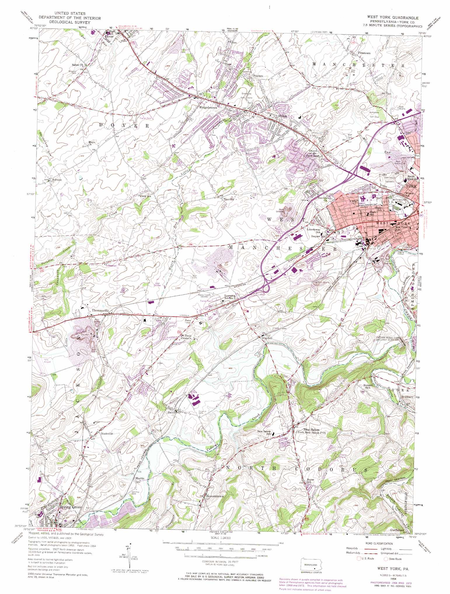
USGS Topo Quad 39076h7 - 1:24,000 scale
| Topo Map Name: | West York |
| USGS Topo Quad ID: | 39076h7 |
| Print Size: | ca. 21 1/4" wide x 27" high |
| Southeast Coordinates: | 39.875° N latitude / 76.75° W longitude |
| Map Center Coordinates: | 39.9375° N latitude / 76.8125° W longitude |
| U.S. State: | PA |
| Filename: | o39076h7.jpg |
| Download Map JPG Image: | West York topo map 1:24,000 scale |
| Map Type: | Topographic |
| Topo Series: | 7.5´ |
| Map Scale: | 1:24,000 |
| Source of Map Images: | United States Geological Survey (USGS) |
| Alternate Map Versions: |
West York PA 1954, updated 1956 Download PDF Buy paper map West York PA 1954, updated 1967 Download PDF Buy paper map West York PA 1954, updated 1969 Download PDF Buy paper map West York PA 1954, updated 1974 Download PDF Buy paper map West York PA 1954, updated 1974 Download PDF Buy paper map West York PA 1998, updated 2000 Download PDF Buy paper map West York PA 2010 Download PDF Buy paper map West York PA 2013 Download PDF Buy paper map West York PA 2016 Download PDF Buy paper map |
1:24,000 Topo Quads surrounding West York
Mechanicsburg |
Lemoyne |
Steelton |
Middletown |
Elizabethtown |
Dillsburg |
Wellsville |
Dover |
York Haven |
Columbia West |
Hampton |
Abbottstown |
West York |
York |
Red Lion |
Mcsherrystown |
Hanover |
Seven Valleys |
Glen Rock |
Stewartstown |
Littlestown |
Manchester |
Lineboro |
New Freedom |
Norrisville |
> Back to 39076e1 at 1:100,000 scale
> Back to 39076a1 at 1:250,000 scale
> Back to U.S. Topo Maps home
West York topo map: Gazetteer
West York: Airports
Gilbert Airport elevation 129m 423′YBP Heliport elevation 140m 459′
York Airport elevation 140m 459′
West York: Dams
York Dam elevation 137m 449′York Indian Rock Dam elevation 127m 416′
West York: Mines
York Quarry elevation 137m 449′West York: Populated Places
Admire elevation 168m 551′Bair elevation 141m 462′
Botts elevation 140m 459′
Brillhart elevation 124m 406′
Campbell Estates elevation 146m 479′
Fairway elevation 122m 400′
Fireside Park elevation 121m 396′
Foustown elevation 153m 501′
Graybill elevation 134m 439′
Greenbriar elevation 149m 488′
Holly Heights elevation 141m 462′
Martin elevation 134m 439′
Nashville elevation 144m 472′
New Salem elevation 185m 606′
Poplars elevation 125m 410′
Shiloh elevation 141m 462′
Stoverstown elevation 184m 603′
Taxville elevation 150m 492′
Thomasville elevation 147m 482′
Weigelstown elevation 157m 515′
West York elevation 118m 387′
West York: Post Offices
York New Salem Post Office elevation 185m 606′West York: Streams
Honey Run elevation 118m 387′Paradise Creek elevation 124m 406′
South Branch Codorus Creek elevation 113m 370′
Stoverstown Branch elevation 132m 433′
West York digital topo map on disk
Buy this West York topo map showing relief, roads, GPS coordinates and other geographical features, as a high-resolution digital map file on DVD:
Atlantic Coast (NY, NJ, PA, DE, MD, VA, NC)
Buy digital topo maps: Atlantic Coast (NY, NJ, PA, DE, MD, VA, NC)
 map DVD")